Viewing entries in
Blog

Jewish People Want To Pray On Temple Mount

Jewish People Want To Pray On Temple Mount

file_zps80c66ef3.jpg

Last week, when I wrote a post about the movie "Jerusalem", I made the comment that if I could use one word to describe Jerusalem, it would be "confusing". I say that sarcastically, of course. The city is absolutely beautiful and every time I go, I find many more new and exciting things to see. However, when I say "confusing", it is usually in response to a question that someone asks when I know all they want is a 20 second response. In reality, it would take several hours to properly explain Jerusalem to someone who has never been there. And even at that, you would have only talked about the city at a very high level.

Case in point: the Washington Post had a story today discussing the desire of some Jewish people who want to publicly pray on the Temple Mount. The Temple Mount area is under the oversight of the Muslim people and prayers by any non-Muslim is strictly forbidden. I encourage you to read this story. It is a very difficult situation for everyone involved. For better or worse, everyone who lives over there is very passionate about their own beliefs. And, when they feel that their beliefs are being threatened, they become defensive. Over time, this defensiveness builds up and finally someone takes action.

This is not unique to Jerusalem, for situations similar to this arise in every country on the planet. However, in Jerusalem, it seems to be different. For instance, here in the United States, we have our own struggles. But they are things that we have been struggling with for a few decades and perhaps a century or two. In Jerusalem, they have been struggling with some of the same problems (or variants of the same problem) for thousands of years.

Will they be successful in their desire to pray on the Temple Mount? Only time will tell. But, it will be interesting to watch.

The picture at the top of the post is of me standing in front of the Dome of the Rock on the Temple Mount. NOTE: If you are reading this post from an email, you might need to click on the title and see the post from a web page to view the picture.

Benjamin Plateau Video

Benjamin Plateau Video

photo.jpg

Tonight, I am going to conclude my series on the Benjamin Plateau. However, since there are so many other things that I could write about this area, I am sure that I will pick it up again in the near future. In earlier posts on this series, I have written about the plateau itself and the four cities that guard its passages, Gibeon, Gibeah, Geba and Mizpah. I encourage you to go back and read those.

To bring it all together, I invite you to go and watch a video that was produced by Bill Schlegel and the folks associated with the Satellite Bible Atlas. The video covers the Benjamin Plateau and does a great job of graphically showing the many different aspects of this region in light of Scripture. This video is the fourth in a series of (currently) seven videos that accompany the Satellite Bible Atlas.

Ironically, Todd Bolen posted some information about the Satellite Bible Atlas today. Do you know someone who is interested in Biblical geography? If so, I would recommend that you purchase this book for them. Along with it, you get digital copies of all of the maps and you have the option of also purchasing a wall map the land of Israel. It is well worth the money.

Being Thankful

Being Thankful

file_zpsa27f80dd.jpg

Now it happened as Jesus went to Jerusalem that He passed through the midst of Samaria and Galilee. Then as He entered a certain village, there met Him ten men who were lepers, who stood afar off. And they lifted up their voices and said, “Jesus, Master, have mercy on us!” So when He saw them, He said to them, “Go, show yourselves to the priests.” And so it was that as they went, they were cleansed. And one of them, when he saw that he was healed, returned, and with a loud voice glorified God, and fell down on his face at His feet, giving Him thanks. And he was a Samaritan. So Jesus answered and said, “Were there not ten cleansed? But where are the nine? Were there not any found who returned to give glory to God except this foreigner?” And He said to him, “Arise, go your way. Your faith has made you well.” - Luke 17:11-19

Leprosy was a terrible disease. Outside of the disfiguring physical effects, the social effects were even more disheartening. Lepers were completely ostracized from society. No one cared for them and they were forced to stay away from everyone else. You can even see that in the passage above in the fact when Jesus first saw the lepers, they "stood afar off". So, when this man realizes that he has been given a great gift, he immediately stops what he is doing to turn around and say "thanks". What a wonderful and appropriate thing to do.

I'm thankful that I live in a country that pauses for a day to say "thanks". And, we have so much to be thankful for. Sometime today, in between the parades and the football games and the turkey and the naps take a few minutes to list the things that you are thankful for. It will be a humbling and satisfying experience.

Happy Thanksgiving.

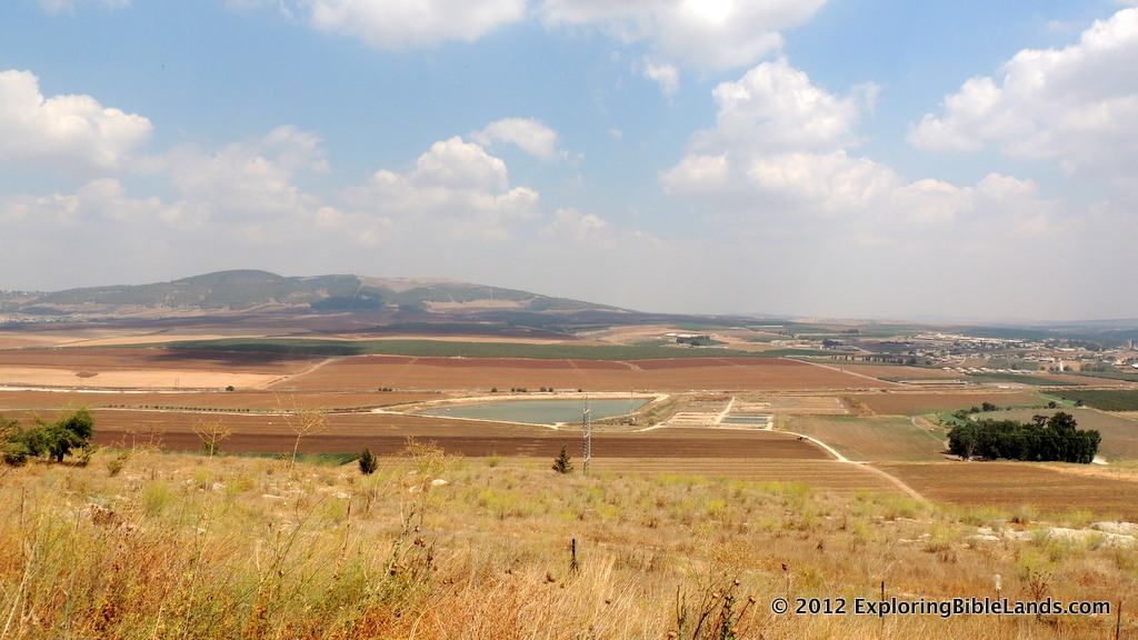
(The picture at the top of this page is of the Jezreel Valley and the Hill of Moreh from the tel at Jezreel. In the passage, it is mentioned that Jesus was traveling to Jerusalem in the midst of, or on the border of, Galilee and Samaria. While we do not know for sure exactly where Jesus was, it was probably in the general area of this picture. Just beyond the Hill of Moreh is the hills of Galilee and the mountains of Samaria rise behind the picture in the opposite direction. NOTE: If you are reading this post from an email, just click on the title and view this post from a webpage to see the picture.)

Mizpah

Mizpah

Screen-Shot-2013-11-27-at-8.03.32-AM.png

Today, we are going to continue our series on the Benjamin Plateau. We have discussed three of the main cities that guard entrances to the plateau (Gibeon on the west, Gibeah to the south and Geba to the east). Today, we will take a look at Mizpah, which guards the plateau to the north. There are two different locations that are identified as Mizpah: Nebi Samwil and Tell en-Nasbeh. However, associating the site of Mizpah with Nebi Samwil is probably not correct. For a good analysis of this, I encourage you to read an article on Todd Bolen's blog from 2008.

Tell en-Nasbeh is located about 8 miles north of Jerusalem along the "Road of the Patriarchs". It is in the central mountain ridge. Considerable Iron Age artifacts and construction have been found at the site. The city of Mizpah is typically identified with the prophet Samuel.

It is at Mizpah that Samuel prayed for the children of Israel after they had been worshiping Baal.

And Samuel said, “Gather all Israel to Mizpah, and I will pray to the Lord for you.” So they gathered together at Mizpah, drew water, and poured it out before the Lord. And they fasted that day, and said there, “We have sinned against the Lord.” And Samuel judged the children of Israel at Mizpah. Now when the Philistines heard that the children of Israel had gathered together at Mizpah, the lords of the Philistines went up against Israel. And when the children of Israel heard of it, they were afraid of the Philistines. So the children of Israel said to Samuel, “Do not cease to cry out to the Lord our God for us, that He may save us from the hand of the Philistines.” And Samuel took a suckling lamb and offered it as a whole burnt offering to the Lord. Then Samuel cried out to the Lord for Israel, and the Lord answered him. Now as Samuel was offering up the burnt offering, the Philistines drew near to battle against Israel. But the Lord thundered with a loud thunder upon the Philistines that day, and so confused them that they were overcome before Israel. And the men of Israel went out of Mizpah and pursued the Philistines, and drove them back as far as below Beth Car. Then Samuel took a stone and set it up between Mizpah and Shen, and called its name Ebenezer, saying, “Thus far the Lord has helped us.” - 1 Samuel 7:5-12

Samuel gathered the people at Mizpah again to identify Saul as their king:

Then Samuel called the people together to the Lord at Mizpah, and said to the children of Israel, “Thus says the Lord God of Israel: ‘I brought up Israel out of Egypt, and delivered you from the hand of the Egyptians and from the hand of all kingdoms and from those who oppressed you.’ But you have today rejected your God, who Himself saved you from all your adversities and your tribulations; and you have said to Him, ‘No, set a king over us!’ Now therefore, present yourselves before the Lord by your tribes and by your clans.” And when Samuel had caused all the tribes of Israel to come near, the tribe of Benjamin was chosen. When he had caused the tribe of Benjamin to come near by their families, the family of Matri was chosen. And Saul the son of Kish was chosen. - 1 Samuel 10:17-21

In some upcoming posts, we will discuss some more aspects of the Benjamin Plateau.

The map at the top of this post comes from the Satellite Bible Atlas, a fantastic resource for Bible geography. I have written about this book before and I encourage you to purchase it. (NOTE: If you are reading this post from an email, you might need to click on the title to view the post from a web page in order to see the map.)

I Finally Saw "Jerusalem"

I Finally Saw "Jerusalem"

jerusalem_the_movie.jpg

I have made two different trips to Israel. During that time, I have spent a number of days in Jerusalem. In addition, I have read dozens of blog posts and Internet articles about the city. I have also purchased books about Jerusalem and read through them. Often, I have people ask me, "What can you tell me about Jerusalem?" My sarcastic answer is usually the same, "It is confusing."

Seriously, Jerusalem is an amazing city. It has a unique beauty. It is has been almost continually inhabited for over 4,000 years. Over time, the city has been built up and destroyed a number of times. Millions of people throughout history have called Jerusalem their home.

About a year ago, when I first saw the seven minute promotional video for Jerusalem, I instantly fell in love with it and could not wait to see it. Then, in August, they released a trailer for the movie. However, the movie was not being shown in my area. My wife and I discussed making trips to St. Louis or Atlanta to see it, but we were having a hard time fitting it into our schedule.

My wife, Tabatha, and I outside the theatre where Jerusalem was being shown.Every year, we travel to Jacksonville, Florida to visit family for the Thanksgiving holiday. This year, we decided to take a slight detour through Tallahassee and see the Florida State/Idaho football game. (My wife and I met each other at Florida State.) Two days before we left home to head to Tallahassee, I saw a Facebook post advertising that Jerusalem was being shown in Tallahassee the same weekend. I quickly bought tickets online and we headed out of town.

So, how was the movie? Fantastic. I really enjoyed it. The movie revolves around the lives of three young ladies who live in Jerusalem. One is a Christian, on is Jewish and one is Muslim. They all live within the confines of the Old City of Jerusalem, but due to their different religious beliefs, their paths rarely (if ever) cross. In the movie, the three women are interviewed about the city and what it means to them. It is a compelling story which highlights some of its history and, at a very high level, attempts to explain the religious, cultural, social and economic differences that currently exist within the city.

While this was interesting, I was more interested in the cinematography. I went to the movie because I wanted to see pictures of the city in IMAX format. In the theatre where we went, the movie was being show in 3D. While I am not a huge fan of 3D movies, there were a number of scenes in which it has a huge impact. Some of them are:

Mount of Olives - Many scenes from the Mount of Olives were fantastic in 3D. When you travel to Israel, this is the "traditional view" of the city that all tourists enjoy. Seeing it in 3D helped you visualize the true beauty of that overlook.

Temple Mount - There was a sweeping view that started at the bottom of the southwest corner of the Temple Mount. As the camera panned up and away from the corner, the view changed from actual video to a computer generated image of the Temple Mount during the First Century. It was fantastic.

Garden of Gethsemane - The traditional location of the Garden of Gethsemane is below the Church of All Nations that sits just east of the East Gate across the Kidron Valley. Outside that building, they are several (very) old olive trees. There is a view that begins beneath one of these trees and then rises to show the city of Jerusalem. It was a great sequence showing the close proximity of the Garden of Gethsemane to the city. I wrote about this in an earlier post, and it was interesting to see this same view in a different perspective.

Should you go and see this film? In a word, YES. It is really good. While there were a few statements that I did not totally agree with, it is a good introduction to the city itself. And, it gives any student of the Bible an opportunity to see some fantastic pictures of the land of Israel.

Mount Precipice

Mount Precipice

file_zps4019d121.jpg

As you travel around the lands of the Bible, you are immediately swept up in the thought of being in the actual places where the events took place. However, it is important to keep things in perspective. We know where places like the Sea of Galilee, the Jezreel Valley, Jerusalem and Megiddo are located. However, sometimes other places are not so evident, even though some claim that they are. Many people believe that the Transfiguration of Jesus took place on Mount Tabor. To that end, the Roman Catholic Franciscans have constructed the Church of the Transfiguration on top of the mountain. The Eastern Orthodox also have a monastery on the summit. It is possible that the transfiguration happened there, but we do not know for sure because the Bible does not tell us. (Personally, I tend to think that the transfiguration occurred on or around Mount Hermon in northern Israel.)

Earlier today, Todd Bolen released a post informing us of a movement to construct a large statue of Jesus on Mount Precipice near Nazareth. The mount is called "Mount Precipice" because it is the traditional location of where the people of Nazareth tried to throw Jesus off of the cliff. However, Todd makes an interesting point in his blog:

The traditional hill is not the place where Jesus was nearly killed, for ancient Nazareth was not built on this hill.

And, in this, Todd is correct. Look at the passage from Luke 4 describing the event:

So all those in the synagogue, when they heard these things, were filled with wrath, and rose up and thrust Him out of the city; and they led Him to the brow of the hill on which their city was built, that they might throw Him down over the cliff. - Luke 4:28-29

The hill that we call Mount Precipice is not the hill on which the ancient city was built.

Traveling to Israel is a wonderful experience. It opens up words in passages that you have read a thousand times. But, you must be objective in what you see and hear. Take what you learn and compare it to what God's Word says.

The picture at the top of this post is of Mount Precipice. The picture was taken from Megiddo looking north across the Jezreel Valley. You can see Highway 60 as it cuts into the mountain and climbs toward Nazareth in the hills of Lower Galilee. (NOTE: If you are reading this post in an email, you will need to click on the title and view the post on a web page to see the picture.)

Geba

Geba

Screen-Shot-2013-11-21-at-7.02.24-PM.png

As I stated in the first post of this series, the Central Benjamin Plateau is guarded by four cities: Mizpah on the north, Gibeon on the west, Gibeah on the south and Geba on the east. Of the four cities, Geba is probably the least known. During the time of King Saul, the city was a garrison for the Philistines.

And Jonathan attacked the garrison of the Philistines that was in Geba, and the Philistines heard of it. Then Saul blew the trumpet throughout all the land, saying, “Let the Hebrews hear!” - 1 Samuel 13:3

During the time of the Divided Kingdom, Baasha (King of Israel) and Asa (King of Judah) were in war against each other. After Asa created an agreement with the king of Syria, Asa built up the city of Geba.

Now there was war between Asa and Baasha king of Israel all their days. And Baasha king of Israel came up against Judah, and built Ramah, that he might let none go out or come in to Asa king of Judah. Then Asa took all the silver and gold that was left in the treasuries of the house of the Lord and the treasuries of the king’s house, and delivered them into the hand of his servants. And King Asa sent them to Ben-Hadad the son of Tabrimmon, the son of Hezion, king of Syria, who dwelt in Damascus, saying, “Let there be a treaty between you and me, as there was between my father and your father. See, I have sent you a present of silver and gold. Come and break your treaty with Baasha king of Israel, so that he will withdraw from me.” So Ben-Hadad heeded King Asa, and sent the captains of his armies against the cities of Israel. He attacked Ijon, Dan, Abel Beth Maachah, and all Chinneroth, with all the land of Naphtali. Now it happened, when Baasha heard it, that he stopped building Ramah, and remained in Tirzah. Then King Asa made a proclamation throughout all Judah; none was exempted. And they took away the stones and timber of Ramah, which Baasha had used for building; and with them King Asa built Geba of Benjamin, and Mizpah. - 1 Kings 15:16-22

When the Assyrians were on their way to attack the city of Jerusalem, they traveled through Geba on their entrance to the Benjamin Plateau.

It shall come to pass in that day that his burden will be taken away from your shoulder, and his yoke from your neck, and the yoke will be destroyed because of the anointing oil. He has come to Aiath, he has passed Migron; at Michmash he has attended to his equipment. They have gone along the ridge, they have taken up lodging at Geba. Ramah is afraid, Gibeah of Saul has fled. - Isaiah 10:27-29

The map at the top of this post comes from the Satellite Bible Atlas, a fantastic resource for Bible geography. I have written about this book before and I encourage you to purchase it. (NOTE: If you are reading this post from an email, you might need to click on the title to view the post from a web page in order to see the map.)

Gibeah

Gibeah

gibeah_tell-el-ful_fjenkins090311_0398sm.jpg

(NOTE: This is the third in a series of posts about the Benjamin Plateau. There have been other posts about the plateau and the town of Gibeon.) Located just a few miles north of Jerusalem, the town of Gibeah guarded the southern end of the Benjamin Plateau. It is located about 2800 feet in elevation on the watershed ridge along the central mountain range. As a traveler going north along the "Way of the Patriarchs" out of Jerusalem, Gibeah would have been the first city that they would have come to. No doubt, many of the central figures of the Bible went through Gibeah.

During the reign of King Saul (~1050BC-1010BC), he set up his capital in Gibeah. And, as we read the account of his reign in 1 Samuel, we can even read that it is referred to as "Gibeah of Saul".

Then Samuel went to Ramah, and Saul went up to his house at Gibeah of Saul. - 1 Samuel 15:34

King Hussein of Jordan's partially built palace on Tell el-Ful.  Photo from Wikipedia.The location of Gibeah is known as Tell el-Ful. William F. Albright led a couple of excavations of this site in the 1920s. During his work, he found evidence of a rather large fortress, which dates back to the time of Saul. In modern times, Tell el-Ful is easy to recognize due to the large, partially built building on top. In the 1960s, King Hussein of Jordan began construction a palace in Tel el-Ful, but construction was halted when the Six-Day War broke out. Since Israel won the war, the palace was never finished and now all that remains is the skeleton of the building.

The picture at the top of this post is of Tell el-Ful from the east. It was taken by Ferrell Jenkins in 2011. NOTE: If you are reading this post from an email, you might have to click on the title to view the post from a webpage to see the image.

Gibeon

Gibeon

file_zps008fe4d9.jpg

In my last post, I began a series on the Benjamin Plateau. As I mentioned, the plateau is guarded by four cities. The city on the western edge is Gibeon. Anyone who came from the coastal plain and through the Aijalon Valley would approach the area through Gibeon. The city of Gibeon is mentioned a number of times in Scripture. Among them are:

Joshua 9 - After the Israelites conquered Jericho and Ai, the citizens of Gibeon tricked Joshua into signing a treaty. Once Joshua found out what had happened, he honored his agreement, but made them woodcarvers and water carriers.

But when the inhabitants of Gibeon heard what Joshua had done to Jericho and Ai, they worked craftily, and went and pretended to be ambassadors. And they took old sacks on their donkeys, old wineskins torn and mended, old and patched sandals on their feet, and old garments on themselves; and all the bread of their provision was dry and moldy. And they went to Joshua, to the camp at Gilgal, and said to him and to the men of Israel, “We have come from a far country; now therefore, make a covenant with us.”...And that day Joshua made them woodcutters and water carriers for the congregation and for the altar of the Lord, in the place which He would choose, even to this day. - Joshua 9:3-6, 27

Joshua 10 - After the Amorites heard about the treaty the Gibeonites made with the Israelites, five neighboring kings decided to attack the city. The Gibeonites then called on Joshua to assist them. As Joshua drove the Amorites back toward the coast along the Beth Horon ridge, God cast down large hailstones upon them. Then, as Joshua was continuing to fight, God caused the sun to stand still so the battle could be won.

Joshua therefore came upon them suddenly, having marched all night from Gilgal. So the Lord routed them before Israel, killed them with a great slaughter at Gibeon, chased them along the road that goes to Beth Horon, and struck them down as far as Azekah and Makkedah. And it happened, as they fled before Israel and were on the descent of Beth Horon, that the Lord cast down large hailstones from heaven on them as far as Azekah, and they died. There were more who died from the hailstones than the children of Israel killed with the sword...So the sun stood still in the midst of heaven, and did not hasten to go down for about a whole day. And there has been no day like that, before it or after it, that the Lord heeded the voice of a man; for the Lord fought for Israel. - Joshua 10:9-11, 13-14

2 Samuel 2 - Abner and Joab met at the Pool of Gibeon where there was a fight between the two armies.

Now Abner the son of Ner, and the servants of Ishbosheth the son of Saul, went out from Mahanaim to Gibeon. And Joab the son of Zeruiah, and the servants of David, went out and met them by the pool of Gibeon. So they sat down, one on one side of the pool and the other on the other side of the pool. Then Abner said to Joab, “Let the young men now arise and compete before us.” And Joab said, “Let them arise.” So they arose and went over by number, twelve from Benjamin, followers of Ishbosheth the son of Saul, and twelve from the servants of David. And each one grasped his opponent by the head and thrust his sword in his opponent’s side; so they fell down together. Therefore that place was called the Field of Sharp Swords, which is in Gibeon. So there was a very fierce battle that day, and Abner and the men of Israel were beaten before the servants of David. - 2 Samuel 2:12-17

The picture at the top of this post is of Gibeon, as seen from Nebi Samwil. In the distance, you can see modern-day Ramallah in the West Bank. (NOTE: If you are reading this post in an email, you will need to click on the link in the title to see the picture.)

Next June, I'm heading to Israel on a Bible Study Tour. Why don't you join me?

The Benjamin Plateau

The Benjamin Plateau

file_zps2e12a5e8.jpg

As the nation of Israel crossed the Jordan River and conquered the land, Joshua helped divide the land among the tribes. Each tribe was given different pieces of land for them to live. These lands varied in size, shape, terrain and resources. Having traveled through Israel a couple of times, I have spent time in each of these tribal inheritances, I can vouch for the fact that each piece of land has its own pros and cons. Some have good access to water, so do not. Some are in the mountains, some are by the sea. Some would receive an abundance of rain every year, some would not. The land allotted to the tribe of Benjamin is an interesting piece of land. It stretches approximately 20 miles east to west and between 5-10 miles north to south. The territory contained Jericho, Jerusalem and Kiriath-Jearim. Its eastern edge was the Jordan River around 800 feet below sea level and the land rose to over 3000 feet along the central mountain range.

But, with that being said, the most important aspect of the land of Benjamin was location. Anybody traveling to or from Jerusalem from the west, north or east must go through this land, and in particular, they must pass through the Benjamin Plateau.

The Benjamin Plateau is a very small piece of land in the hill country of central Benjamin. This land was guarded by four cities (Mizpah to the north, Gibeon to the west, Gibeah to the south and Geba to the east), and provided plenty of drama during Biblical times.

Over the next few weeks, I'm going to try to post a number of stories and descriptions about this very important piece of land.

The picture at the top of this post is of a mosque that sits on top of Nebi Samwil, just north of Jerusalem. I'll have some more information about Nebi Samwil in a later post. From this high point, you have a beautiful view of the Benjamin Plateau to the northeast. (NOTE: If you are reading this post from an email, you might need to click on the title to view the picture from a web page.)

The Importance of Jezreel

The Importance of Jezreel

file_zpsa27f80dd.jpg

Even a casual reading of the period of the Divided Kingdom in the Old Testament reveals the importance of a particular city in the Northern Kingdom...Jezreel. The city of Jezreel is located on a small bluff on the western edge of Mount Gilboa. The city overlooks the beautiful Jezreel Valley to its north. The panoramic view stretches from Mount Carmel to the west, across the Nazareth ridge to the north, past Mount Tabor and the Hill of Moreh to the Harod Valley in the east. It is one of my favorite sites in Israel as you can visualize so many Biblical stories taking place within its view. This morning, I read an interesting article by Norma Franklin from the University of Haifa. She talks about the importance of the city of Jezreel throughout history, but in particular, the period of the Divided Kingdom. I invite you to read it.

Want to see Jezreel? I'll be going over there next June, and I'm leading a tour. I would be honored for you to join me on this exciting trip as we study the Bible while traveling through Israel.

Opportunities to Learn

Opportunities to Learn

photo-23.jpg

As I have said many times in this blog, the more you learn about the lands of the Bible, the more you can understand the Bible. To that end, here are a number of different ways in which you can increase your knowledge of the Bible lands. A few days ago, I received a book in the mail that I have been wanting for a long time. It is the New Moody Atlas of the Bible. It is a beautiful book with many pictures, illustrations and well-done maps. I have already read some of the introductory sections and am looking forward to reading more of the details. I encourage you to purchase it if you do not have it in your library.

Second, I have spoken before about the Satellite Bible Atlas by Bill Schlegel. This book is fantastic. And, I am proud to say that they have now released the book in hardback. In addition, they have produced a large wall map of Israel. Measuring 55x20 inches, it shows in great detail the geographical features of the land of Israel. I would recommend that this map hang in any Bible classroom.

Next, if you want up-to-the-minute details about the land, I encourage you to read Leon Mauldin's blog. He is currently leading a tour in Israel and is providing pictures and descriptions of the places he is visiting. Yesterday, he visited Caesarea Maritima, Mount Carmel and Megiddo.

Finally, if you are interested in going to these lands and seeing them for yourself, I know of two tours that you might be interested in.

Ferrell Jenkins is leading a tour to Eastern Turkey to visit the sites of Paul's First Missionary Journey (as well as many other sites) next May. He has been leading tours for nearly 40 years and has a top-notch knowledge of the land. I have personally been on two of his tours and I can not say enough about how much I learned and enjoyed them.

If you are interested in Israel, I will be leading a tour to Israel next June. This tour is timed in the summertime so that teachers and students will have the opportunity to go. We will visit many places across the land of Israel and study them in their Biblical and geographical context. This trip is perfect for any student of the Bible. Be sure to also check out the Frequently Asked Questions.

As I said in the beginning, learning about the lands of the Bible helps you understand the Bible. Take advantage of as many of these opportunities as you can.

Casemate Walls at Khirbet Qeiyafa

Casemate Walls at Khirbet Qeiyafa

38-11-6.jpg

I am not an archaeologist. Although friends of mine that have participated in an actual dig in Israel (Ferrell Jenkins at Lachish, Luke Chandler at Khirbet Qeiyafa, Trent and Rebekah Dutton at Ashkelon) have told me to give it a try. Perhaps one day I will. Participating in a dig allows you to gain first hand knowledge of the people of past civilizations. Earlier today, I received the latest edition of Biblical Archaeology Review magazine. In it, there is a really good article by Yosef Garfinkel (and others) concerning the dig that he has been participating in since 2007. The dig has been centered around Khirbet Qeiyafa (possibly Biblical Sha'arayim), but they are in the process of moving next season to Lachish. (For more information about this particular dig, I encourage you to read Luke Chandler's blog. He has participated in the dig for several seasons.)

In the article, there is a fantastic picture of a casemate wall from the city. I tried to find the same picture on the Internet with no luck. However, I found a similar picture that I have included at the top of this post. (NOTE: If you are reading this post from an email, you might need to click on the title and view the post from the web to see the picture.) In the center of the picture, you can see a four-chambered gate which led into the city. However, along the edge of the city walls, you can see a series of small rooms very similar in size. The walls in these small rooms were thicker than normal walls. During peace times, the inhabitants of the city used these small rooms for storage. However, if the enemy decided to attack, these rooms could be quickly filled with dirt, rock and other debris, which would make the city more secure.

Thanks to the real archaeologists and their teams of volunteers, we can learn so much more about the land and the people in the Bible. And, by learning more about the land and the people, we can learn more about the Bible.

I have got to figure out a way to participate in a dig in the near future.

Credit: The picture at the top of the post comes from the Israel Antiquities Authority website.

They Came To Land at Gennesaret

They Came To Land at Gennesaret

file_zps58e55d37-1.jpg

Jesus spent a large percentage of His public ministry in the area around the Sea of Galilee. In one such passage, we read:

And when they had crossed over, they came to land at Gennesaret. And when the men of that place recognized him, they sent around to all that region and brought to him all who were sick and implored him that they might only touch the fringe of his garment. And as many as touched it were made well. - Matthew 14:34-36

The Plain of Gennesaret from the Mount of Beatitudes.This location is sometimes referred to as the Plain at Gennesaret and is located on the northwestern edge of the Sea of Galilee. Because of the surrounding terrain, water flows down from the nearby hills into this area making it a very fertile location for the growing of crops. In the First Century AD, there were a number of small communities in the area such as Magdala and possibly Dalmanutha.

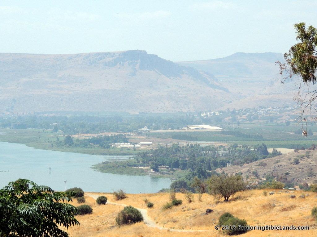
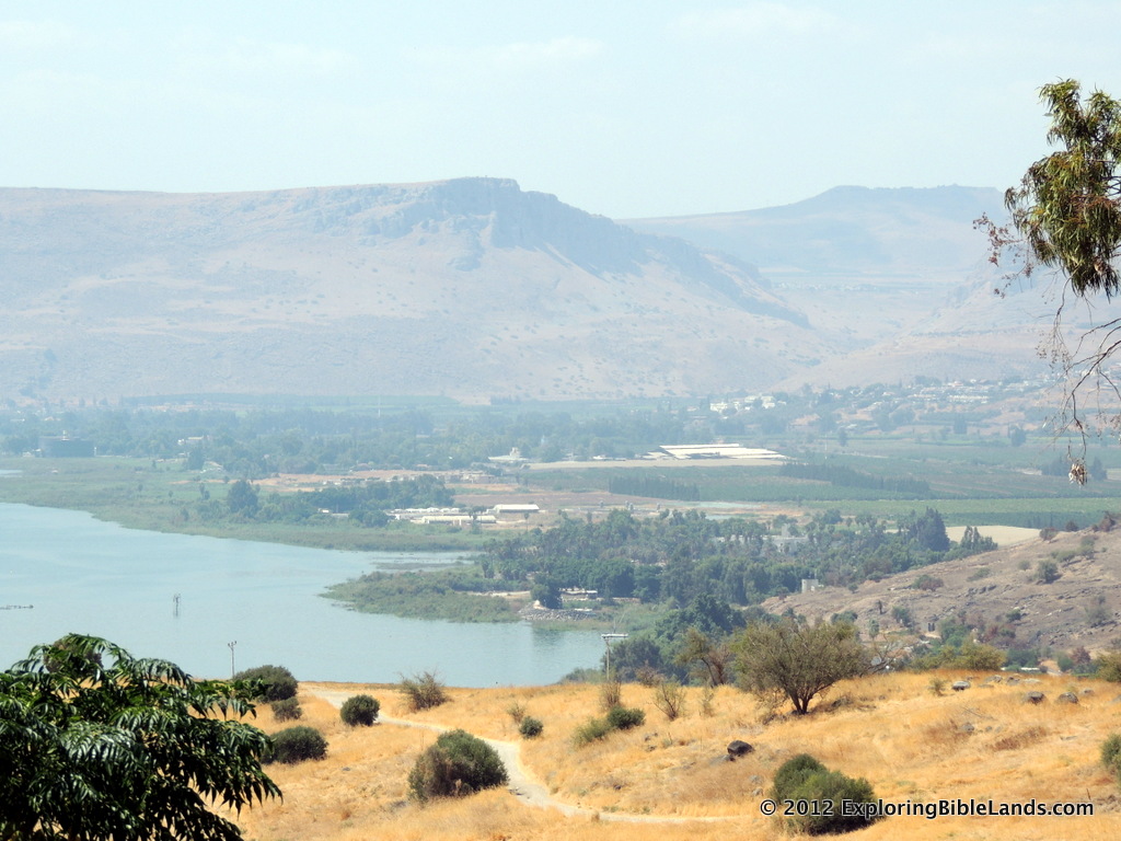
The picture at the top of this post shows part of the Plain at Gennesaret from the Sea of Galilee. Mount Arbel is on the left with the Galilean hills in the background. (NOTE: If you are reading this post from an email, you need to click on the title to see this post online.)

Sky Above Jerusalem

Sky Above Jerusalem

file_zps5d96c665-001.jpg

Earlier this evening, I found a very interesting video on YouTube. The focus of the video is the clouds and sky above Jerusalem. I'll admit, since I have a degree in Meteorology, I may take a greater interest in something like this than most people. But, it is a beautifully produced, 4-minute video and I encourage you to watch it. It is hard to watch a video like this and not think about all of the Biblical figures that have either lived in Jerusalem or spent some time there. Abraham, Melchizedek, David, Solomon, Josiah, Jeremiah, Hezekiah, Jesus, Peter, Paul and Barnabas...just to name a few. All of them probably saw similar skies fly over while they were there.

It kind of makes you think.

Wonderful Stones and Wonderful Buildings

Wonderful Stones and Wonderful Buildings

article-2429244-182D228300000578-499_964x706.jpg

About a year ago, I mentioned in a blog post about an upcoming IMAX film entitled Jerusalem. About two weeks ago, the movie was finally released and can be seen in selected theaters across the United States. (Unfortunately, I have not seen it yet. But, I hope to as soon as I can.) Earlier tonight, I was able to see some still pictures from the film. Many of them are breathtaking.

In particular, I was struck by a computer animated drawing of Jerusalem from the First Century. I have included this picture at the top of this post. When I saw the picture, I was reminded of a statement that Jesus' disciples said to Him while they were walking through Jerusalem.

And as he came out of the temple, one of his disciples said to him, “Look, Teacher, what wonderful stones and what wonderful buildings!” And Jesus said to him, “Do you see these great buildings? There will not be left here one stone upon another that will not be thrown down.” - Mark 13:1-2

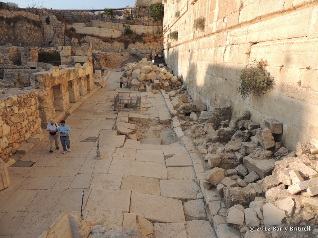
First Century street along the southwest corner of the Temple Mount.  Piles of rock from the destruction in 70AD  lay scattered along the road.Of course, we don't know exactly what Jerusalem looked like in the First Century, but this drawing is probably a pretty good representation. The Temple Mount area dominated the skyline. No doubt, it was a matter of pride to many of the citizens of Jerusalem. Hence, the comment from the disciples.

Interestingly, Jesus responds by telling them that there will come a time in which the Temple will be destroyed. And, of course, that happened when the Romans destroyed the city in 70AD. Even today, as you are walking around the Temple Mount area, you can seen remnants of this destruction that was foretold by Jesus.

(NOTE: If you are reading this post from email, then you might not see picture. Just click on the title of this post and you will be able to see the picture on the website.)

Explorations in Antiquity Center

Explorations in Antiquity Center

artifacts-gallery.jpg

A few years ago, my family and I had the opportunity to travel to LaGrange, Georgia and visit the Explorations in Antiquity Center. This is a very fascinating place and I encourage all Bible students to drop by if you get the chance. They have a number of reconstructed Biblical items (buildings, walls, pillars, altars, etc) that help you understand every day life in Bible times. If you have the time, you can also arrange to participate in a Biblical meal. Recently, they have been able to expand their range of exhibits by including some real antiquities dating all the way back to the Bronze Age. With the additions of these antiquities, the Explorations in Antiquity Center is now one of only seven museums worldwide selected by the Israel Antiquities Authority (IAA) to receive a permanent collection of artifacts.

Within the United States, there are only three other museums that have been selected by the IAA for this honor. They are the Metropolitan Museum of Art in New York City, the Jewish Museum in New York City and the Skirball Museum in Los Angeles.

If you have the time, I encourage you to visit the Explorations in Antiquity Center, as I will try to do soon. For more information, you can visit their website or follow them on Facebook.

For more information about this story, you can read the story by Times-Herald.com.

NOTE: Featured photo credited to the Exploration in Antiquity Center website.

Dalmanutha found?

Dalmanutha found?

file_zpsa74d1561.jpg

If you are follow blogs like this, then you may have already seen some news articles about the possible location of the Biblical city of Dalmanutha. If you haven't, here are a couple for you to consider from USA Today and FoxNews. The city is only mentioned once in the Bible.

And immediately he got into the boat with his disciples and went to the district of Dalmanutha. - Mark 8:10

However, the companion passage says:

And after sending away the crowds, he got into the boat and went to the region of Magadan. - Matthew 15:39

The location of Dalmanutha has been debated for a long time. For an in-depth discussion, I encourage you to read Ferrell Jenkins' post on the topic from earlier this year.

The announcement today states that they have found a location very near the city of Migdal (hometown of Mary Magdalene), which is on the southern edge of the plain of Gennesaret on the northwestern shore of the Sea of Galilee. This location, in light of the two passages that I mentioned above, gives some credibility to today's announcement. It will be very interesting to see what else they find at this location. Stay tuned.

The picture of the top of the post is of the Plain of Gennesaret from the Mount of Beatitudes. The city of Magdala (ancient Migdal) would sit just off the picture to the left at the foot of Mount Arbel. (NOTE: If you are reading this post from an email, you will need to click on the title to go to the website to see the picture.)

HT: Alan Cornett, Rusty Greene

On The Road To Damascus

On The Road To Damascus

file_zps0d471f14.jpg

In Acts 9, we read the account of the conversion of Saul. Saul had asked permission from the High Priest for him to travel to Damascus and bring followers of Christ back to Jerusalem. As you know, as he neared Damascus he saw a bright light and Jesus spoke to him. Soon thereafter, he spent some time with Ananias and was baptized. But, what do we know about his trip to Damascus? How far is it? Which roads did he take? Well, honestly, we don't know. The Bible doesn't give us that level of detail. But, we do know what roads were available during that time and can discuss the topic from that perspective.

The distance from Jerusalem to Damascus is around 150 miles. So, if Saul was traveling by foot, the trip would have taken about two weeks (give or take a few days). But, which path did he take?

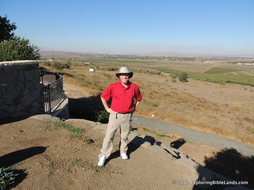
Picture of me standing on the Syrian border.  The city of Damascus lies about 25 miles to the north on the ridge just behind me.The first option would have taken Saul east out of Jerusalem and descend to the Jordan Rift Valley via Wadi Qilt. (This would be the road that Jesus referred to in his parable of the Good Samaritan.) Once he arrived near Jericho, he would have turned north and headed toward Scythopolis (in the Old Testament, this city is called Beth-Shean). From Scythopolis, Saul would have crossed the Jordan River and proceeded north along the mountain ridge east of the Sea of Galilee (today, we refer to this ridge as the Golan Heights). From here, Saul would have traveled north toward the area of Caesarea Philippi where they would joined the Via Maris on their way to Damascus.

The second option, and the most likely option, is the northern route. From Jerusalem, Saul would have traveled north through the mountains of Samaria and arrived on the southern edge of the Jezreel Valley. As he crossed the Jezreel Valley, he would have joined the Via Maris which led toward the western shore of the Sea of Galilee in the Plain of Gennesaret. Following the northern shore of the sea, Saul would have passed Capernaum before heading north toward Caesarea Philippi and then on to Damascus.

After spending some time in Damascus, Saul headed back to Jerusalem. Most likely, along the same path on which he travelled some time earlier. If that is true, and as Saul approached the location where Jesus appeared to him, I wonder if he paused to contemplate how his life had changed since the last time he was there.
My would like to think that he probably did.

The picture at the top of this post was taken last September from the Israel/Syria border northwest of the Sea of Galilee. It is in this area where Saul would have traversed on his way to Damascus, which lies about 25 miles away. (NOTE: If you are reading this blog post from an email, you may need to click on the blog title to view the image in your browser.)

Solomon's Porch

Solomon's Porch

IMG_2917.jpg

In our study of the Book of Acts, we read about the early Christians often congregating in Solomon's Porch. One such occurrence is in Acts 3, which is the account of Peter and John healing the lame man at the Beautiful Gate.

Then Peter said, “Silver and gold I do not have, but what I do have I give you: In the name of Jesus Christ of Nazareth, rise up and walk.” And he took him by the right hand and lifted him up, and immediately his feet and ankle bones received strength. So he, leaping up, stood and walked and entered the temple with them—walking, leaping, and praising God. And all the people saw him walking and praising God. Then they knew that it was he who sat begging alms at the Beautiful Gate of the temple; and they were filled with wonder and amazement at what had happened to him. Now as the lame man who was healed held on to Peter and John, all the people ran together to them in the porch which is called Solomon’s, greatly amazed. - Acts 3:6-11

So, what is "Solomon's Porch"? When King Herod expanded the Temple platform, he constructed a covered colonnade around the entire perimeter. The colonnade on the eastern wall was commonly called "Solomon's Porch". We even read of Jesus walking in Solomon's Porch during the winter.

Jerusalem Model at the Israel Museum.  The Beautiful Gate (gold doors) is seen with Solomon's Porch being located on the inside of the eastern wall of the Temple Mount.Now that we know where it was, think about the passage we mentioned earlier. When Peter and John healed the lame man near the Beautiful Gate, the lame man was overjoyed. He began leaping and praising God. (Wouldn't you?) Even though the passage doesn't mention it, you can assume that this reaction would have been a distraction to all of the people who had specifically come to the Temple to pray (see Acts 3:1). It would have been very easy for Peter and John to accommodate the crowd that surely would have gathered by simply walking away from the gate to the covered area of Solomon's Porch located a few hundred feet away.

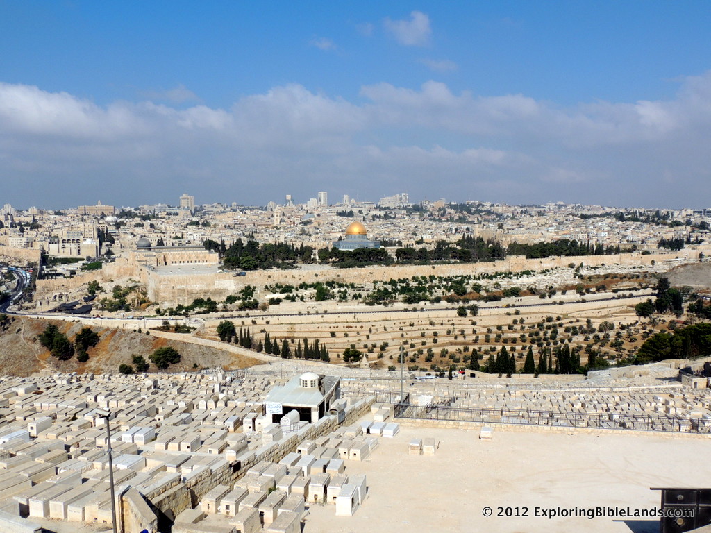
In the picture at the top of this blog was taken in 2010 from the Temple Mount with the Mount of Olives in the background. Solomon's Porch would have been located on the eastern edge of the platform. (NOTE: If you are reading this blog post from email, then you might need to click on the blog title to go to the webpage to see the image.)