 We mentioned on Tuesday that Beth Shean’s history covers an enormous expanse of time. During the Iron Age, Israel possessed Beth Shean for some time, and fortifications such as this one are thought to belong to this period. One can see the immense territory this lookout could cover, with this view showing the detail of the top of the tel, but also showing a view into and across the Jordan Valley.
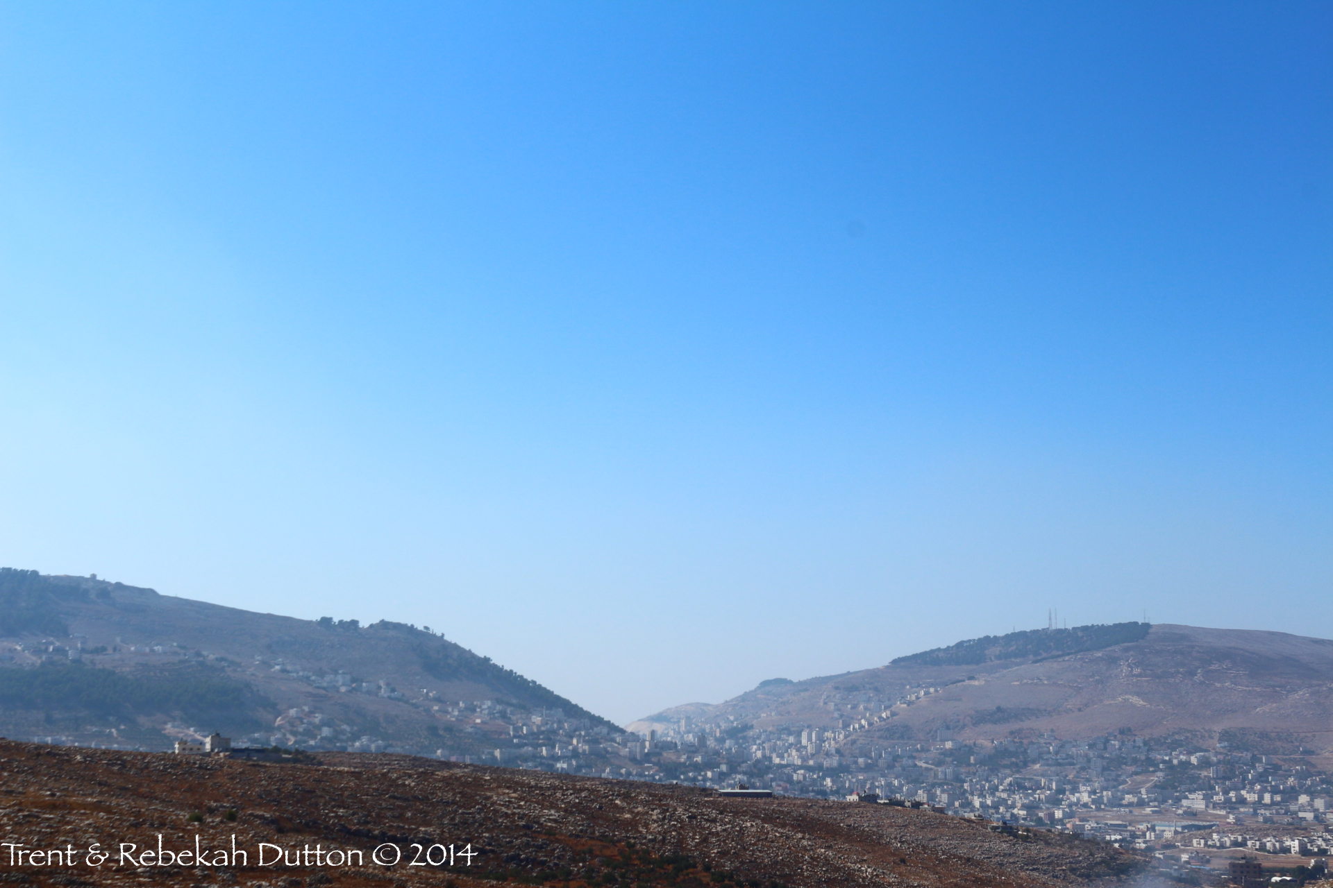 A view not often seen on a typical tour of Israel is that of Mt. Gerizim (left) and Mt. Ebal (right), looking west at their profiles. From this angle, one can see their proximity, illustrating how two halves of one great nation could face one another on each mountain to deliver the blessings and the curses. These mountains can most commonly be seen on the North-South highway approaches to the modern day city of Nablus, which contains the ancient site of Shechem.
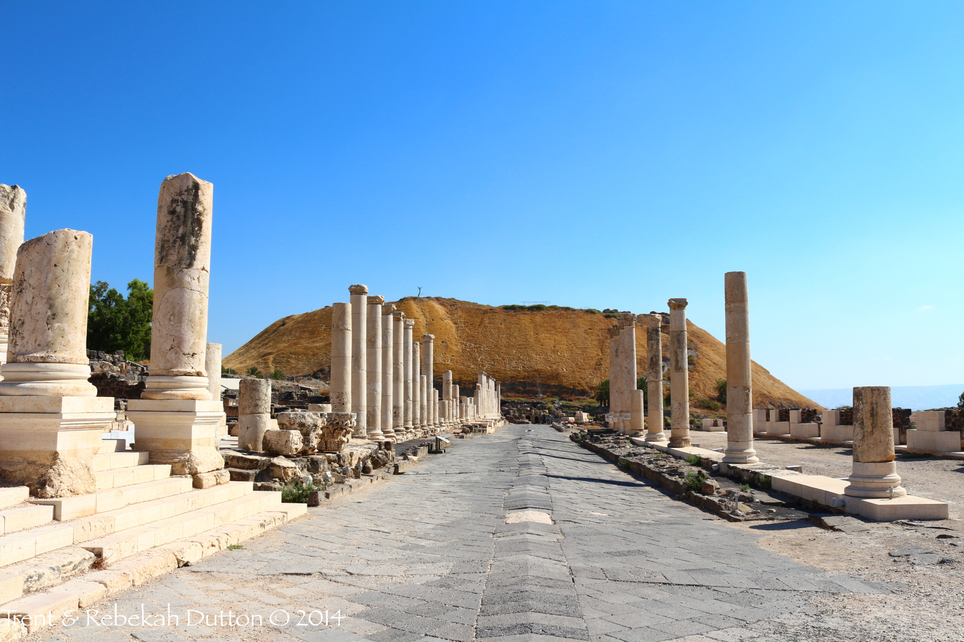 We have recently mentioned Bethshean from the perspective of Mt. Gilboa. This is a view from ground level just below the tel, from the Roman Cardo Maximus. Once an Egyptian governor’s seat during the Middle Bronze Age, Beth Shean would change hands often, eventually moving from the main tel to the fully Romanized city below—due mainly to its strategic location in the Jordan Valley.
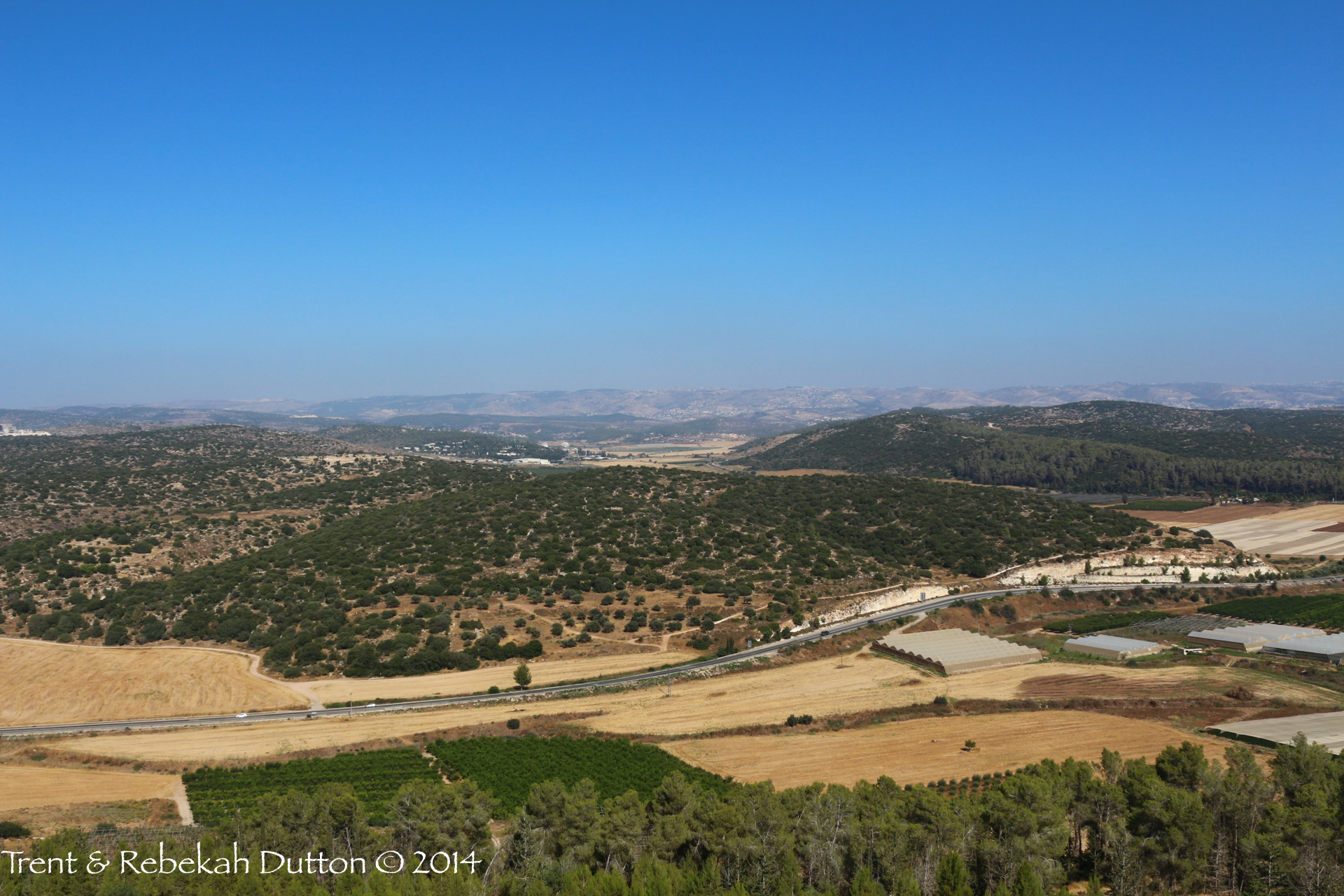 As with so many views from high points or tels in Israel, much can be packed into one landscape. This view from Azekah is significant enough itself, but from here looking east and slightly southeast, you can see the Elah Valley just beyond the road and green hill below. To the right of the valley is Sochoh, on the left is Khirbet Qeiyafa, of much Biblical Archaeology fame and debate over the past few years. Azekah, Sochoh, and the Elah Valley all feature in the account of David and Goliath (I Samuel 17).
A few days ago, Ferrell Jenkins wrote a post about the flooding that was taking place in the area of Qumran. These floods are the results of some strong winter storms that the country is experiencing right now. Heavy rains that fall in the Central Mountain Range quickly collect and overflow the dry river beds (wadis). Yesterday, Israel National News posted a video on YouTube of some of the filled wadis from the recent rain. (If you notice, they entitled this video "Blessed Rain of Israel". These type of rains are not a problem. They are a blessing.)
As you read the Bible, you'll notice that travelers of this land knew when to travel and where to travel. They understood the land and knew what could happen quickly during different times of the year.
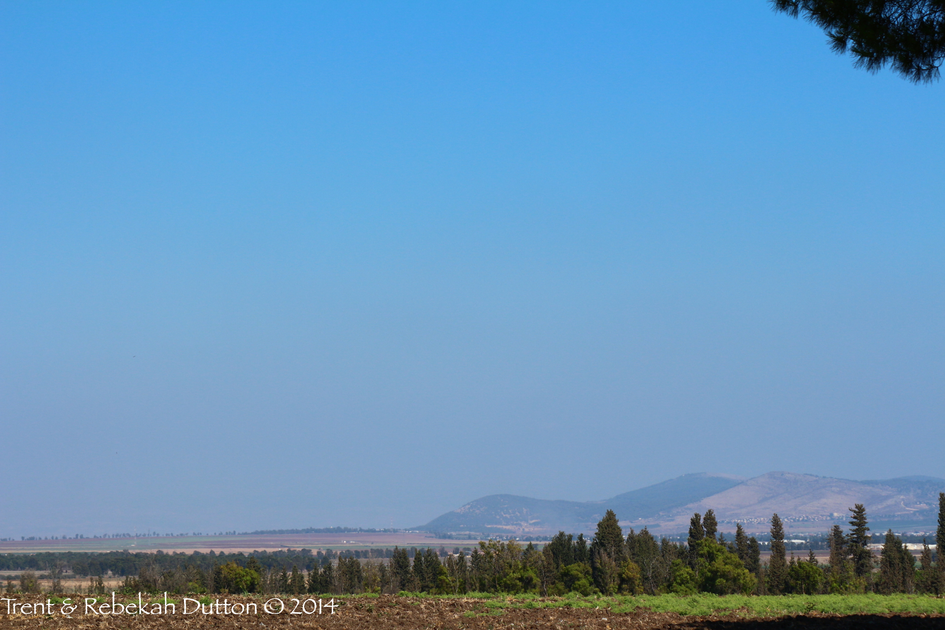 Mount Gilboa, along with the Hill of Moreh form the narrow passage that separates the Jezreel and Harod Valleys just west of Beit She’an. It was on this mountain that Saul and his sons fell to the Philistine army. Tradition claims this is the reason the eastern face of the mountain remains bare even to this day.
We’ll began posting again next week, after the Thanksgiving Holiday.
 From the tel of ancient Samaria, one can see the long stretch of mountains and mountain passes that make up the road from the Shechem Valley to the famous trading routes along the coast. Looking west, generations of its inhabitants have marveled at nature’s beauty as they watched the sun set over the Mediterranean beyond the hills.
 Within the Negev’s Southern Highlands is the beautiful Zin Valley, also known as the Desert or Wilderness of Zin. The wilderness offered one of the few roads through the mountainous highlands, including the winding Scorpions Ascent (Ascent of Akrabbim) along the Bozrah-to-Gaza Spice Route. As the valley approached the Jordan Valley, it becomes desolately arid with stifling heat.
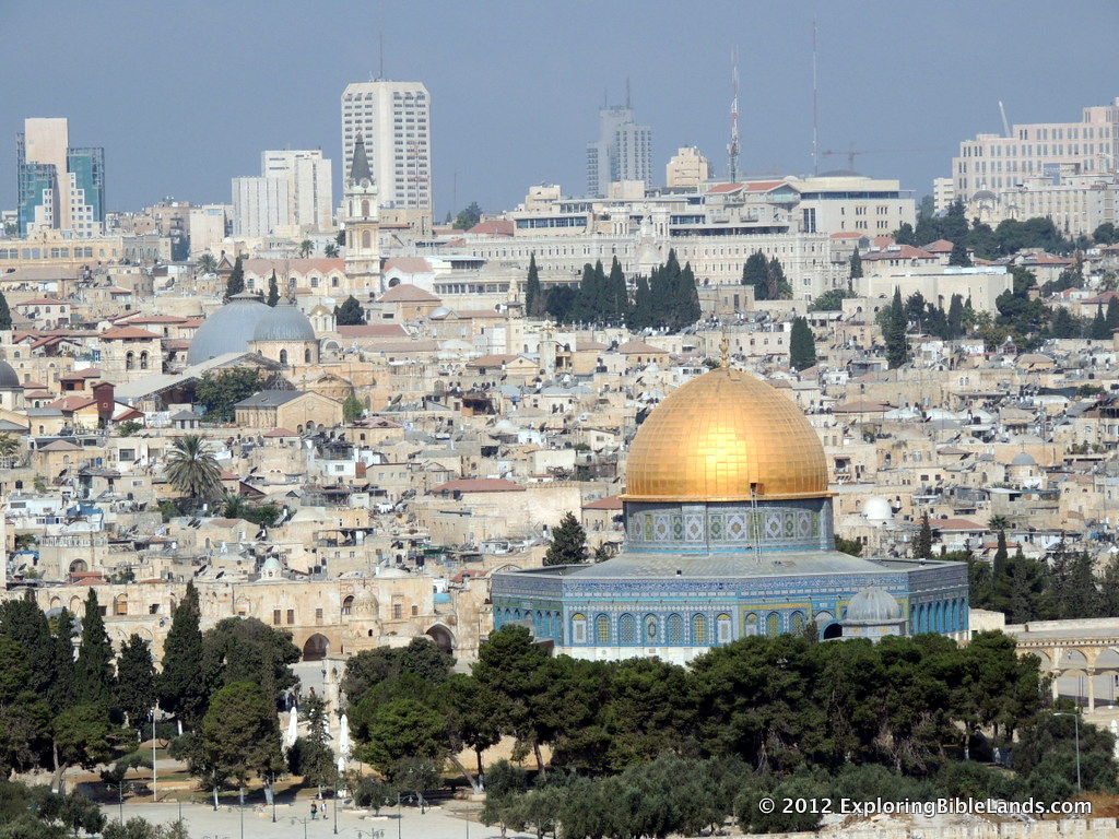 Jerusalem is a beautiful city. And, when you stand on top of one of its many hills, you can't help but think of all of the history that has occurred within your field of vision.
But, when people ask me to describe Jerusalem to them, I usually just joke and say, "it is confusing". The city has changed so many times over the millennia that it is often difficult to describe to visitors what they are looking at.
Of course, at the center of this confusion is the Temple Mount. A small piece of land that has changed so much that very little of the original hill remains. Over the past couple of weeks, Leen Ritmeyer has written a number of excellent blog posts on the history of the Temple Mount. I encourage all Bible students to read through them. Knowing a little bit more about the city of Jerusalem, and in particular the Temple Mount, will help you understand the Bible stories even more.
So far, he has written posts on the following time periods:
Mount Moriah Jebusite Period Time of Solomon King Hezekiah Ezra and Nehemiah Hellenistic and Hasmonean Periods
I look forward to more posts from Mr. Ritmeyer on this topic.
 The sycomore fig (Ficus sycomorus) was a staple fruit common in orchards in Israel (II Chronicles 1:15), and can produce small, fig-shaped fruits throughout the year. They are mentioned several times in the Old Testament, most famously as Amos’s means of living. The broad, heavily branched trunks would also make it easy for a man like Zacchaeus to climb high enough to see over a crowd (Luke 19:1-4).
 Access to water was a primary concern in any Israelite city, but particularly so in the arid regions to the south and east. Not only must the people ensure they had ample water to sustain them through the dry months between April and September, but also protect their supply from enemies during the age of siege warfare. Water systems, such as this one at Beersheba, solved both problems. These steps within the city walls lead down to a series of subterranean cisterns, which collected both ground water and overflow from the nearby wadi.
 The Mount of Temptation fringes the Judean Wilderness just north of the Dead Sea, where it looms over the site of Jericho (Tel es-Sultan). Because tradition states that, following His baptism, Jesus ascended this mountain to be tempted, a beautiful, gravity-defying monastery has been built on the mountainside. Above this is the fortress some believe to be Ptolemy’s hideaway, Dagon, mentioned by Josephus—though others conjecture this may be a later Crusader structure.
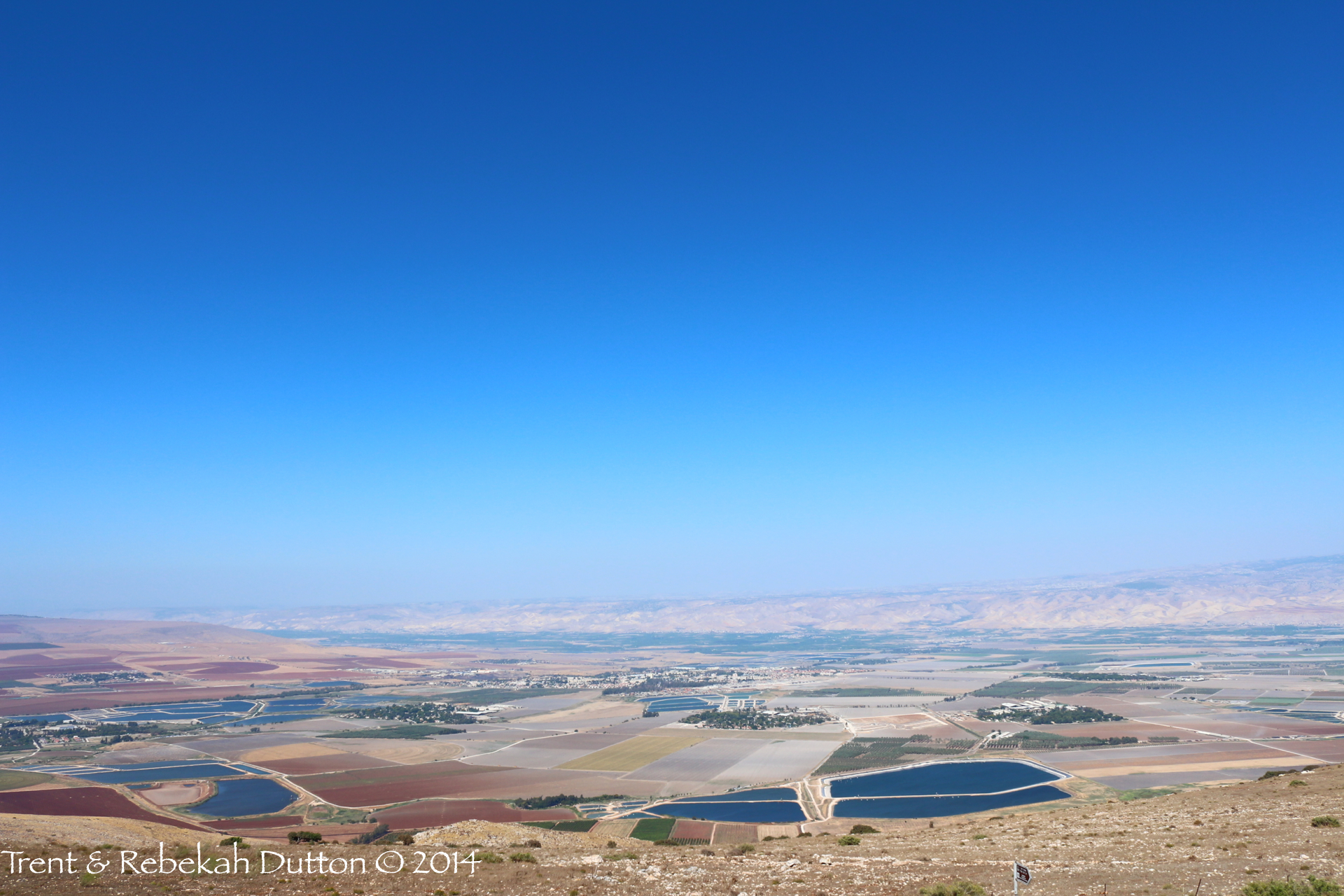 From atop Mount Gilboa, one is afforded a stunning view of the Jezreel Valley as it intersects with the Jordan Valley. At the center of this major junction is the ancient city of Beit She’an (Bethshean), where it guarded the crossing point from Pella in Jordan to the Jezreel—which would then lead on past Megiddo to the trade opportunities of International Trunk Route (sometimes called the Via Maris). This bottleneck of commerce underscores the value of Bethshean, beginning with Egyptians, Israelites, Philistines, and eventually even the empires of Alexander and Rome.
 The rock hyrax, or rock badger, is a gopher-sized mammal found in mountainous regions of Israel, such as Ein Gedi and Arbel. Known in the Mosaic laws as being unclean (as they chew the cud, but do not have cloven hoofs), Proverbs praises the small, social creatures as being one of four things which are little on the earth, but exceedingly wise: they are not a mighty people, but they make their home among the rocks.
 Aphek was already ancient even before it was granted to the tribe of Asher during the period of conquest. Located on a strategic bottleneck of the coastal roads, this was a valuable site which Herod the Great redesigned as a Romanesque city, complete with a theater and cardo, or main North-South street (pictured above). He renamed it Antipatris, after his father, and it was to this city that Claudias Lysias brought Paul to escape the Jewish plot.
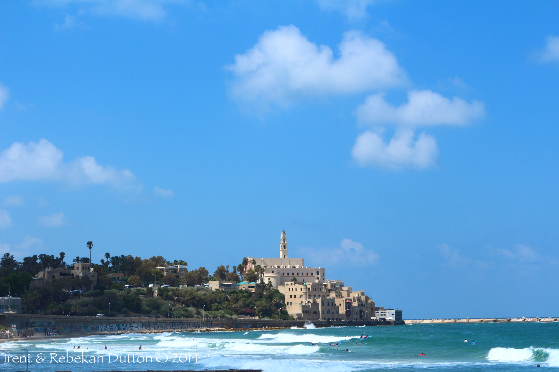 The ancient city of Joppa lies on the coast of the Mediterranean sea, mostly underneath buildings from much later periods, in modern-day Tel Aviv. It served as a seaport for delivering Phoenician cedars to Israel, and was a jumping off point in Jonah’s flight to distant Tarshish. Peter would later receive Cornelius’s emissaries after healing Tabitha in this seaside town.
 From the top of Wadi David at Ein Gedi, you can see the coast of the Dead Sea as far as Masada in the center of the faint ridge in the distance (a wadi is a deep ravine, usually with seasonal flash floods). This view is one not often seen, as it is a 45-minute hike up from the waterfalls of Ein Gedi, at the site of the Chalcolithic era temple at Ein Gedi. I Samuel 23:14 states that David had strong holds in the wilderness, and this wadi at Ein Gedi could have sustained many men while also providing an excellent defensive position.
The photo below was shot with a telephoto lens from the same perspective as the above photo, but zoomed in on Masada. If you are familiar with Masada, you will recognize this as it's north face. You can see the Roman siege ramp on the right side. While Masada is best known from Herod the Great's period, sites like it and Ein Gedi could have also served as strongholds for fugitives like David or for his watchmen who needed to maintain a line of sight with other encampments.
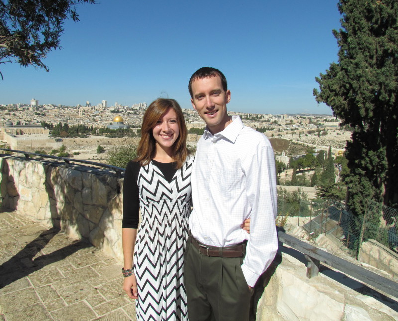 I have a couple of important updates that I am really excited about.
First, ever since I started this website, my goal has been to provide information to you that you can use in either your personal Bible study or in teaching others about the Gospel. To that end, Trent and Rebekah Dutton have agreed to help me. I first met Trent and Rebekah in 2012 as we traveled together in Israel on one of Ferrell Jenkins' tours. Soon afterwards, they decided to pursue Masters degrees in Biblical Archaeology. In the summer of 2013, they spent eight weeks participating in a dig at the Philistine city of Ashkelon. From there, they enrolled at Jerusalem University College for a semester before moving to Chicago to finish their coursework at Wheaton College. Last summer, they were able to go back to Ashkelon and continue their work for a second dig season.
While they were in Israel, they took some time to travel throughout the country and photograph it from all angles. Within the next couple of days, they will begin to share some of their pictures with you by posting them to the blog. If you haven't signed up to have the blog automatically emailed to you, I highly encourage you to do that. Our goal is to post a new picture every weekday. But, be patient with us. Sometimes we get busy!
Second, for those of you who have not heard otherwise, I have scheduled my next Bible Study Tour of Israel! It is scheduled for October 12-23, 2015. For Christians, I highly recommend taking a trip to Israel. Many of the Bible stories that we have read our entire lives take on new life and new understanding when you can see the locations in which they took place. This tour is perfect for married couples, parents & children, grandparents & grandchildren, singles, teachers, preachers and students of the Bible. For more information, please check the Exploring Bible Lands website for an itinerary and frequently asked questions. This is a high-quality tour. If you have any interest, please contact me soon so I can help you reserve a space.
So, in summary: 1) Be sure to sign up for the blog to receive the daily pictures, and 2) Seriously consider joining me on my tour next year!