Viewing entries in
Blog

Random Items of Interest

Tel Burna, located in the Shephelah, is one of the possible locations of Biblical Libnah.Over the past couple of days, a number of little things have come across my desk that I wanted to write about. However, they are starting to pile up, so here is a quick list of items that I thought that you might enjoy. Khirbet Qeiyafa Video - Luke Chandler announced on his blog yesterday that there is a 20 minute video that will be released soon about Khirbet Qeiyafa (sometimes called "The Elah Fortress"). Luke has participated in the dig at that site for a number of years. The video will be released on his blog on June 1. T-minus 10 days and counting....

The Jesus Trail - The BBC has written an interesting piece on the Jesus Trail. It is a 65KM trail that stretches between Nazareth to Capernaum. I have spoken to a couple of people who have hiked this trail. It is on my bucket list. What a fantastic way to learn more about these Biblical lands.

Satellite Bible Atlas - A couple of months ago, I wrote a post about the Satellite Bible Atlas by Bill Schlegel who works at IBEX. Ferrell Jenkins, who recently completed a tour of Israel, provided his tour group with this amazing book. Likewise, I highly recommend that everyone adds this book to your library.

Dig Time - With the summer season approaching, it is time to think about the archaeological digs that will be taking place in the next couple of months. Tel Burna (possibly the site of Biblical Libnah) will be starting their summer dig on June 1. I have some friends that are about to start working with the dig at Ashkelon, one of the Philistine cities during the United and Divided Kingdom periods. Abel Beth Maacah will begin their second season of digging soon. And, of course, there are a number of other digs that are ongoing or will be starting up in the next few weeks. Stay tuned for updates.

Water Flowing From The Sea of Galilee

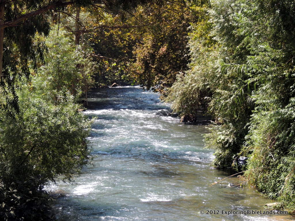
The Senir River in northern Israel.  The Senir River drains the snow melt from Mount Hermon into the Jordan River north of the Sea of Galilee.I was thrilled yesterday to read a story in the Jerusalem Post concerning an increase in the amount of water that they are allowing to flow into the Jordan River. In the past, I have written a number of posts about the water levels in the Sea of Galilee, Jordan River and the Dead Sea. To recap, you can read them here:

However, over the winter, the country of Israel has received a large amount of rain. Mount Hermon, located in the northern part of the country, had a large amount of snow. That snow is now melting and is draining into the Sea of Galilee. About a month ago, Ferrell Jenkins supplied two pictures of the difference in the Sea between last September and April.

Slow water flow of the Jordan River at Qasr al-Yahud.  The Jerusalem Post article mentions that beginning next month, they will release an additional 1,000 cubic meters of water per hour into the Jordan River. I'll be anxious to see what difference this makes further downstream. Currently, by the time the Jordan River flows at Qasr al-Yahud (the traditional Jesus baptismal site in Israel), it is hardly flowing at all. You can see this by looking at the picture to the right.

HT: Todd Bolen

Muhraqa

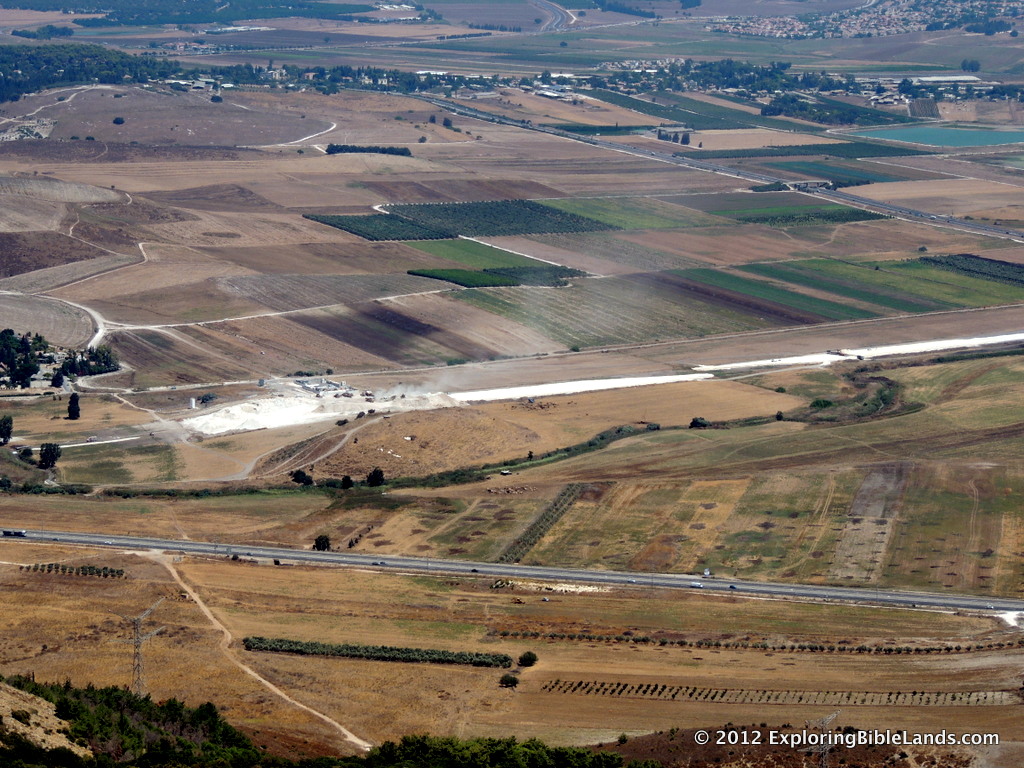
The Jezreel Valley from the top of Mount Carmel.In our Bible class at church, we have been studying the period of time that we commonly refer to as The Divided Kingdom. It is the time in which the people of Israel had divided itself into two, separate nations. Last week, our study focused on the prophet Elijah and the work that he did in the Northern Kingdom of Israel. One of the most memorable stories is of Elijah's contest against the prophets of Baal on Mount Carmel. Mount Carmel is actually a range of mountains that run from the northwest to the southeast and compromise the southwestern edge of the Jezreel Valley. The traditional location of this event is at Muhraqa, which is located about 500 meters (about 1600 feet) above the valley floor.

I don't hike as much as I used to. But, when I do, I really enjoy it. However, if there is one thing that I have learned in hiking, it is to never underestimate the height of the mountain you are climbing. In this case, 500 meters may not sound like a lot of elevation to climb, but it can be. Especially if you have to do it twice!

In 1 Kings 18, it mentions that Elijah and all of the people gathered on top of Mount Carmel.

So Ahab sent for all the children of Israel, and gathered the prophets together on Mount Carmel. - 1 Kings 18:20.

Then, after God showed his power to the people, Elijah gathered the 450 prophets of Baal and slew them at the Kishon Brook. The Kishon Brook is located in the floor of the Jezreel Valley.

And Elijah said to them, “Seize the prophets of Baal! Do not let one of them escape!” So they seized them; and Elijah brought them down to the Brook Kishon and executed them there. - 1 Kings 18:40

A close up of the Kishon Brook from the top of Mount Carmel.(The picture at the top of the this post shows the view from Mount Carmel looking east. The Kishon Brook is in the foreground on the valley floor. The second picture shows you a closeup of the brook, located along the line of shrubs just above the modern road.)

Then, after Elijah warns Ahab about the rain and then reclimbs Mount Carmel.

Then Elijah said to Ahab, “Go up, eat and drink; for there is the sound of abundance of rain.” So Ahab went up to eat and drink. And Elijah went up to the top of Carmel; then he bowed down on the ground, and put his face between his knees, and said to his servant, “Go up now, look toward the sea.” - 1 Kings 18:41-43a

After Elijah sees that his prediction of rain was about to come true, he heads towards the city of Jezreel, which is about 25 kilometers (16 miles) away.

Honestly, the exact timeframe of all of these events is uncertain. But regardless, this is a lot of ground for one man to cover in a short amount of time. Up a mountain, down a mountain, up a mountain and then 16 miles to Jezreel. I am tired just reading it.

Jezreel

Jezreel (center) and the surrounding area.  Picture from the Jezreel Expedition Facebook Page, taken by Todd Bolen Earlier today, the Jezreel Expedition Facebook page updated their cover photo. All I have to say is "wow". That is a fantastic aerial shot of Jezreel as it overlooks the southeastern corner of the Jezreel Valley and the Valley of Harod.

This picture is facing almost due east. Jezreel is the light brown area just below the exact center of the picture. The northern end of Mount Gilboa is off to the right and the Transjordan Plateau is in the distance. The Jordan River, which sits in the Jordan Rift Valley is not visible as it falls below the land line between Jezreel and the Transjordan Plateau.

How many Biblical events can you name that happened in this picture? Well, here is a list to get you started.

  • Gideon narrowed his army from many thousand to only 300 men at the Spring of Harod. That spring is located at the foot of Mount Gilboa in the closest shady area just beyond Jezreel. Later that night, Gideon attacked the Midianites near the Hill of Moreh, located just off of the picture to the left. (Judges 7:1-25)
  • Saul was killed on Mount Gilboa. When the Philistines found Saul's body, they took it and hung it over the walls at Beth-Shean. Beth-Shean sits about halfway between Mount Gilboa and the Jordan River (not visible from this angle). (1 Samuel 31:1-10)
  • Jehu rode "furiously" through this area. Jehu had been anointed by a prophet to be the next king of Israel at Ramoth Gilead. Ramoth Gilead was located on top of the Transjordan Plateau in the distance in this picture. A Jehu was riding back to Jezreel, the men in the tower saw him coming up the valley you see in the picture. (2 Kings 9:1-29)
  • This view is probably the last view that Jezebel saw just before she was pushed out a window to her death. (2 Kings 9:30-37)

Many other Biblical events happened within the view of this picture. In addition, anyone traveling from the Galilee area (to the upper left) to the Jerusalem area could have come through this area.

To the Jezreel Expedition: Thanks for supplying this picture! And to Todd Bolen, thanks for taking the picture! It was a great reminder of all of the things that happened here.

The Cyrus Cylinder

The Cyrus Cylinder in the British Museum.  Photo by Ferrell Jenkins.Earlier this week, I had the opportunity to visit the Smithsonian’s Arthur M. Sackler Gallery and Freer Gallery of Art in Washington DC. My purpose in going was to see the Cyrus Cylinder. The Cyrus Cylinder is a clay cylinder that is dated to the 6th Century BC. It was found during a British expedition in 1879 and is mostly intact. On the exterior is written a declaration by King Cyrus the Great. In this declaration, among other things, King Cyrus allows all prisoners that were being held by the Persian Empire to return to their homeland. This object is often nicknamed "The First Human Rights Charter". This find was very important to Biblical scholars. The Cyrus Cylinder represented an external reference to an event recorded in 2 Chronicles 36.

Now in the first year of Cyrus king of Persia, that the word of the Lord by the mouth of Jeremiah might be fulfilled, the Lord stirred up the spirit of Cyrus king of Persia, so that he made a proclamation throughout all his kingdom, and also put it in writing, saying, Thus says Cyrus king of Persia: All the kingdoms of the earth the Lord God of heaven has given me. And He has commanded me to build Him a house at Jerusalem which is in Judah. Who is among you of all His people? May the Lord his God be with him, and let him go up! - 2 Chronicles 36:22-23

I was thrilled to be able to see such an important historical object. The cylinder is usually housed at the British Museum. However, it is currently on a tour of different museums in the United States. (This is a little ironic. Later this year, my wife and I are planning a trip to London and a stop of the British Museum. While we are there, the cylinder will be over here.)

While viewing it, I was reminded of an important lesson. It takes three requirements to take a picture. First, you must have a camera. No problem, I had my camera with me. Second, you must have something to take a picture of. Again, no problem, the Cyrus Cylinder was less than two feet from my lens. Finally, you must have permission to take the picture. Unfortunately, according to the rather large, armed security officer that seemed to appear from nowhere, I did not have the required permission. Disappointment. I am still forced to use pictures that were taken by friends of mine. The picture above was taken by Ferrell Jenkins when he saw it at the British Museum.

For friends of mine in Houston, New York, San Francisco and Los Angeles: The Cyrus Cylinder is coming to a museum near you. I hope that you had better luck than I with your pictures.

Why Travel to Israel?

In Seth Rodriquez's blog post, he mentions seeing the High Place at Dan for the first time.  This is a picture of me standing on this place of worship, built by Jeroboam.Since I took my first trip to Israel in 2010, I have been asked this question a number of times. Today, on the BiblePlaces.com blog, Seth Rodriquez provides a wonderful answer to that question. I encourage you to read his article. But, to provide a quick summary, Seth states: So why go to Israel? Well, for one thing, the Bible will come alive for you in ways you don't expect.

I completely agree. All of my life, I have read the stories in the Bible. But, to see the actual places where these stories took place was amazing. As I have continued to study, I have come to realize how accurate the writers of the Bible really are. When you see these places, you understand why the writers used the specific words that they used. They were giving an accurate description of the geography of the history they were recording.

The Bible stories are real. At real locations.

Do you have any questions about Biblical geography? If you think I can help, feel free to contact me. If I know the answer, I'll be happy to tell you. If I don't know the answer, I'll be happy to investigate it for you. If I still don't know the answer, we will find someone who does know the answer and ask them.

Tel Burna

Tel Burna, located in the Shephelah, is one of the possible locations of Biblical Libnah.Normally, archaeological excavations in Israel take place in the summer months since their activity is primarily driven by university professors and students. However, a couple of days ago, I noticed that a Spring session has started at Tel Burna. Tel Burna is located in the region of Israel that we know of as the Shephelah. During the time of the United Kingdom, this area served as a boundary between the Israelites and the Philistines. Tel Burna is recognized by a number of scholars as the probable location of the Biblical town of Libnah. (Another possibility is Tel Zayit, which sits about 3 kilometers, or 2 miles, due west of Tel Burna.)

How many events can you name that are associated with Libnah? Let us name a few:

Upon entering the land of Canaan, Joshua fought against the city.

Then Joshua passed from Makkedah, and all Israel with him, to Libnah; and they fought against Libnah. - Joshua 10:29

After the conquest, it was one of the cities given to the children of Aaron.

Thus to the children of Aaron the priest they gave Hebron with its common-land (a city of refuge for the slayer), Libnah with its common-land, Jattir with its common-land, Eshtemoa with its common-land, Holon with its common-land, Debir with its common-land, Ain with its common-land, Juttah with its common-land, and Beth Shemesh with its common-land: nine cities from those two tribes; and from the tribe of Benjamin, Gibeon with its common-land, Geba with its common-land, Anathoth with its common-land, and Almon with its common-land: four cities. All the cities of the children of Aaron, the priests, were thirteen cities with their common-lands. - Joshua 21:13-19

King Josiah of Judah married Hamutal, who was from Libnah.

Jehoahaz was twenty-three years old when he became king, and he reigned three months in Jerusalem. His mother’s name was Hamutal the daughter of Jeremiah of Libnah. - 2 Kings 23:31

God killed 185,000 Assyrians who under the command of King Sennacherib very near Libnah.

Then the Rabshakeh returned, and found the king of Assyria warring against Libnah, for he heard that he had departed from Lachish. - Isaiah 37:8

To find Tel Burna on a map, it is located at 31.629495, 34.873261.

Water Levels at the Sea of Galilee

The Senir River in northern Israel.  The Senir River drains the snow melt from Mount Hermon into the Jordan River north of the Sea of Galilee.I have mentioned the water levels around Israel a number of times on this blog. Here are some of the previous posts:

From the above links, you learn that the entire country of Israel had a lot of rain over the winter. Ferrell Jenkins is currently leading a tour in Israel and supplied us with two pictures of the Sea of Galilee. The first picture was taken last September, at the same time I was over there. The second picture was taken earlier today. There is quite a difference in the water level. The water level should continue to rise a little bit more over the next month as the snow melt from Mount Hermon makes its way through the tributaries and eventually into the Sea of Galilee.

The Bible mentions a number of times about the "early and latter rains", which Israel still experiences today. Because if the distribution of water during the year, the inhabitants of this land has always found unique ways of storing water to use during the dry months (April through October).

The Dead Sea Scrolls

Kando's Antiquity Store, located in Bethlehem.Earlier today, I read an interesting article on the importance of the Dead Sea Scrolls from the standpoint of legitimizing the Bible. It is a really good article and I encourage you to read it. In the article, there is a picture of Khalil Iskander Shahin, otherwise known as "Kando". I have mentioned him in my post on Qumran, which is where the Dead Sea Scrolls were found. Kando was a cobbler who lived in Bethlehem. In the back of his store, he had a small antiquities shop. He ended up being "the middle man" between the bedouins and the museum curators and scholars at the time.

Today, if you travel to Bethlehem, you can stop in a Kando's. Kando's grandson runs a very nice store which specializes in jewelry, olive wood carvings and of course, antiquities.

While we don't need the Dead Sea Scrolls to believe in the accuracy of the Bible, it is nice to know that there are people like Kando. He recognized the importance of the scrolls which were brought to him and made sure that they were preserved for others to study.

From Nazareth to Capernaum

View of the Arbel Pass from the Sea of Galilee.  In Matthew 4, there is a seemingly uninteresting sentence about Jesus. It states:

Now when Jesus heard that John had been put in prison, He departed to Galilee. And leaving Nazareth, He came and dwelt in Capernaum, which is by the sea, in the regions of Zebulun and Naphtali. - Matthew 4:12-13

Jesus went to Nazareth (his hometown) and then decides to go to Capernaum. There are a couple of different ways that He could have travelled, but there is one way in particular which is the most direct. Nazareth is about 325 meters (1400 feet) in elevation and sits on the northern ridge of the Jezreel Valley. Capernaum, on the other hand, sits on the shore of the Sea of Galilee at an elevation of 212 meters (700 feet) below sea level. In the 30 kilometers between the two cities, the road drops nearly 550 meters (2100 feet) as it descends to the sea.

The path goes through the Turan Valley and then arrives at the Sea of Galilee through the valley seen in the picture above. The ridge on the left is Mount Arbel, which towers to 181 meters (~550 feet) in elevation, or about 380 meters (~1100 feet) above the surface of the sea.

Once the path reaches the shores of the Sea of Galilee, it is met by the town of Magdala. When Jesus arrived at Magdala, he would have turned north and walked another 10 kilometers (~6 miles) to Capernaum.

Knowing a little bit about geography of the Bible lands can help even the uninteresting verses become, well, interesting.

The Hinnom Valley

The Hinnom Valley from the top of the Mount of Olives.The traditional southern boundary of the city of Jerusalem is the Hinnom Valley. If you are a student of the Bible at all, then you can probably list a number of times that it is referenced. While serving as boundary between the tribes of Benjamin and Judah, it also is the location of many terrible acts of pagan worship. The Hinnom Valley comes through the western side of the city before turning east and merges into the Kidron Valley. The confluence of the Hinnom and Kidron Valleys is very near the location of En Rogel, which we read about in 1 Kings 1.

Yesterday, I read a really good article by Kyle Pope from Focus Online about the Hinnom Valley. I invite all of you to read it as well.

Simon the Tanner

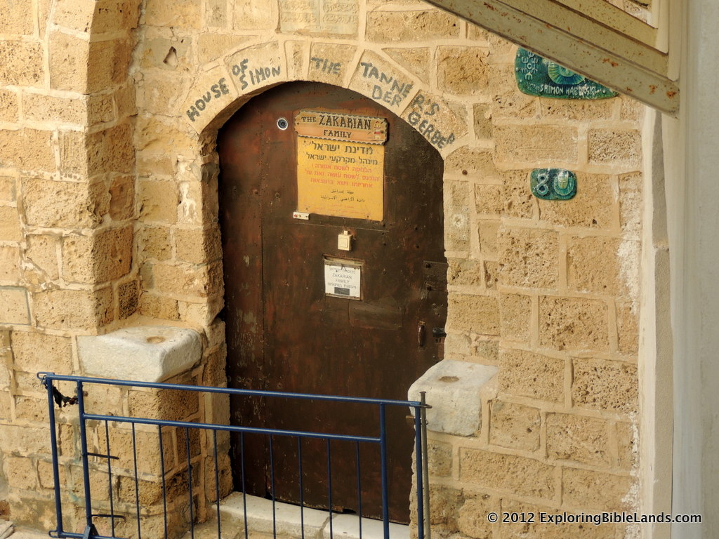
Doorway to the traditional location of the House of Simon the Tanner, located in the Old City of Jaffa.In my last post, I showed a picture of St. Peter's Church in modern day Jaffa (ancient Joppa). This church sits on the traditional location where Peter raised Dorcas from the dead. In that post, I quoted from Acts 9:26-42. In this post, I wanted to discuss the next verse.

So it was that he [Peter] stayed many days in Joppa with Simon, a tanner. - Acts 9:43

After Peter raised Dorcas from the dead, he stayed with a gentleman by the name of Simon. In the next chapter, we learn a little more about Simon's house. An angel speaks to Cornelius, who lived in Caesarea, and tells him to go find Peter.

So he said to him, “Your prayers and your alms have come up for a memorial before God. Now send men to Joppa, and send for Simon whose surname is Peter. He is lodging with Simon, a tanner, whose house is by the sea. He will tell you what you must do.” - Acts 10:4-6

From this verse, we learn that Simon's house was by the sea.

As you walk through the narrow corridors of the Old City of Jaffa, you come across a humble door (pictured above) which is marked as the "House of Simon the Tanner".

Often, when you are the Holy Lands, you see churches or markers denoting the "traditional" locations of many Biblical events. Some of the locations are rooted in a thread of fact, so there is some justification to their claim. Others have to scrutinized a little more closely in light of Scripture. (And there are some, which are just plain wrong.)

Is this home in the ancient city of Joppa? Yes. Is it on the seashore? Yes. (The west side of this building is almost directly on the shoreline.) Is this the real house of Simon the Tanner? Probably not, especially given the fact that the architecture is clearly much more recent. Does it sit on the location of the original house? There is no way of knowing.

Regardless, it is interesting. And, seeing this locations, even if they are not exactly correct, help you to understand the Scriptures more.

Dorcas Lived In Joppa

St. Peter's Church, located in Old Jaffa.In Acts 9, we read an interesting story involving the apostle Peter and a woman by the name of Dorcas. Dorcas died and her friends sent to the nearby town of Lydda to contact Peter. Seeing how distressed the people were, Peter raised Dorcas from the dead.

At Joppa there was a certain disciple named Tabitha, which is translated Dorcas. This woman was full of good works and charitable deeds which she did. But it happened in those days that she became sick and died. When they had washed her, they laid her in an upper room. And since Lydda was near Joppa, and the disciples had heard that Peter was there, they sent two men to him, imploring him not to delay in coming to them. Then Peter arose and went with them. When he had come, they brought him to the upper room. And all the widows stood by him weeping, showing the tunics and garments which Dorcas had made while she was with them. But Peter put them all out, and knelt down and prayed. And turning to the body he said, “Tabitha, arise.” And she opened her eyes, and when she saw Peter she sat up. Then he gave her his hand and lifted her up; and when he had called the saints and widows, he presented her alive. And it became known throughout all Joppa, and many believed on the Lord. - Acts 9:36-42

As is mentioned, this event took place in Joppa (modern day Jaffa). Today, St. Peter's Church (picture above) sits on the traditional location of this story. The church was originally built in 1654, but later destroyed. The current structure was rebuilt in the late 1800s. The church sits high on the tel of ancient Joppa and has a stunning view of the Mediterranean Sea.

Your Rod and Your Staff, They Comfort Me

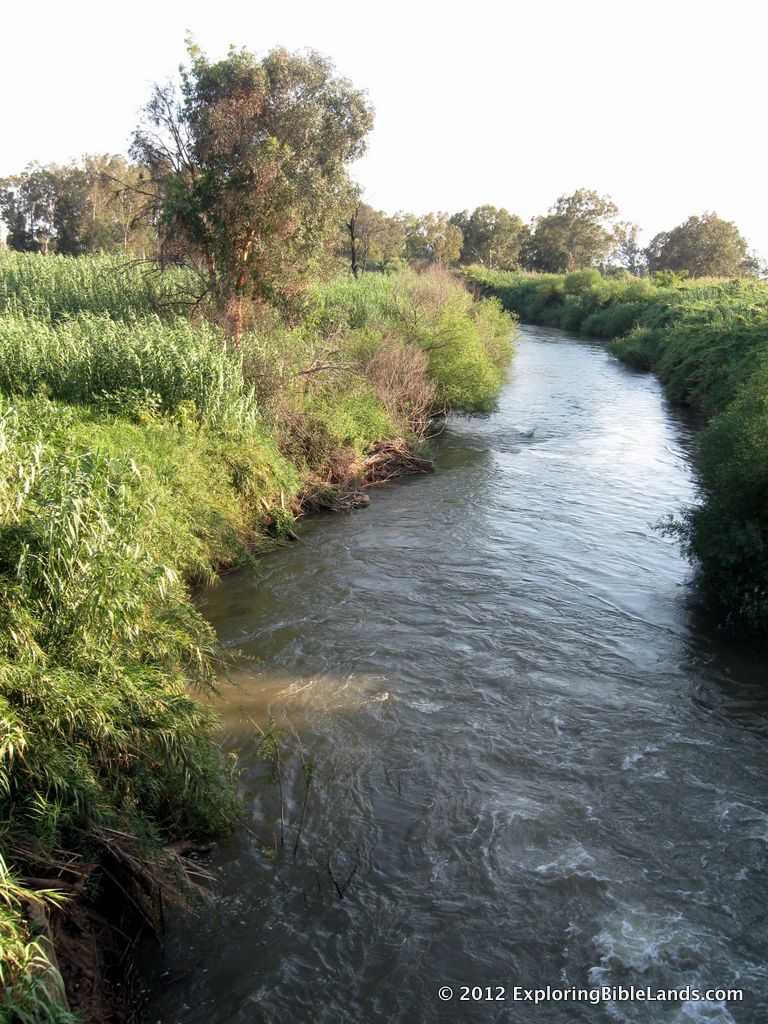
The Jordan River as it makes its way down to the Sea of GalileeThis has been a strange week. In our area, it was Spring Break, so my wife (who is a teacher) and my kids got to relax and do a few things "de-educational". That was good. However, it has also been a sad week. Often, bad things happen when we least expect it. That certainly has been the case this week. Many that I know are hurting right now because of friends and family that are no longer with us. As David was growing up, he spent a lot of time outdoors. He was a shepherd. I can picture him sitting on a hillside at night. He would be comforted by the cool breeze. He would listen to the tumbling stream as it bounced across rocks making its way down the valley. And he would probably stare up at the stars and think about the promise that God had made to Abraham. No doubt, these things influenced David as he wrote the psalms.

Years later, when David was stressed out with the pressures of being king, my guess is that he thought about those simpler times. He probably took comfort in the things in which he wrote. Luckily, we have many of those psalms recorded for us. We can read them when we need comfort.

I've thought about some of those psalms a lot this week.

The Lord is my shepherd; I shall not want. He makes me to lie down in green pastures; He leads me beside the still waters. He restores my soul; He leads me in the paths of righteousness for His name’s sake. Yea, though I walk through the valley of the shadow of death, I will fear no evil; For You are with me; Your rod and Your staff, they comfort me. You prepare a table before me in the presence of my enemies; You anoint my head with oil; My cup runs over. Surely goodness and mercy shall follow me all the days of my life; And I will dwell in the house of the Lord forever. - Psalm 23

Repost: Jesus Stayed in Bethany

The model of the Temple from the First Century Jerusalem Model at the Israel Museum.With all of the discussion in the world this week about Jesus' last week before His crucifixion, I thought that it was a good time to repost an article that I wrote last November. During this week, Jesus' typical pattern was to travel into Jerusalem and spend the day there, but in the evening He would retreat back to the little town of Bethany. Why would He do this? Why not just stay in Jerusalem?

Well, I can think of a couple of reasons. One is obvious, but you'll need a map for the second one.

A View of Jerusalem

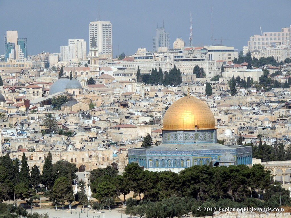
Jersalem, from the Mount of Olives.  Visible are the Dome of the Rock with the blue domes of the Church of the Holy Sepulchre in the distance.Yesterday, Todd Bolen, in his "Weekend Roundup" blog post, included a link to a very high quality picture of the city of Jerusalem from the Mount of Olives. Having stood on that exact spot and spend many days in Jerusalem, I spent a lot of time looking at this picture, panning to the left, panning to the right, zooming in, zooming out, etc. There are so many things to see, and the quality of this picture allows you to see many things in relationship to one another. Given that many people are thinking about the events of Jesus' trials, crucifixion and resurrection this week, I thought that I would point out some sites of interest from this picture. (NOTE: The smaller pictures in this post are screen captures from zoomed in views of the larger, high-quality image. I recommend opening the larger image in a separate window so you can read through is post. Then, use the smaller pictures to find their location.)

First, let me discuss a location that is not in the picture: Bethany. During the last week of Jesus' life before he crucifixion, Jesus stayed in Bethany. From this picture, Bethany is behind you about a kilometer. Every day during this week, Jesus would leave Bethany, climb over the Mount of Olives and descend into Jerusalem.

Zoomed in view of the Dome of the Rock.While He as in Jerusalem, Jesus would typically go to the Temple. The Temple was located on the large Temple Mount platform that was enlarged by King Herod. Since the late 7th Century AD, the space where the Temple was located has been occupied by a Muslem shrine commonly referred to as the Dome of the Rock. Jesus would spent a great deal of time during this week in the Temple or Temple Precinct teaching those that would listen.
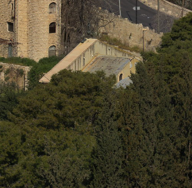
Zoomed in view of the Church of All Nations.On the night that Jesus was taken into custody, he was with his disciples at the Garden of Gethsemane, which was located east of the Temple Mount, across the Kidron Valley at the foot of the Mount of Olives. Today, the traditional location of the Garden of Gethsemane is occupied by the Church of All Nations, which is used by the Roman Catholic Church. In the picture, you can see the top of the building as it faces the Old City. It is here where Jesus prayed to His Father, was betrayed by one of His disciples and arrested.
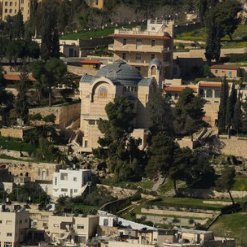
Zoomed in view of the Church of St. Peter in Gallicantu.After Jesus was arrested, he was led to the house of Annas and then to Caiaphas. The exact locations of these events, is unknown. However, most people feel that they were probably held in what is commonly called the Upper City. The traditional location is now occupied by a Roman Catholic Church called the Church of St. Peter in Gallicantu (meaning "cock's crow"). The accompanying picture shows a close up of the building from the Mount of Olives. If you zoom in close enough, you can see some First Century steps leading up to the right of the building. Even if these are not the exact locations, you can begin to estimate the distance Jesus had to walk (while in custody) from the Garden of Gethsemane to His first trials before Annas and Caiaphas.
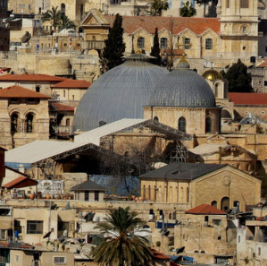
Zoomed in view of the Church of the Holy Sepulchre.After Pilate condemned Him to death, Jesus was led to Golgotha to be crucified. Once He died, His body was taken down by Joseph of Arimathea and buried in a nearby tomb. Like many other locations, the exact spot of these events are not known. However, the traditional locations place it at the spot where the Church of the Holy Sepulcher now resides. It can easily be identified by the blue domes that stand out against the other buildings in the city.

The view of Jerusalem from the Mount of Olives is a view that everyone should experience. So much history can be seen from this one place. Perhaps at a later time, I will point out other Biblical areas of interest that can be seen from here.

HT: Todd Bolen

The Dead Sea Scrolls Exhibit

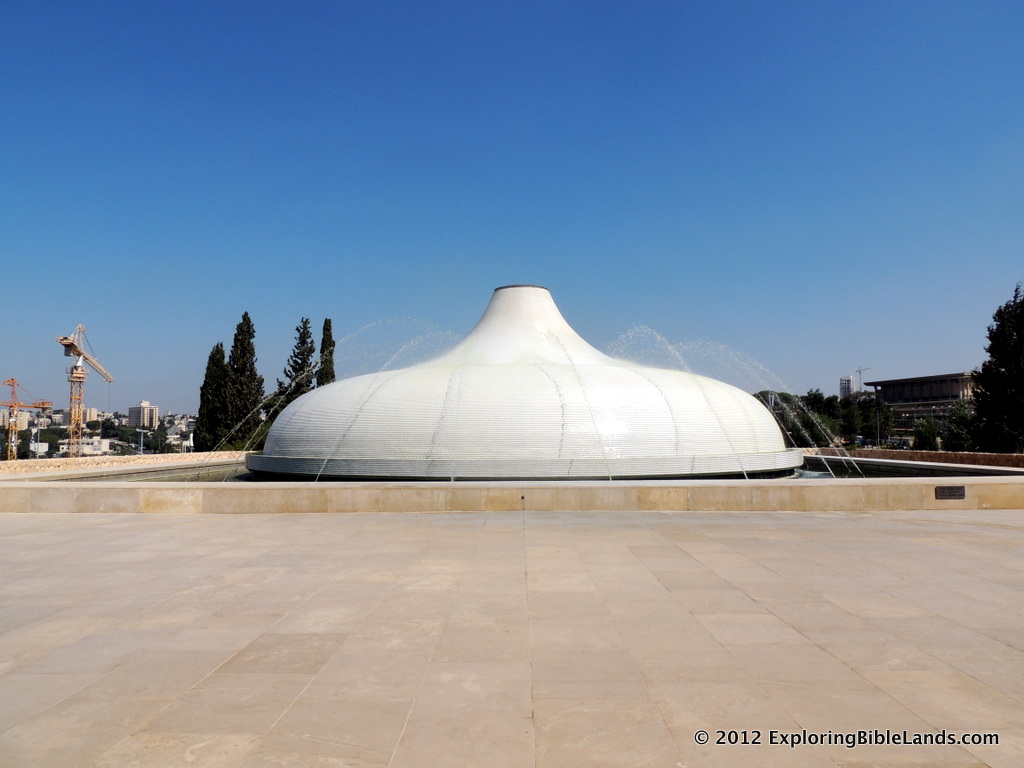
The Shrine of the Book at the Israel Museum where the Dead Sea Scrolls are on display.This morning, while visiting Israel, President Obama had the opportunity to visit the Israel Museum. In particular, he visited an area of the museum called "The Shrine of the Book", where some of the Dead Sea Scrolls are on display. The Dead Sea Scrolls were found in the caves of Qumran and are some of the oldest manuscripts of the Bible. Earlier today, USA Today posted a video of him visiting the site. This video is rather rare in the fact that cameras are normally not allowed in this area. Having been there a couple of times, I've been "reminded" of the rules by the kind museum employees. I guess I'll need to go get myself elected President of the United States if I want my own pictures!

The Latter Rains

The steps on the southern end of the Temple Mount, with the Mount of Olives in the distance.I read a story yesterday of a tour group that was sitting on the southern steps of the Temple Mount in Jerusalem. While they were there, a huge rainstorm came up causing them to retreat to the closest building for cover. As much as the tourists probably did not like it, I am sure that the people living in Israel and the West Bank were very thankful for it. They are in the midst of the period of year of the "latter rains". We read about this a number of times in the Scripture. Here is one example:

Then I will give you the rain for your land in its season, the early rain and the latter rain, that you may gather in your grain, your new wine, and your oil. - Deuteronomy 11:14

The early rains fall in October to November and the latter rains fall in February to March. Between the months of April and October, the country of Israel gets very little, if any, rain. So, the rain that fell in Jerusalem over the weekend might be the last rain that the city sees for a number of months.

Isn't it interesting how the truths found in the Bible are still true?

The Ark in Jerusalem

The city of Jerusalem, from the Mount of Olives.NOTE: This is the final post in a series on locations associated with the Ark of the Covenant. To see earlier posts, just enter "Ark of the Covenant" in the search bar. The Ark has had a long journey. After being built by Moses (and his people) while en route to the Promised Land, the Ark made a number of stops as the children of Israel worked to secure the land. Finally, the Ark was located at the house of Abinadab in Kiriath Jearim where it remained for a long time. Finally, David came to the throne and wanted the Ark moved to Jerusalem.

Along the way, David and his men were transporting the Ark by use of an ox cart. (This, by the way, was not according to God's instruction.) At one point, the Ark stumbled and Uzzah, one of the sons of Abinadab, touched the Ark to steady it. Because of this, God killed Uzzah instantly.

Once in Jerusalem, David put the Ark in the tabernacle.

So they brought the ark of the Lord, and set it in its place in the midst of the tabernacle that David had erected for it. Then David offered burnt offerings and peace offerings before the Lord. - 2 Samuel 6:17

Later, once Solomon built the temple, the Ark was moved from the tabernacle to the Most Holy Place in the temple.

And he prepared the inner sanctuary inside the temple, to set the ark of the covenant of the Lord there. - 1 Kings 6:19

So, what happened to the Ark? Where is it now? These are questions that are commonly asked, but difficult to answer. In 586BC, the Babylonians destroyed Jerusalem and one theory is that they may have either destroyed or taken the Ark with them. Another theory states that Jeremiah, being warned by God of the oncoming Babylonian invasion, took the Ark and hid it in a cave near Mount Nebo. Even today, the Ethiopian Orthodox Church claim to be in possession of the Ark. In 1981, Steven Spielberg make a feature length movie claiming that the Ark was found in the 1930s by Professor Henry Jones, Jr in the lost city of Tanis.

For hundreds of years, the Ark of the Covenant represented God's presence with His people. For people who obeyed God, the Ark brought safety, security and prosperity. For those that disobeyed God, it brought punishment.

The Ark at Kiriath-Jearim

The Arab village of Abu Ghosh, which sits on the ancient town of Kiriah-Jearim. Photo by Ferrell Jenkins.NOTE: This is the seventh in a series of posts about locations that are associated with the Ark of the Covenant. Previously, we have discussed: the Plains of Moab, the Jordan River, Jericho, Mount Ebal and Gerizim, Shiloh, the Land of the Philistines and the Sorek Valley. The citizens of Beth-Shemesh received the Ark from the Philistines as it made its way through the Sorek Valley. However, they made a mistake and looked into the Ark, for which they were punished by God.

Then He struck the men of Beth Shemesh, because they had looked into the ark of the Lord. He struck fifty thousand and seventy men of the people, and the people lamented because the Lord had struck the people with a great slaughter. - 1 Samuel 6:19

After this event, they sent to the people of Kiriath-Jearim to take the Ark.

And the men of Beth Shemesh said, “Who is able to stand before this holy Lord God? And to whom shall it go up from us?” So they sent messengers to the inhabitants of Kirjath Jearim, saying, “The Philistines have brought back the ark of the Lord; come down and take it up with you.” Then the men of Kirjath Jearim came and took the ark of the Lord, and brought it into the house of Abinadab on the hill, and consecrated Eleazar his son to keep the ark of the Lord. - 1 Samuel 6:20-7:1

The Ark remained in the house of Abinadab for many years before David eventually took the Ark to Jerusalem.

The ancient city of Kiriath-Jearim is located about 15 kilometers (9 miles) west of the city of Jerusalem. The modern Arab village of Abu Ghosh sits on the location and can be seen just north of the main highway that runs between Jerusalem and Tel Aviv. It is first mentioned in Scripture in Joshua 9:17 as one of the cities of the Hivites. It is also mentioned in Judges 18:12 as one of the encampments of the Danites as they made their way from their allotted territory to the northern location that they moved to.

Years later, as the Ark was leaving Kiriath-Jearim, we have the story of Uzzah being punished by death for touching the Ark.