Viewing entries in
Blog

The Ark in the Sorek Valley

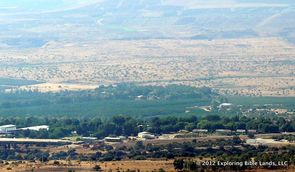
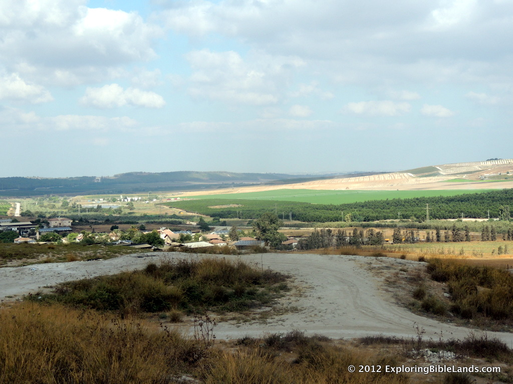
Looking west down the Sorek Valley from the tel at Beth Shemesh.NOTE: This is seventh story in a series of posts following locations where the Ark of the Covenant visited. Other places we have visited include the Plains of Moab, the Jordan River, Jericho, Mount Ebal and Mount Gerizim, Shiloh and the Land of the Philistines. For seven months, the Ark of the Covenant plagued the Philistines. Consequently, no one wanted the Ark and it was passed between the cities of Ashdod, Gath and Ekron. Finally, they decided that the only way to rid themselves of the tumors was to return the Ark to the Israelites.

And the Philistines called for the priests and the diviners, saying, “What shall we do with the ark of the Lord? Tell us how we should send it to its place.” So they said, “If you send away the ark of the God of Israel, do not send it empty; but by all means return it to Him with a trespass offering. Then you will be healed, and it will be known to you why His hand is not removed from you.” - 1 Samuel 6:2-3

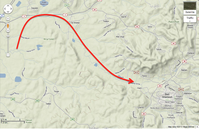
So, the Philistines loaded the Ark onto a cart pulled by two milk cows and sent it down through the Sorek Valley toward the Israelite city of Beth Shemesh. Along with it, they included a chest that had five golden tumors and some golden rats to represent the plague that had been wrought upon them. As the cows and cart neared Beth Shemesh, the people were in the valley working in the fields and saw it coming.

Now the people of Beth Shemesh were reaping their wheat harvest in the valley; and they lifted their eyes and saw the ark, and rejoiced to see it. Then the cart came into the field of Joshua of Beth Shemesh, and stood there; a large stone was there. So they split the wood of the cart and offered the cows as a burnt offering to the Lord. The Levites took down the ark of the Lord and the chest that was with it, in which were the articles of gold, and put them on the large stone. Then the men of Beth Shemesh offered burnt offerings and made sacrifices the same day to the Lord. - 1 Samuel 6:13-15

Possible path the Ark of the Covenant took as it travelled from Ekron through the Sorek Valley to Beth Shemesh.

This section of the Sorek Valley runs basically east to west through the Shephalah. It is also mentioned a couple of other times in the Bible.

  • It served as a portion of the boundary between the Tribe of Dan and the land of the Philistines.
  • Samson's first wife came from Timnah, which sat in the western end of the valley (Judges 14:1-3)
  • Another one of Samson's wives, Delilah, lived in the Sorek Valley. (Judges 16:4)

The Ark in the Land of the Philistines

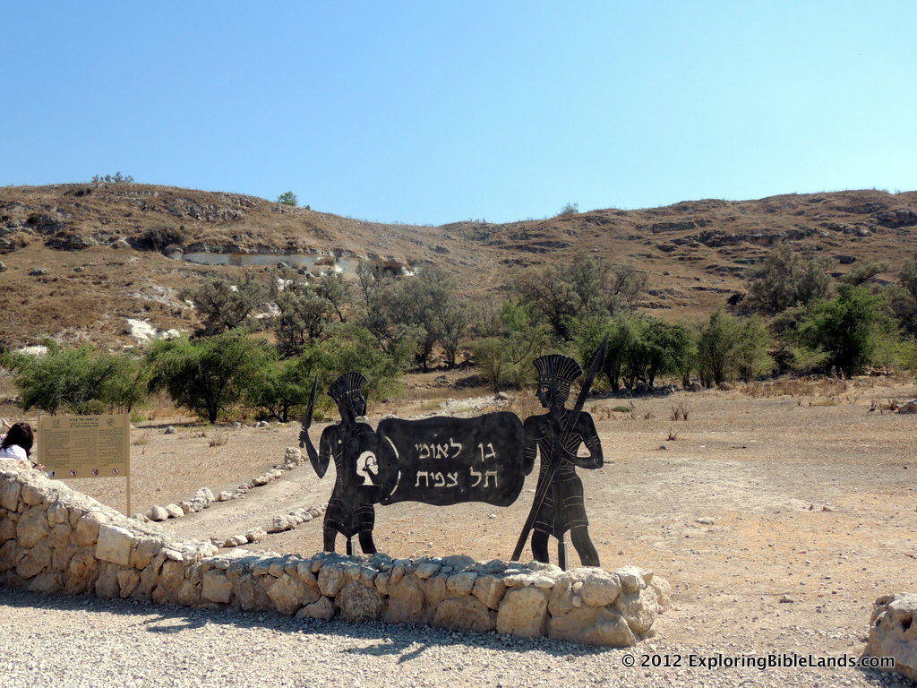
The tel of Gath, located in Tel Tzafit National Park.In the last post in this series, we learned that the Ark of the Covenant had been captured by the Philistines in the battle with the Israelites at Ebenezer. Just as the Ark generally brought prosperity for the Israelites, the Philistines' experience was not nearly as positive. First, they took the Ark to the city of Ashdod and placed it in the house of Dagon. The next morning, when the Philistines went to the house, they found Dagon had fallen face first before the Ark. The following morning, the god Dagon had fallen before the Ark and broken into pieces. However, it was worse for the citizens of Ashdod. God struck them with tumors.

Having had their fill of the Ark in their city, they sent the Ark to Gath. Unfortunately, for the citizens of Gath, the results were similar.

Therefore they sent and gathered to themselves all the lords of the Philistines, and said, “What shall we do with the ark of the God of Israel?” And they answered, “Let the ark of the God of Israel be carried away to Gath.” So they carried the ark of the God of Israel away. So it was, after they had carried it away, that the hand of the Lord was against the city with a very great destruction; and He struck the men of the city, both small and great, and tumors broke out on them. - 1 Samuel 5:8-9

By this time, the citizens of Ekron had heard of what had happened in the other cities and were not excited about the Ark's arrival.

Therefore they sent the ark of God to Ekron. So it was, as the ark of God came to Ekron, that the Ekronites cried out, saying, “They have brought the ark of the God of Israel to us, to kill us and our people!” So they sent and gathered together all the lords of the Philistines, and said, “Send away the ark of the God of Israel, and let it go back to its own place, so that it does not kill us and our people.” For there was a deadly destruction throughout all the city; the hand of God was very heavy there. And the men who did not die were stricken with the tumors, and the cry of the city went up to heaven. - 1 Samuel 5:10-12

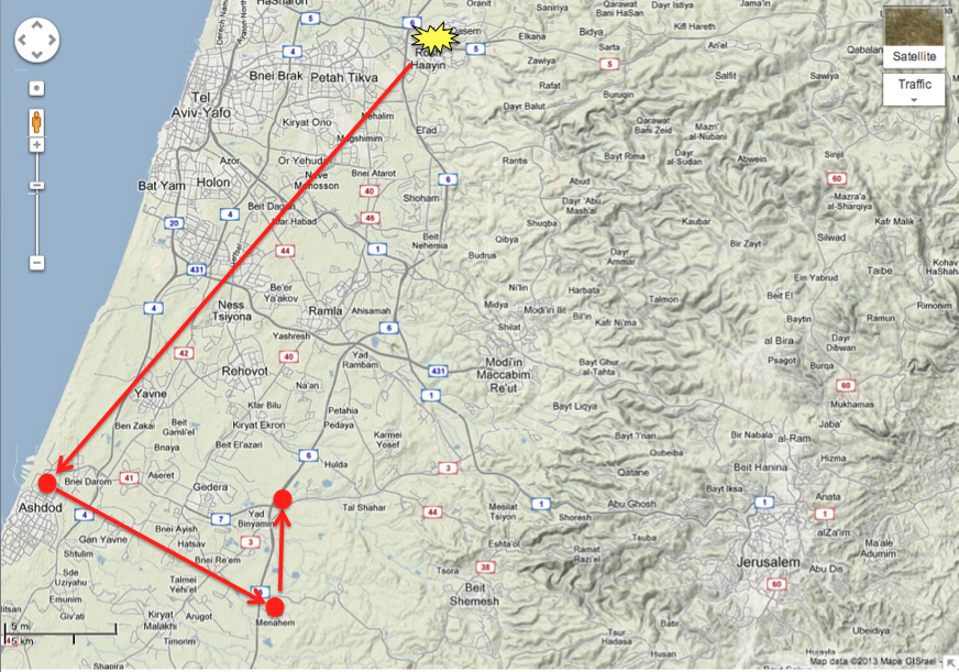
All of these cities were in the region of Israel that we often call the "Coastal Plain". It is a region about 10-15 miles wide between the Shephelah and the Mediterranean Sea.

The path the Ark of the Covenant took as it was passed through the land of the Philistines.

In the next post of this series, we will look at how the Ark was delivered back to the Israelites and where this took place.

Hilly Jerusalem

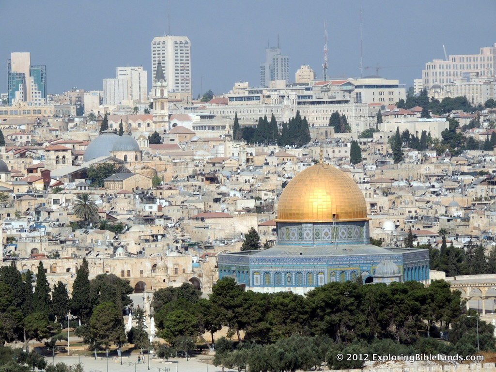
Jersalem, from the Mount of Olives.  Visible are the Dome of the Rock with the blue domes of the Church of the Holy Sepulchre in the distance.Back in high school, I used to run cross-country. And, I used to run a lot of 10 kilometer races. I don't run much any more, but tend to stand on the sidelines and watch my son run. However, I do try to keep up with it. Recently, I read a number of articles about the Jerusalem Marathon. It was held yesterday with about 20,000 runners competing in the races. The Jerusalem Post had a story about the race. In it, they interviewed the winner, Amos Matui from Kenya. I thought his quote was interesting.

Elite Kenyan runner Amos Matui, who won marathons in Singapore, the US state of Tennessee, and in Casablanca, Morocco, also said he expected his faith as a Seventh Day Adventist to carry him over the finish line. “It’s spiritual and exciting to see this ancient city,” he said. “This is my first time in Jerusalem, and it’s hillier than I expected... we hope to have a good emotional and impressive run.”

Yes, Jerusalem is hilly. The older part of the city consists of about 5 different hills with rather deep valleys running between them. In ancient times, these hills made it easy to defend and difficult to attack. It modern times, these same hills are apparently troublesome for marathoners.

Tips For Traveling to Israel

Steps leading to the High Place at Dan.  Jeroboam built this platform for worship to a golden calf during the period of the Divided Kingdom.Taking a trip to Israel is a life-changing experience. For those of us who have continually read the stories in the Bible since childhood, the opportunity to see the actual places where these stories took place is a once-in-a-lifetime experience. So, you need to make the most of it. Recently, Wayne Stiles has written two excellent articles on how to get the most out of your trip. I highly recommend reading them. His first article, entitled "How to Prepare for a Holy Land Tour" discusses a number of items that you need to do before you go. Of the things he mentioned, I'd like to highlight two of them.

First, become familiar with the geography. You have probably seen a map of Israel a million times. There is probably one posted in your Bible classroom at church. But, have you really studied it? You need to. You are about to be there. Understand the terrain. Have a general understanding of where places are and how they are affected by other locations.

Second, get in shape. You are going to visiting places that were originally constructed thousands of years go. Therefore, there are no elevators, escalators or moving sidewalks. There are uneven sidewalks, ancient stone steps and rocky slopes. You need to be able to get on and off a bus with ease, walk moderate distances on uneven terrain and do so in the heat of the outdoors. You don't have to be in perfect shape to go, but you need to be prepared for what is ahead of you. Trust me, it will be worth it.

His second article, entitled "8 Tips to Maximize your Holy Land Tour" discusses things you should do while you are over there. Again, I'll highlight a couple of suggestions.

First, stay hydrated. As I have already mentioned, you'll be doing a lot of outside walking. Depending on when you go, the air could be pretty dry. Normally, I do not get out of the bus without three items: my hat, my camera and a bottle of water. Drink water continuously while you are over there. I know what it is like to be over there and not drink enough water. Trust me, you will be glad that you did.

Second, look for opportunities to see things that are not on your itinerary. Every tour spends a night or two in Tiberias on the shore of the Sea of Galilee. One morning you are there, get up a little early, walk down to the shore and watch the sun rise over the Golan Heights. It is not on your itinerary, but it will be one of the highlights of your trip.

I know of some friends that are going over there in April. Be sure to read what Wayne has written. His words will help you get the most out of your trip.

The Ark at Shiloh

This picture of Tel-Shiloh in the Hill Country.  Photo taken by Ferrell Jenkins.NOTE: This post is the fifth in a series of posts about locations where the Ark of the Covenant visited. I have previously written about the Plains of Moab, the Jordan River, Jericho and Mount Ebal and Mount Gerizim. With the Israelites on the western side of the Jordan River, Joshua led them as them began to conquer the land. Joshua 9-21 details the battles that Joshua led, the cities that he conquered and the division of the land among the tribes. At the end of Joshua 19 we read,

These were the inheritances which Eleazar the priest, Joshua the son of Nun, and the heads of the fathers of the tribes of the children of Israel divided as an inheritance by lot in Shiloh before the Lord, at the door of the tabernacle of meeting. So they made an end of dividing the country. - Joshua 19:51

The Israelites had set up the tabernacle at Shiloh, and in it, the Ark of the Covenant was kept. Joshua used this location as the place where he divided the land for the Israelites.

Shiloh is located in the hill country about 30 miles north of Jerusalem. Today, Shiloh is identified with Tell Seilun and a lot of excavation work has been done there.

Shiloh is where Samuel grew up. When Samuel was born, Hannah, his mother, promised to give the child back to God. When Samuel was old enough, she took him to live with Eli, who lived in Shiloh.

Now there was a certain man of Ramathaim Zophim, of the mountains of Ephraim, and his name was Elkanah the son of Jeroham, the son of Elihu, the son of Tohu, the son of Zuph, an Ephraimite. And he had two wives: the name of one was Hannah, and the name of the other Peninnah. Peninnah had children, but Hannah had no children. This man went up from his city yearly to worship and sacrifice to the Lord of hosts in Shiloh. Also the two sons of Eli, Hophni and Phinehas, the priests of the Lord, were there....Now when she had weaned him, she took him up with her, with three bulls, one ephah of flour, and a skin of wine, and brought him to the house of the Lord in Shiloh. And the child was young. Then they slaughtered a bull, and brought the child to Eli. - 1 Samuel 1:1-3, 24-25

The Ark remained at Shiloh for a few hundred years through most of the time period that we know as the "period of the judges". In 1 Samuel 4, the Ark was taken from Shiloh to a battle against the Philistines. This decision turned out to be a bad one. The Ark was captured by the Philistines. When the news of this reached Eli, who was an old man by this time, he fell off his chair in the gate of the city of Shiloh and died.

Then a man of Benjamin ran from the battle line the same day, and came to Shiloh with his clothes torn and dirt on his head. Now when he came, there was Eli, sitting on a seat by the wayside watching, for his heart trembled for the ark of God. And when the man came into the city and told it, all the city cried out. When Eli heard the noise of the outcry, he said, “What does the sound of this tumult mean?” And the man came quickly and told Eli. Eli was ninety-eight years old, and his eyes were so dim that he could not see. Then the man said to Eli, “I am he who came from the battle. And I fled today from the battle line.” And he said, “What happened, my son?” So the messenger answered and said, “Israel has fled before the Philistines, and there has been a great slaughter among the people. Also your two sons, Hophni and Phinehas, are dead; and the ark of God has been captured.” Then it happened, when he made mention of the ark of God, that Eli fell off the seat backward by the side of the gate; and his neck was broken and he died, for the man was old and heavy. And he had judged Israel forty years. - 1 Samuel 4:12-18

The Ark never returned to Shiloh again.

The Ark Between Mount Ebal and Mount Gerizim

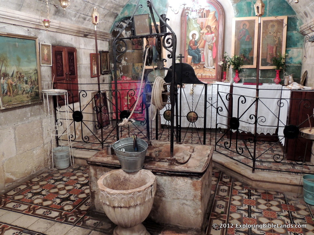
Jacob's Well, which is located in the basement of an Eastern Orthodox monastery in Nablus.  Nablus is located in a narrow valley between Mount Ebal and Mount Gerizim.NOTE: This is the fourth in a series of posts on locations associated with the Ark of the Covenant. We have previously discussed the Plains of Moab, the Jordan River and the city of Jericho. After the defeat of Ai, Joshua gathered the people together to read the Book of the Law to them. He placed the Ark of the Covenant between Mount Ebal and Mount Gerizim. The people then divided themselves on the two mountains and listened to Joshua.

Now Joshua built an altar to the Lord God of Israel in Mount Ebal, as Moses the servant of the Lord had commanded the children of Israel, as it is written in the Book of the Law of Moses: “an altar of whole stones over which no man has wielded an iron tool.” And they offered on it burnt offerings to the Lord, and sacrificed peace offerings. And there, in the presence of the children of Israel, he wrote on the stones a copy of the law of Moses, which he had written. Then all Israel, with their elders and officers and judges, stood on either side of the ark before the priests, the Levites, who bore the ark of the covenant of the Lord, the stranger as well as he who was born among them. Half of them were in front of Mount Gerizim and half of them in front of Mount Ebal, as Moses the servant of the Lord had commanded before, that they should bless the people of Israel. And afterward he read all the words of the law, the blessings and the cursings, according to all that is written in the Book of the Law. There was not a word of all that Moses had commanded which Joshua did not read before all the assembly of Israel, with the women, the little ones, and the strangers who were living among them. - Joshua 8:30-35

These two mountains, located about 60 kilometers (40 miles) north of Jerusalem, face each other with the modern city of Nablus on a very narrow piece of land between them. Nablus is approximately 550 meters (~1800 feet) above sea level and the mountains each rise over 300 meters (1000 feet) on either side. As the Israelites sat on these mountains to listen to Joshua, it would have been very easy for them to look across the valley at their fellow family members on the other side.

This same area is the same location as the Biblical city of Shechem. Jewish tradition holds that the original meaning of the word is "saddle", which gives indication of the what it looks like. In Genesis 12, Abraham offered a sacrifice to God in this area. Later, Jacob built a well nearby that is mentioned a number of times in the Bible. Shortly after the nation divided, 1 Kings 12:1 tells us that capital city of the northern nation was briefly set up at Shechem.

And Rehoboam went to Shechem, for all Israel had gone to Shechem to make him king. - 1 Kings 12:1

In the New Testament, we read of Jesus coming through this area and has a conversation with a Samaritan Woman by Jacob's Well.

He left Judea and departed again to Galilee. But He needed to go through Samaria. So He came to a city of Samaria which is called Sychar, near the plot of ground that Jacob gave to his son Joseph. Now Jacob’s well was there. Jesus therefore, being wearied from His journey, sat thus by the well. - John 4:5-6

Given the history that the Israelites had with this area, as well as the geographical features that allowed for a large group of people to be gathered, it is no wonder that Joshua chose this location to remind the people of the Law with God had given to them.

The Ark around the City of Jericho

Archaeological work at Tell es-Sultan, otherwise known as ancient Jericho.NOTE: This is the third post of a series in which we are discussing some of the locations where the Ark of the Covenant was present. We've discussed the Plains of Moab and the Jordan River. After the Israelites entered the Promised Land, they set out to fulfill the commandment that God had given to them. They needed to drive out and destroy all of the inhabitants of the land of Canaan. In doing so, God would be with them and deliver the land to them. The Israelites put their sights on Jericho.

The city of Jericho (also known as "The City of Palms") is mentioned several times in Scriptures. Among them are:

  • Elijah and Elisha went through the city - 2 Kings 2:1-6
  • Jesus healed the blind man Bartimaeus in the city - Mark 10:46-52
  • Zacchaeus lived in the city - Luke 19:1-10

Jericho is located about 10 kilometers (6 miles) west of the Jordan River at an elevation of about 260 meters (850 feet) below sea level. Because of the warm tropical conditions, King Herod built a large palace in Jericho. The city is only about 15 miles from Jerusalem, but it is over 3000 feet lower in elevation. And due to the geography, Jericho only receives about one-fourth of the annual rainfall as Jerusalem.

At the time of the conquest, Jericho was a fortified city surrounded by a casemate wall. The harlot Rahab had a house on this wall.

Then she let them down by a rope through the window, for her house was on the city wall; she dwelt on the wall. - Joshua 2:15

For six days, the Israelites carried the Ark of the Covenant from Gilgal (where they were encamped) and walked around the city of Jericho. On the seventh day, the Ark of the Covenant led them around the city of Jericho seven times. After which, they blew their trumpets and the walls of the city were breached. It was a glorious victory for God and His people.

The Ark in the Jordan River

The Jordan River, just north of the where the river flows into the Dead Sea.This is the second in a series of posts featuring some of the locations where the Ark of the Covenant resided. The first post of the series featured the Plains of Moab. Now, we'll move on to the Jordan River. Granted, the Ark really didn't reside in the Jordan River, but merely paused there as a demonstration of God's power. As the Israelites approached the Promised Land, there was one remaining geographical stumbling-block in their way, the Jordan River. The Jordan River is a 250 kilometer (about 150 miles) river that flows from north to south along a fault line in eastern Asia. Today, a majority of it serves as the boundary between Israel & the West Bank to the west and the Hashemite Kingdom of Jordan to the east.

The Jordan River as it flows underneath the old Allenby Bridge. This picture was taken around 1920.A visit to the Jordan River today in the area where the Israelites crossed could leave the visitor with some confusion about why a miracle was needed to get the people across. As you can tell from the picture at the top of this post, the Jordan River is not much to look at and would not have been a major impediment to the Israelites as they crossed into Canaan. (I have discussed the low level of the water in other posts.) However, this is not what the river looked like at that time. Of course, we don't have photographs from that time, but we can make some estimates. Even as little as 100 years ago, the width of the Jordan River was much wider than it is today. Consider the other two pictures associated with this post. The first picture shows the Jordan River as it flows under the old Allenby Bridge. This picture was taken around 1920 and as you can tell, the river is much wider. The second picture is much more striking. This picture, taken in 1935, shows how the river could easily flood the region during the rainy periods. (NOTE: Both of these pictures are from Volume 3 of The American Colony and Eric Matson Collection.)

Now, let us look back at our story. In Joshua, we read:

So it was, when the people set out from their camp to cross over the Jordan, with the priests bearing the ark of the covenant before the people, and as those who bore the ark came to the Jordan, and the feet of the priests who bore the ark dipped in the edge of the water (for the Jordan overflows all its banks during the whole time of harvest), that the waters which came down from upstream stood still, and rose in a heap very far away at Adam, the city that is beside Zaretan. So the waters that went down into the Sea of the Arabah, the Salt Sea, failed, and were cut off; and the people crossed over opposite Jericho. Then the priests who bore the ark of the covenant of the Lord stood firm on dry ground in the midst of the Jordan; and all Israel crossed over on dry ground, until all the people had crossed completely over the Jordan. - Joshua 3:14-17

The Jordan River, in 1935, as it overflowed its banks. The Allenby Bridge can be seen in the upper-right portion of the photographAs the Israelites approached the Jordan River, it had overflowed its banks. The priests carried the Ark of the Covenant and as they put their feet into the waters of the Jordan River, it dried up. The waters piled up at Adam, and the Israelites were able to cross on dry land. After all of the Israelites had crossed, the priests walked out of the riverbed and the Ark of the Covenant entered the Promised Land for the first time. We will pick up the story here in our next post.

The Ark in the Plains of Moab

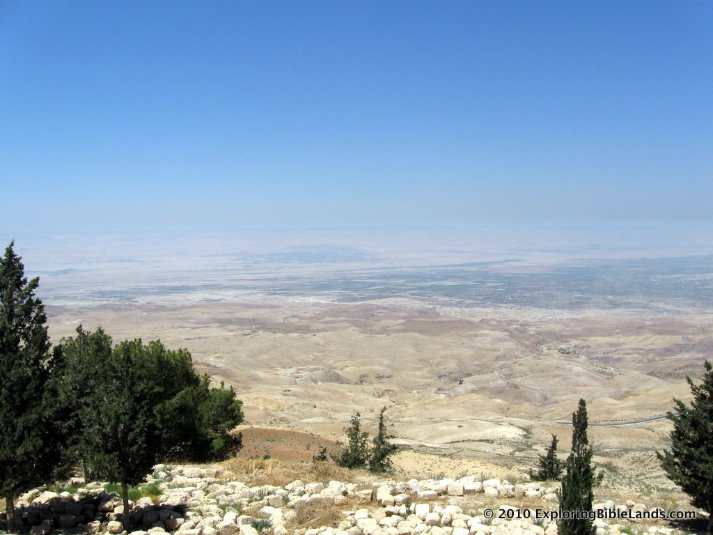
View looking west from Mount Nebo at the Plains of Moab across from Jericho.When the Israelites were encamped at Mount Sinai, God gave instructions to build a gold-plated, wooden box. This box became known as the Ark of the Covenant and it remained in the possession of the Israelites for hundreds of years. They carried the Ark before them and it led them into battle. I thought that it would be interesting to take a look at some of the places where the Ark resided and discuss them in a series of posts. After wandering in the wilderness for 40 years, the Israelites approached the land of Canaan from the east and temporarily settled in the Plains of Moab. Moses ascended to the top of Mount Nebo where God showed him the land that was being given to the nation of Israel. After Moses died, the Israelites stayed in the Plains of Moab while they mourned his death.

And the children of Israel wept for Moses in the plains of Moab thirty days. So the days of weeping and mourning for Moses ended. - Deuteronomy 34:8

The plains of Moab stretched north-to-south along the eastern side of the Jordan River, opposite from the city of Jericho. The land is rather flat and ranges from 5-10 miles wide before rising dramatically into what we commonly call the Trans-Jordan plateau. A majority of it lies below sea level, but despite the arid climate, crops and agriculture flourish.

Later, we recognize this location as the same area where Elijah was taken into Heaven in a whirlwind. In New Testament times, this was part of what we know as Perea. The location of Bethany beyond the Jordan was also in this same area.

Different Views of the Jezreel Valley

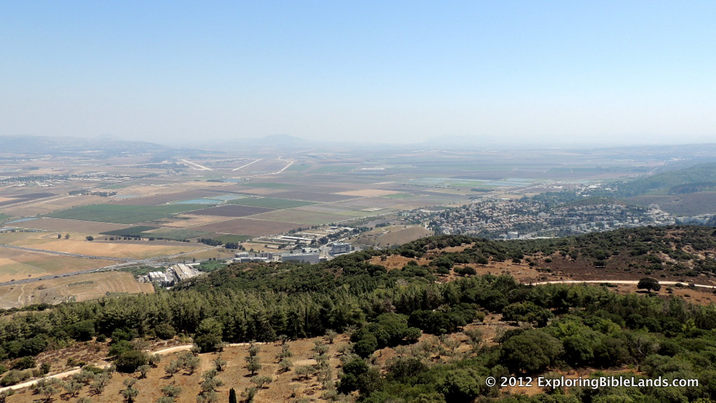
The Jezreel Valley, looking southeast from the top of Mount Carmel.From time to time, people will ask me what my favorite spot is in Israel. Well, that is a very difficult question. In many ways, that is like comparing apples to oranges. How do you compare the history of Jerusalem to the beauty of Upper Galilee? Or, how do you compare either one of those to majesty of Masada? Well, you can't. But, that is what makes traveling to Israel so interesting...and fun. There are so many great things to see. With that being said, I do enjoy the Jezreel Valley. For millennia, the Jezreel Valley has been the site of literally hundreds of historical events. But, what makes it interesting is how small it is. The triangular-shaped valley is only about 20 miles long by 12-15 miles wide. Consequently, in a single day, you are able to easily drive around and see the valley from so many different angles. By doing so, you can mentally reenact many of the Biblical stories in your head.

You can visualize:

  • Deborah and Barak as they gathered the fighting men on Mount Tabor before attack on Sisera and the Caananites (Judges 4).
  • Gideon and his 300 men as they snuck across the valley to the Hill of Moreh to attack the Midianites (Judges 7).
  • Saul as he disguised himself to speak with the medium at Endor (1 Samuel 28).
  • The children of Israel as they watched Elijah go up against the prophets of Baal on Mt. Carmel. (1 Kings 18).
  • The Shunammite Woman riding across the valley to visit with Elisha on Mount Carmel (2 Kings 4).
  • Jehu furiously riding his chariot across the valley floor toward Jezreel (2 Kings 9).
  • Josiah losing his life near Megiddo as he battled the Egyptians (2 Kings 23).
  • Jesus as he raised from the dead, the son of a widow at Nain (Luke 7).

While there are hundreds of places to visit in the country, the Valley of Jezreel should definitely be at the top of anyone's list. Go, enjoy and learn.

He Knew They Were Coming

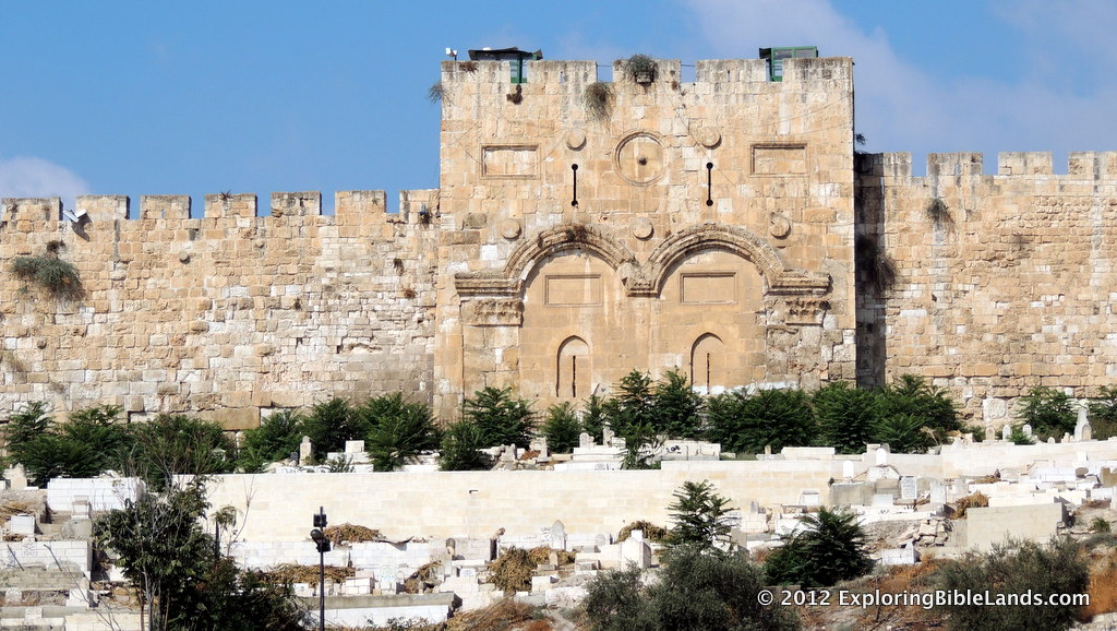
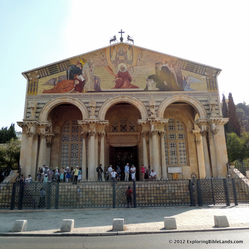
The Golden Gate from the steps of the Church of All Nations in Jerusalem.On the night that He was arrested, Jesus went to the Garden of Gethsemane to spend some time with God in prayer. The traditional site of the Garden of Gethsemane sits at the base of the Mount of Olives just across the Kidron Valley from the city of Jerusalem. Today, a Roman Catholic church, commonly called The Church of All Nations, is built on this spot. The Church of All Nations in JerusalemIf you stand on the steps of the Church of All Nations and look toward your west, you see the view that is depicted in the picture at the top of this post. I took this picture last September while visiting the site. It is a picture of what is commonly called the Golden Gate. This gate was built in the 6th Century AD on the ruins of another gate that dated to the Second Temple Period. During the time of Christ, this gate served as an entrance to the Temple Mount area for people that came from the east (Bethany, Bethpage, etc). It is not unreasonable to assume that Jesus, his disciples and many other people of that day went through that gate. As you can tell from the picture, the gate is not far at all from the Garden of Gethsemane.

Let's look at the picture a little differently. Imagine it is the middle of the night. Except for lanterns or torches that are illuminating the rock walls, it is completely dark. And, it is quiet. So quiet that Peter, James and John could fall asleep....twice. Now, let's read the passage from Matthew 26:

Then He came to His disciples and said to them, “Are you still sleeping and resting? Behold, the hour is at hand, and the Son of Man is being betrayed into the hands of sinners. Rise, let us be going. See, My betrayer is at hand.” And while He was still speaking, behold, Judas, one of the twelve, with a great multitude with swords and clubs, came from the chief priests and elders of the people. - Matthew 26:45-47

From the passage, we know that the multitude came from the chief priests and elders, and it is probably safe to assume that they were in the city. If so, then Judas and the rest of the multitude could have come out of this gate.

Jesus could look up the hill and could see the lit torches that they would have been carrying. He could probably hear their voices and the clanging of the soldiers armor.

He knew that they were coming. He could have run away. But He didn't.

Psalm 125

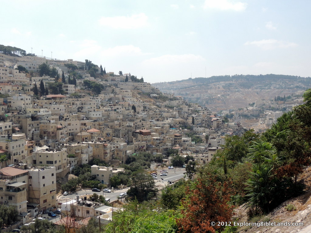
The view from the ancient city of Jerusalem, looking southeast. From this vantage point, you can see the Kidron Valley and the southern end of the Mount of Olives rising high above the city.Writers and speakers often use illustrations to make their point. In the Bible, the most recognizable use of this technique was Jesus. When speaking to the multitudes, He would often use parables. Jesus would tell a story that the listeners could easily understand in order to make a deeper point. Recently, while studying some of the Psalms, I was reminded of another great example of this. Consider Psalm 125:

Those who trust in the Lord are like Mount Zion, which cannot be moved, but abides forever. As the mountains surround Jerusalem, so the Lord surrounds His people from this time forth and forever. For the scepter of wickedness shall not rest on the land allotted to the righteous, lest the righteous reach out their hands to iniquity. Do good, O Lord, to those who are good, and to those who are upright in their hearts. As for such as turn aside to their crooked ways, the Lord shall lead them away with the workers of iniquity. Peace be upon Israel!

Did you notice the second sentence? The writer is describing the love and protection that God continually provides to His people. In it, he uses an illustration about the geography of Jerusalem to make his point. In doing so, he is making the assumption that his readers already understand the geography of the city. And, because they do understand it, he can create the beautiful analogy.

Jerusalem sits in the central mountain range approximately 2500 feet above sea level. During the time of the writing of this psalm, the main city of Jerusalem sat on a small ridge (approximately 10 acres in size) surrounded by three valleys. On the opposite side of the valleys, there are taller mountains on all sides of the city. From anywhere in the city, the Israelites could look in all directions and see the mountains surrounding them. These valleys and mountains provided a level of security and comfort to the inhabitants. That is the concept that the writer is using as the foundation for his point.

When you visit Jerusalem today, you can still see these same mountains. They haven't moved. They still surround the ancient city of Jerusalem. And just like the psalm says, God's love and protection still surrounds us.

Adam

Most of the time, when we think of Biblical Adam, we think about the first man. However, did you know that there is a location in the Bible called "Adam"? It is mentioned only one time, and God used that location to demonstrate his power and help deliver His promise to His people. Do you remember where you read about it? If you can't remember, don't feel too bad. I've only recently remembered while it while doing some personal study. You can read about it and see it on a map here.

Satellite Bible Atlas

The Satellite Bible Atlas by Bill Schlegel and Todd BolenI admit it...I'm a map geek. I love good maps. I also despise bad maps. When Google came out with their mapping program(s), the skies in my world became a deeper shade of blue. If I could somehow count the number of hours that I have spent looking at Google Maps and bouncing back and forth between Traditional View, Satellite View and Terrain View, I would probably be embarrassed. As a Bible student, I really love good, high resolution maps of Biblical places. And, for some reason, finding good Bible maps is much harder than you would think. As I flip through Bible workbooks, I have seen Jericho in about a dozen different places. It is usually generally in the right area, but it should be in the right place. What good is a map if the cities on it are not in the right locations? Well, it ceases to be a map. It's really just a work of art that vaguely resembles a map. (By the way, if you want to know where Old Testament Jericho is located, it is at 31.870037,35.443788.)

About a week ago, Todd Bolen blogged about a new resource that was being released called the Satellite Bible Atlas. After reading through the description and looking at the sample pages, I couldn't hit the "Purchase" button fast enough. The last six days have been an exercise in patience waiting for it to arrive. Over the weekend, my wife and I travelled to Tampa, Florida where we were able to visit with Ferrell Jenkins. He had been given an advanced copy and showed it to me. Ten minutes later he was having to pry it out of my fingers for fears that he may never see it again.

I'm happy to say that my copy arrived in the mail yesterday. And, it is everything that I knew it would be. Featuring over 75 full-page, high resolution maps, it does a fantastic job of pointing out many of the locations that we read about in the Bible. Some maps even feature colorization of the valleys to show you why those locations are so strategically important. If you are interested in Biblical geography at all, this is something that you need to add to your library. I noticed this morning that Luke Chandler's copy arrived in the mail yesterday as well.

Well done, Todd Bolen and Bill Schlegel. Very well done.

A Different Perspective

Tel Dan sits in the middle of the valley in Northern Israel.One of the great things about traveling to the Bible lands is the ability that you have to see things in a totally different perspective. For years, I read the stories in the Bible and had developed mental images for the places in which they lived. When I made my first trip to Israel, I realized that many of my mental images were completely wrong. You begin to understand why cities were located in certain places and not located in other places. Close up of Tel Dan. The brown covering is shielding the Bronze Age gate.This morning, I was reading a blog post by my friend Steve Braman and I was reminded of a picture that I took last September. When the Israelites conquered the land of Canaan, God instructed them to drive out all of the current inhabitants of the land. Unfortunately, they did completely do what they were told and that caused them problems for hundreds of years. The tribe of Dan was originally given land along the Mediterranean Coast but due to their unwillingness to completely obey God's command, quickly developed problems with their neighbors. Consequently, the Danites soon decided to move. They travelled toward the north and finally conquered the the town of Laish (Judges 18) and renamed the city Dan.

The Bronze Age gate at Tel Dan.Dan is located north of the Sea of Galilee at the foot of Mount Hermon. Walking around the tel allows you to learn about the size of the city and view the surrounding mountains. However, there are other ways of viewing the city. Back in September, I was able to see the city from a different angle. As we were driving up into the Golan Heights, I turned around and was able to capture the picture at the top of this post. (I was in a moving vehicle, so you have to excuse a bit of blurriness and the window reflection.) In the middle of the valley, you can clearly see the city of Dan. The brown cover that is visible is over the Bronze Age gate that is being excavated.

If we were given the ability to talk to Lot's wife, she would probably tell you that turning around is not a good idea. However, it can sometimes pay off. I am so glad that I turned around that day. Seeing the city from this perspective allows you to better understand the importance its location. I continue to be amazed at how much you can learn when you are over there.

Fishing In The Sea of Galilee

A local fisherman casts his net into the Sea of Galilee.For millennia, fishing has been a very prosperous industry around the Sea of Galilee. Jesus spent most of the early years of his ministry in this area. He soon asked twelve men to help him. The first men He selected were local fishermen.

And Jesus, walking by the Sea of Galilee, saw two brothers, Simon called Peter, and Andrew his brother, casting a net into the sea; for they were fishermen. Then He said to them, “Follow Me, and I will make you fishers of men.” They immediately left their nets and followed Him. Going on from there, He saw two other brothers, James the son of Zebedee, and John his brother, in the boat with Zebedee their father, mending their nets. He called them, and immediately they left the boat and their father, and followed Him. - Matthew 4:18-22

Later, after Jesus' resurrection, He encountered His apostles while they were fishing at the Sea of Galilee.

After these things Jesus showed Himself again to the disciples at the Sea of Tiberias, and in this way He showed Himself: Simon Peter, Thomas called the Twin, Nathanael of Cana in Galilee, the sons of Zebedee, and two others of His disciples were together. Simon Peter said to them, “I am going fishing.” They said to him, “We are going with you also.” They went out and immediately got into the boat, and that night they caught nothing. But when the morning had now come, Jesus stood on the shore; yet the disciples did not know that it was Jesus. Then Jesus said to them, “Children, have you any food?” They answered Him, “No.” And He said to them, “Cast the net on the right side of the boat, and you will find some.” So they cast, and now they were not able to draw it in because of the multitude of fish. Therefore that disciple whom Jesus loved said to Peter, “It is the Lord!” Now when Simon Peter heard that it was the Lord, he put on his outer garment (for he had removed it), and plunged into the sea. But the other disciples came in the little boat (for they were not far from land, but about two hundred cubits), dragging the net with fish. Then, as soon as they had come to land, they saw a fire of coals there, and fish laid on it, and bread. Jesus said to them, “Bring some of the fish which you have just caught.” Simon Peter went up and dragged the net to land, full of large fish, one hundred and fifty-three; and although there were so many, the net was not broken. Jesus said to them, “Come and eat breakfast.” Yet none of the disciples dared ask Him, “Who are You?”—knowing that it was the Lord. Jesus then came and took the bread and gave it to them, and likewise the fish. This is now the third time Jesus showed Himself to His disciples after He was raised from the dead. - John 21:1-14

Have you ever wondered what type of fish was caught? I have. Of course, we can't know for sure because the Bible doesn't tell us. But, generally, there were three different species of fish in the sea during the First Century. The most common was a species called Tilapia. It is primarily a fresh water fish and lives in lakes and seas in warmer climates. As an adult, these fish are about 7-8 inches long and weigh about a pound.

Tilapia, a common fish found in the Sea of Galilee, being served at a restaurant in Magdala.Over time, this species of fish has been nicknamed "St. Peter's Fish". This is an obvious reference to the passage mentioned above as well as a couple of others in Scripture. Present day visitors to the area can have the opportunity to eat this at a few restaurants around the shore. On my first trip to Israel, we ate at a small restaurant near the ancient city of Magdala. I have attached a picture of my plate. Being from the southeastern part of the United States, the opportunity to eat fried foods while I was over there was definitely a highlight of the day.

Was it good? Yes, it was.

Dead Sea Follow Up

I wanted to provide a quick follow up from yesterday's blog about the Dead Sea. This morning, I was reading Todd Bolen's blog and he provided a fantastic picture of the western shore of the Dead Sea from the early 1900's. It gives you a great perspective of how much the landscape has changed in the last 50 years. Today, there is a nicely paved two-lane highway that runs the entire length of the western edge of the sea. Clearly from the picture, that was not the case back then. The water level has dropped significantly since then.

From an ecological standpoint, should we be concerned about the height of the Dead Sea? Well, yes and no. History has shown us that the water levels in the Sea of Galilee, Jordan River and the Dead Sea tend to go up and down over time. So, some of this is the normal ebb and flow of nature. However, most of the drastic drop over the past 30 years can be attributed to water being diverted from the tributaries leading to the Jordan River for irrigation and human consumption. While those reasons are completely understandable, scientists are continuing to look at it with the hopes of finding solutions to solve all of the problems.

Todd Bolen's picture comes from the Southern Palestine Photo Collection at Life in the Holy Land.

Dead Sea Water Level Goes Up!

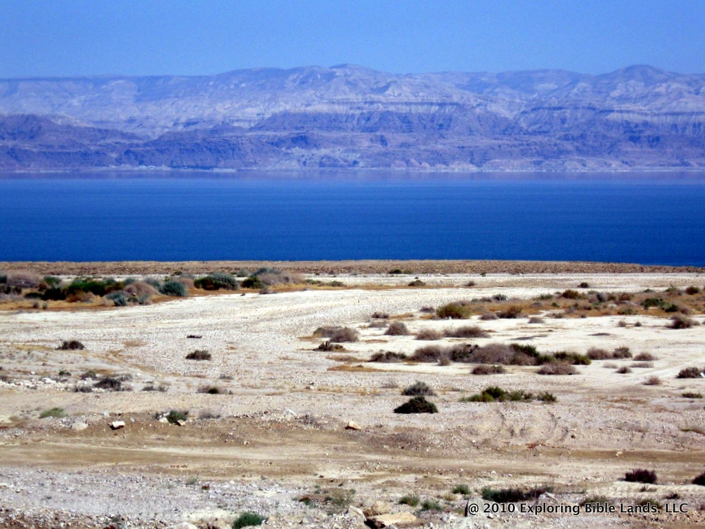
Looking east across the Dead Sea.  Just a few years ago, all of the land in the foreground was under water.Over the past couple of weeks, the land of Israel has received a lot of rain. Some of it, in fact, falling as snow. Some parts of Jerusalem received over 20 centimeters (8 inches) of snow and the top of Mount Hermon recorded over a meter of snow. Well, that rain has made it through the wadis, down to the Jordan River and into the Dead Sea. Consequently, the water in the Dead Sea has risen nearly two feet in the past week. The Times of Israel reports:

A test conducted Wednesday revealed that the Dead Sea rose 10 centimeters since its last monthly measurement, the first recorded increase in volume for the iconic and endangered body of water in 10 years.

The higher level is the result of runoff from the fierce storm that swept across Israel last week, bringing record levels of rainfall and causing the Sea of Galilee to rise by some 70 centimeters, with more expected after the winter runoff.

The Dead Sea is fed by the Jordan River as well as a series of streams running from the Judean Hills, many of which experienced heavy flooding last week.

Pumping from the Sea of Galilee, which feeds the Jordan River, along with the diversion of water to the Dead Sea Works factory and the extremely arid climate have all contributed to a sharp drop in the level of the Dead Sea — over 20 meters since the 1970s.

Of course, this single shot of heavy rain won't provide long-term relief to the sinking water level from the past 30 years. But, it doesn't hurt.

The Safety and Protection of Masada

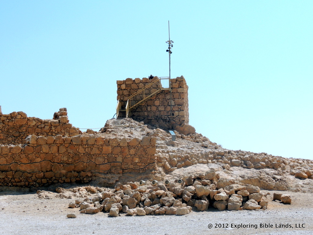
Some of the ruins on the plateau at Masada.Any visit to the country of Israel must include a stop at Masada. Herod the Great built Masada to be one of his palaces to be used in the winter months. The plateau on which Masada was built is about 1300 feet higher than the surface of the Dead Sea. This made it almost impossible for foreign forces to penetrate its outer walls. After Herod the Great died and the Romans destroyed the city of Jerusalem in 70AD, hundreds of Jewish rebels (along with their families) retreated to Masada. Given the easily defendable nature of Masada, it took the Roman forces over three years before they were able to conquer it. Once they came in, they soon realized that all 960 of the inhabitants (with the exception of two women and five children) had burned the storage houses and committed suicide. They would rather suffer death than to live as Roman slaves. Before the time of Herod the Great, a fortress on the plateau of Masada would have been easy for anyone to defend. Although the word "masada" is never found in our English Bibles, the word literally means "fortress" or "stronghold". When David was in the area fleeing from Saul, it mentions that he went to a fortress.

So David swore to Saul. And Saul went home, but David and his men went up to the stronghold. - 1 Samuel 24:22

Later in David's life, as he reflected on his conflict with Saul, David uses the words "fortress" and "stronghold" in his description of God.

I will love You, O Lord, my strength. The Lord is my rock and my fortress and my deliverer; My God, my strength, in whom I will trust; My shield and the horn of my salvation, my stronghold. I will call upon the Lord, who is worthy to be praised; So shall I be saved from my enemies. - Psalms 18:1-3

Given the safety and protection that Masada provided to its inhabitants, it is no wonder that David used that imagery to describe the feelings that he had for God.

I've recently updated the website to include more information and pictures of Masada.

Herod the Great Exhibit Video

Back in December, I posted a blog entry about the upcoming Herod the Great exhibit at the Israel Museum in Jerusalem. Earlier today, I saw a great video made by the Israel Museum promoting the upcoming exhibit. It is only a minute long and I encourage you to watch it.

Even though it is not mentioned in the video, I am fairly confident that it was filmed at the large Jerusalem model at the museum. During Jesus' time, the palace was located on the western edge of the city. Knowing the location of places like this help you to better understand the Biblical accounts.

For instance, during the trials of Jesus, we read:

When Pilate heard of Galilee, he asked if the Man were a Galilean. And as soon as he knew that He belonged to Herod’s jurisdiction, he sent Him to Herod, who was also in Jerusalem at that time. Now when Herod saw Jesus, he was exceedingly glad; for he had desired for a long time to see Him, because he had heard many things about Him, and he hoped to see some miracle done by Him. Then he questioned Him with many words, but He answered him nothing. And the chief priests and scribes stood and vehemently accused Him. Then Herod, with his men of war, treated Him with contempt and mocked Him, arrayed Him in a gorgeous robe, and sent Him back to Pilate. That very day Pilate and Herod became friends with each other, for previously they had been at enmity with each other. - Luke 23:6-12

Although it is not explicitly mentioned, it is reasonable to conclude that this conversation took place in Herod's palace. With that mind, let's consider the last days of Jesus' life.

  • He started in Bethany (about 2 miles east of Jerusalem).
  • He came into town for the last supper with his apostles (possibly in the upper city).
  • He went to the Garden of Gethsemane to pray (located outside the eastern side of the city).
  • He was arrested and led to the house of Caiaphas (possibly located in the upper city).
  • In the morning, He was led to the Sanhedrin (exact location unknown).
  • He was then led to Pilate (located in either the Antonio Fortress or in or near the palace).
  • He was then led to Herod (probably in the palace on the western edge of the city).
  • He was then led back to Pilate.
  • Finally, He was led to the cross (located outside the city).

That is a lot of walking.

We often read passages like "he sent Him to Herod" and don't take the time to consider the fact that he walked these distances (possibly in shackles) with very little sleep. It is no wonder that the guards did not have to break His legs to speed up His death during the crucifixion. By the time Jesus made it to the cross, He was completely exhausted.

As I mentioned earlier, knowing the locations of these Biblical places help you understand the stories.