Viewing entries tagged
Shephelah

Why Study Biblical Geography? Part II

elahIn my last post, I discussed the first of three reasons why I study Biblical geography. In that post, I mentioned that the first reason was: I study Biblical Geography to better understand God's people. In this post, I'll discuss the next reason. Which is:

Reason #2: I study Biblical Geography to better understand God's Word.

If I were to ask you to tell me the story of 1 Samuel 17, more than likely, you would relate a story to me similar to this: "There was a Philistine giant named Goliath that came out and taunted the Israelite army for 40 days. Finally, a shepherd boy named David agreed to fight Goliath. David, founded by a solid faith in God, took five stones from the brook and approached the giant. He then took out a stone and slung it. The stone struck the giant in the head and he died. It was a glorious victory for Israel."

If you would answer my question like that, you would be like nearly everyone else. However, that is not the way that the Bible tells the story. The Bible describes Goliath beginning in verse 4 and describes David beginning in verse 12. So, what is in the first three verses of that chapter? Well, let us read it.

Now the Philistines gathered their armies for battle. And they were gathered at Socoh, which belongs to Judah, and encamped between Socoh and Azekah, in Ephes-dammim. And Saul and the men of Israel were gathered, and encamped in the Valley of Elah, and drew up in line of battle against the Philistines. And the Philistines stood on the mountain on the one side, and Israel stood on the mountain on the other side, with a valley between them. - 1 Samuel 17:1-3

This is a story about geography! Yes, there are important lessons to be learned about David and his faith in God. But to fully understand the importance of this battle, you have to understand the geography of the area! If you understand the geography (including the Coastal Plain, the Shephelah and the Hill Country), then the real importance of this battle can be understood! This is why the Bible gives such a high level of detail regarding the geography.

By understanding the geography, it helps you to better understand God's Word.

(NOTE: The picture at the top of this post was taken on my tour last year. They are walking in the brook that runs through the Elah Valley where David pulled his "five smooth stones".)

One Year Ago - A Tour of the Lowlands

Sorek Valley NOTE: I am continuing my series of retrospective posts on the our tour one year ago. I invite you to start at the beginning and read through all of them.

A year ago today, we toured the Shephelah.

Pressed between the coastal plain and the central mountain range is a small area of land called the Shephelah. In our Bibles, it is translated "lowlands". It only measures about 10 miles wide and 50 miles long, but it played a very important role during the United and Divided Kingdoms.

The Shephelah is bisected by five valleys. During the time of Saul and David, Philistines controlled cities on the western end of the valleys and the Israelites controlled cities on the eastern end. This arrangement was the setup for numerous battles between the two nations.

Probably the most famous battle was the one commonly referred to as "David vs. Goliath". This battle took place in the Valley of Elah. An Israelite defeat in this battle would have given the Philistines an easy path up the valley and into the hill country.

Tomorrow: The little town of Bethlehem.


2015 Israel Poster B

Have you been enjoying these posts on last year's tour? Are you interested in traveling with me this year? Then, I would love to have you join me. Our 12-day tour is scheduled for October 12-23. We will stay one night on the Mediterranean Sea, three nights on the shores of the Sea of Galilee and five nights in beautiful Jerusalem. During the day, we will visit dozens of sites that will enhance your understanding of the land and of the Biblical stories that take place in them. Reservations are coming in, but we still have some availability! This is a first-class tour with many extras thrown in that many Israel tours overlook. If you are interested, I encourage you to read the itinerary and contact me personally for more details.


Meresha Cistern

IMG_3203 copy In the land of Israel, water is a precious commodity and there are three main sources: living water (springs and rivers), wells, and cisterns. Cisterns were especially common in the Shephelah, where the chalk allowed easy digging.  Some cisterns, like this one at Beit Guvrin (Mareshah) could belong to several families, while smaller ones may provide for a single household.

Yossi Garfinkel Podcast

yossi_garfinkel_fc Last fall, Florida College (with the help of Luke Chandler) arranged for archaeologist Yossi Garfinkel to speak in their Life Enrichment Series. The audio podcast of this event has recently been released on Florida College's Special Events podcast. Mr. Garfinkel discusses the recently concluded dig at Khirbet Qeiyafa, a site overlooking the Elah Valley in the Shephelah. His wisdom and wit come through as he discusses their findings and how it relates to the United Kingdom during the time of King David.

While you can not see the slides that he is presenting, a listener should not have any problem following the discussion. This is especially true if you have a fundamental understanding of the location of Khirbet Qeiyafa as well as basic archaeology. I encourage you to listen to this wonderful presentation.

Gezer

2_Gezer_1 Gezer is a beautiful, soaring tell bordering both the hill country and the Shephelah.  On one side, the Mediterranean can be seen sparkling in the sun, while movements through the hill country to the east would have been easily spotted.  The site also boasts a beautiful 6-chambered gate.  This calls to mind I Kings 9:15-16, when Solomon rebuilt the city—the dowry of Pharaoh’s daughter.

Gezer Mazevot

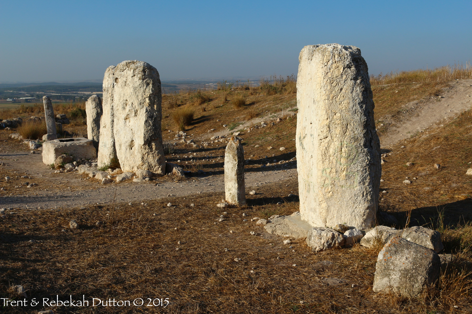
4_Gezer_Mazevot At the site of Gezer in the Shephelah, one cannot miss the beautiful limestone mazzeboth (standing stones), the tallest measuring around 12 feet high.  These particular standing stones were likely erected during the Canaanite period, but they likely served to memorialize an event, such as a treaty which may have taken place at Gezer.  This illustrates the common practice mentioned in the Biblical narrative when individuals set up a stone of memorial, such as Jacob in Bethel (Genesis 28:18) and Samuel with the Ebenezer (1 Samuel 7:12, literally meaning “rock of help”).

A Day In The Lowlands

A Day In The Lowlands

walking_men.jpg

The lands of the Bible in this region has four longitudinal zones. There is the Coastal Plain, the Central Mountain Range, the Rift Valley and the Transjordan Plateau. However, there are a few smaller areas sandwiched in between those primary zones. One of the is the Shephelah. The Shephelah is a small area within the land given to the tribe of Judah with a fertile, rolling plain. Even today, there are plenty of crops growing all over this region. For our interest on this tour, we are interested in the Biblical events that occurred in this area.

We started our day by driving to the Sorek Valley, the stomping grounds of the judge Samson. The site at the eastern end of this valley is Beit Shemesh. We stood at this site and could envision Samson tying the foxes together and setting the fields ablaze. Also, we could see the milk cows dragging and cart behind them carrying the Ark of the Covenant.

elahOur next stop was at the Valley of Elah. After you visit this beautiful valley, you will never read the story of David and Goliath the same again. I am continually impressed by the geographical accuracy of the Biblical writer in telling this story. We stood in the valley and reread parts of the story describing those details. Afterwards, everyone went down into the brook to pick up some "small smooth stones" to take home.

Lachish was next on our list. Seeing this site helps you understand its strategic importance. You can still see the siege ramp built by the Assyrians as they captured the city. The dig season for this site is going to be starting in about a week. We could see the people beginning to move equipment into place in the gate area. I look forward to hearing what they find.

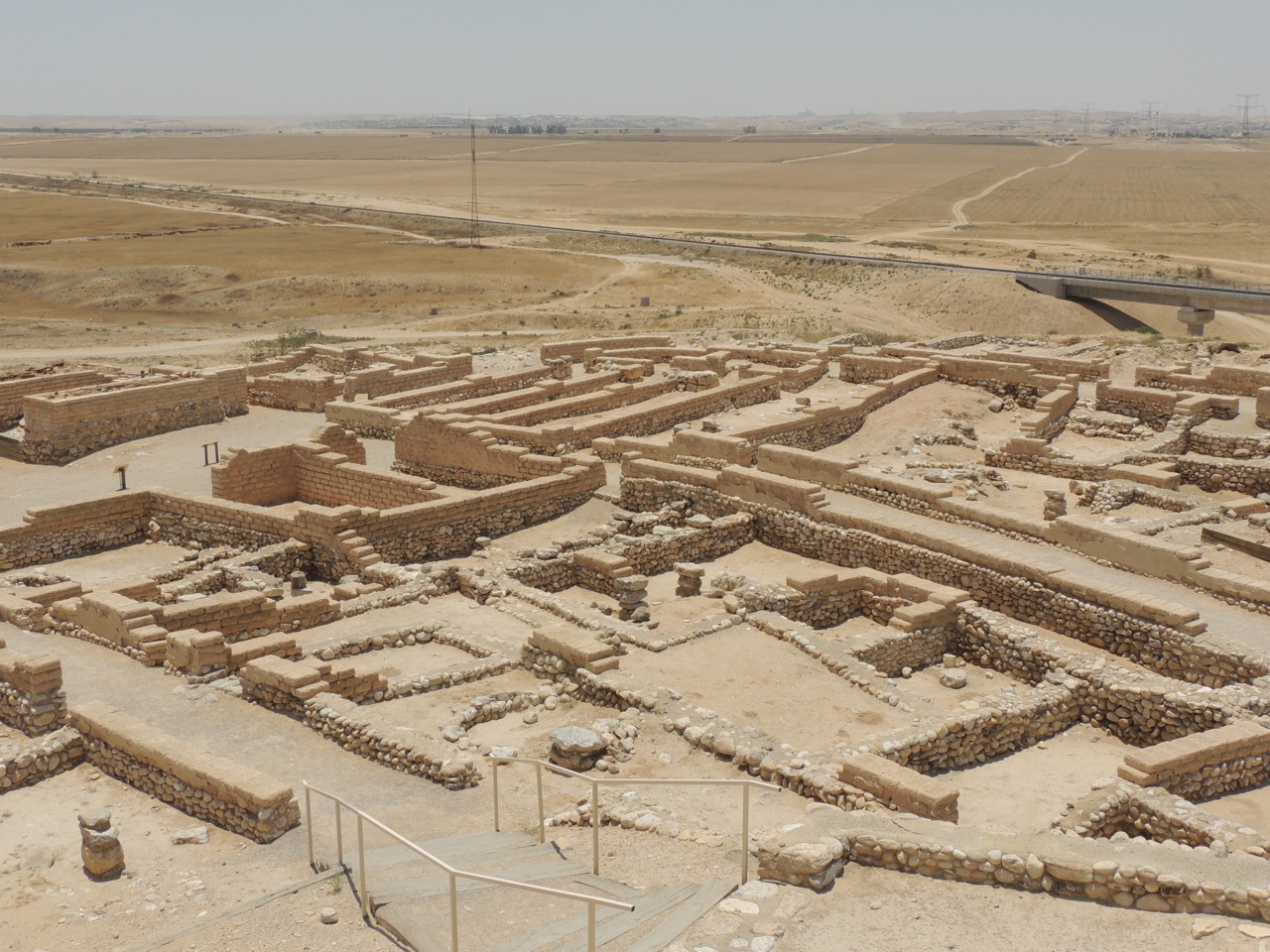
beershebaAfter a bit of a drive, we found ourselves at Beersheba. This site sits on the northern edge of the Negev. This is a beautiful site and easy to walk around and see. They have built a tall tower to view the landscape and we had the opportunity to walk through the water tunnel.

Our final stop of the day was at Nebi Samwil, just north of the city of Jerusalem. From this vantage point, you can see the Benjamin Plateau and overlook the city of Gibeon. The sun stood still here at one time, but not today. We took our pictures and then headed toward the hotel.

Our tour is quickly coming to an end. We have one more big day tomorrow before heading to the airport to catch a late-night flight. As I type this, I can hear the songs of the evening call to prayer for the Muslims. And, I can look out my hotel window and see the Jewish people walking home after finishing their prayers by the Western Wall.

I'll try to post tomorrow night, but time and Internet availability my limit the opportunity. But, I'll be back online soon.

Shalom.

2012 Israel Trip - Day Eleven

2012 Israel Trip - Day Eleven

DSCN1503.jpg

Well, the trip has quickly come to an end. Our flight was scheduled to leave around midnight on Friday night, so when we got up on Friday morning, we knew that it was going to be a very, very long day. However, we don't want to waste our time over here. With that being said, we kept our visiting down to seeing areas and sites that we could drive to. Or, at the least, get to from a very short walk. Today is a great day of the trip because we drive through the Shephelah. The Shephelah is a region of the country between the central mountain range and the coastal region. Our first stop was a Beth-Shemesh, where the Philistines returned the Ark of the Covenant to Israel. It is also the area of Samson.

We then drove through the Valley of Elah. I have to admit, I love driving through that valley. If you open up your Bible and read the story of David and Goliath, the entire valley becomes alive. It's amazing to see the geographic accuracy of the Bible.

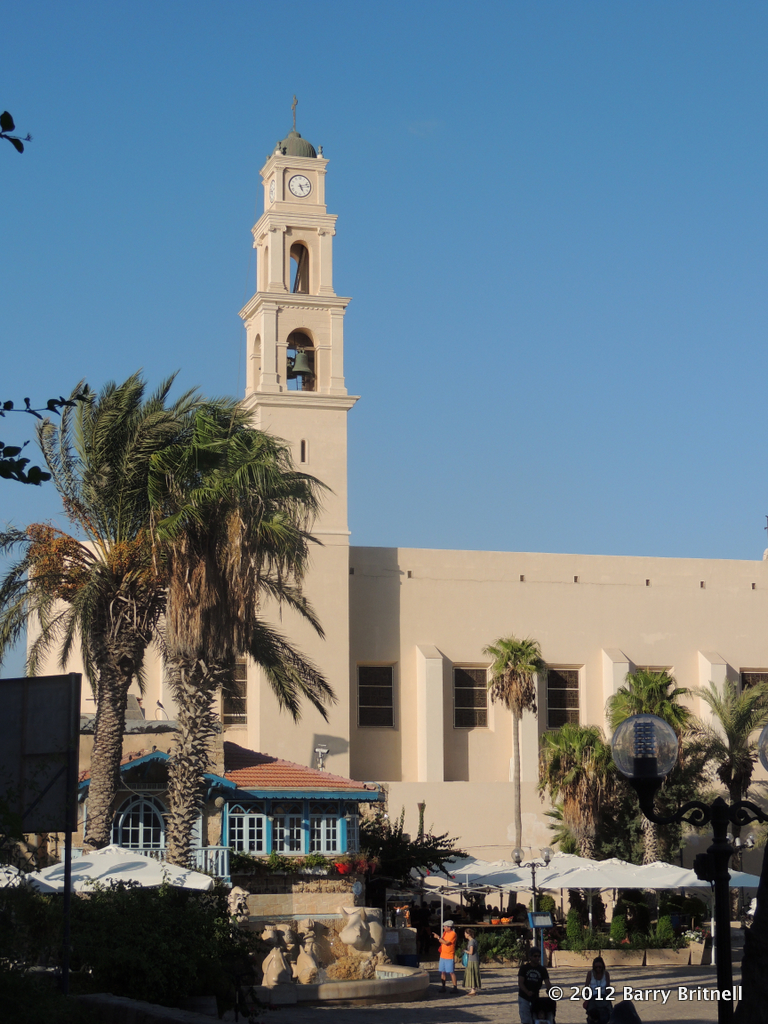
We visited many other sites in the area and finally ended up back in Joppa. The port of Joppa is where Jonah tried to flee from God and where Solomon received the cedars from Lebanon to use in the construction of the temple in Jerusalem.

After dinner, we made our way to the airport to head home. It was another wonderful trip. I realize that it is not possible for every single Christian to go to the Bible lands. I've been lucky enough to make the trip to Israel twice. Even though the trip is over, I'm going to continue to place posts on the blog as well as update and add pages to this site. To be notified of the updates, be sure to like us on Facebook.

I hope that you enjoyed the notes about the trip and let me know if you have any questions!