Viewing entries tagged
Mount Hermon

Rare View of Mount Hermon

dsc_2564 I have been lucky enough to travel to Israel several times. But last June, when I was traveling with the team from Appian Media, I was able to see something that I have never seen before. While we were staying in Tiberias, it was clear enough so that I could see Mount Hermon from the lake. The picture at the top of this post was one (of many) that I captured. Most of the time, there is too much haze in the Hula Valley to see the mountain from this distance.

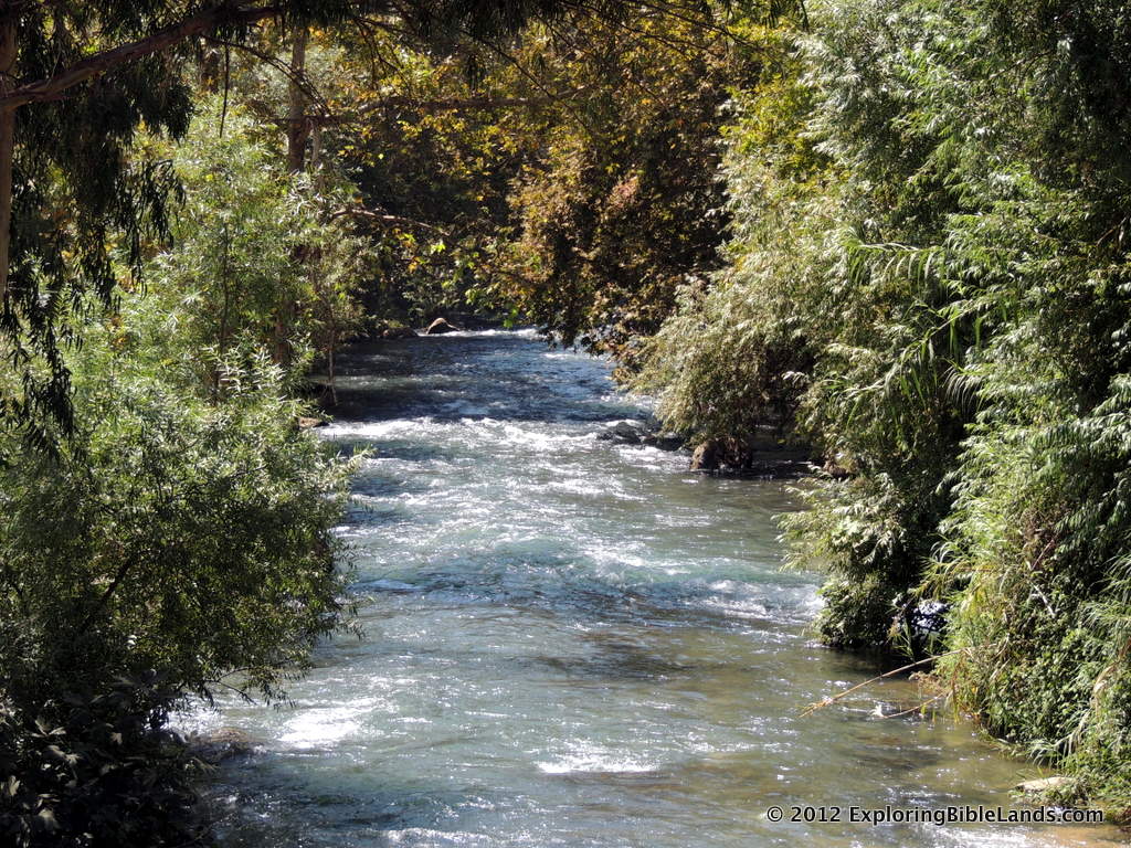
The above picture was taken late one afternoon. You can clearly see Mount Hermon and the location where the Hula Valley (with the Jordan River at its base) empties into the Sea of Galilee.

Mount Hermon sits about 60 miles north of the Sea of Galilee on the modern-day borders of Israel, Syria and Lebanon. It rises over 9,000 feet in elevation. Since the Sea of Galilee sits approximately 700 feet below sea level, the top of the mountain is nearly 10,000 feet above the location of this photograph. The Old Testament city of Dan and the New Testament city of Caesarea Philippi sit near the base of the mountain.

In the 4th century, Bishop Cyril of Jerusalem suggested that since many of the activities in the lifetime of Jesus happened around Mount Tabor, therefore he preferred that site as the probable location of the Transfiguration. Consequently, that site has been recognized as the traditional location of the event since that time.

However, many recent scholars prefer the location of Mount Hermon for the Transfiguration. Just prior to the Transfiguration, Jesus and His disciples were at Caesarea Philippi. This is told to us in Matthew 16:13, when Jesus discusses who they believe He is. Peter responds by saying that "Jesus is the Christ, the son of the living God." Then, six days later (Matthew 17:1), Jesus took Peter, James, and John onto a "high mountain". While it would have been possible to travel from Caesarea Philippi to Mount Tabor (a distance of about 70 miles) in six days, it seems more logical that the "high mountain" that was mentioned in Matthew is referring to Mount Hermon, especially since they were already in the area. I agree with this assessment.

Podcast #4 - Peter's Confession at Caesarea Philippi

[soundcloud url="https://api.soundcloud.com/tracks/193785730" params="auto_play=false&hide_related=false&show_comments=true&show_user=true&show_reposts=false&visual=true" width="100%" height="450" iframe="true" /] In Matthew 18, the apostle records the conversation that Jesus had with his disciples. In this conversation, Peter makes his great confession. But Matthew includes an extra piece of information concerning where this event took place. And that is what we will be discussing in this program.

First Major Snow of the Season

First Major Snow of the Season

jerusalem_model_in_snow.jpg

People often do not think of snow when they think of Israel. But, there is snow every year is parts of Israel. On the northern boundary of Israel sits beautiful Mount Hermon, which is over 9000 feet in elevation. Mount Hermon receives a good bit of snow every year, and even has a few ski slopes on it. Even the city of Jerusalem gets occasional snow. The city sits in the central mountain range and is just under 3000 feet in elevation. (Trivial time: How many US States have a highest point of less than 3000 feet? The answer will be at the end of the post.) The Jerusalem Post reported this morning that the area of Galilee and northern Israel received some thunderstorms and snow in the higher elevations. Consequently, the Sea of Galilee recorded their first rise in water level since April.

When I read stories like this, I am reminded of a few verses in the Bible. Scriptures refers to the rains that come in the autumn as "early rain". (The "latter rain" falls in the spring.)

“And if you will indeed obey my commandments that I command you today, to love the Lord your God, and to serve him with all your heart and with all your soul, he will give the rain for your land in its season, the early rain and the later rain, that you may gather in your grain and your wine and your oil. - Deuteronomy 11:13-14

Also, as I said, Jerusalem is around 3000 feet in elevation. It does turn much cooler during the winter.

At that time the Feast of Dedication took place at Jerusalem. It was winter, and Jesus was walking in the temple, in the colonnade of Solomon. - John 10:22:23

Oh...and the answer to the trivia question? It is 17. There are 17 states that have a highest point that is less than the elevation of Jerusalem. And nearly all of those states record snowfall every year.

(NOTE: The picture at the top of this post was posted last year by the Israel Museum on their Facebook page during their heavy snow fall.)

HT: Todd Bolen

Water Flowing From The Sea of Galilee

The Senir River in northern Israel.  The Senir River drains the snow melt from Mount Hermon into the Jordan River north of the Sea of Galilee.I was thrilled yesterday to read a story in the Jerusalem Post concerning an increase in the amount of water that they are allowing to flow into the Jordan River. In the past, I have written a number of posts about the water levels in the Sea of Galilee, Jordan River and the Dead Sea. To recap, you can read them here:

However, over the winter, the country of Israel has received a large amount of rain. Mount Hermon, located in the northern part of the country, had a large amount of snow. That snow is now melting and is draining into the Sea of Galilee. About a month ago, Ferrell Jenkins supplied two pictures of the difference in the Sea between last September and April.

Slow water flow of the Jordan River at Qasr al-Yahud.  The Jerusalem Post article mentions that beginning next month, they will release an additional 1,000 cubic meters of water per hour into the Jordan River. I'll be anxious to see what difference this makes further downstream. Currently, by the time the Jordan River flows at Qasr al-Yahud (the traditional Jesus baptismal site in Israel), it is hardly flowing at all. You can see this by looking at the picture to the right.

HT: Todd Bolen

Mount Hermon and Caesarea Philippi

Mount Hermon and Caesarea Philippi

Mount_Hermon.jpg

Seth M. Rodriguez from BiblePlaces.com featured a picture today from Todd Bolen's Pictoral History of Bible Lands Collection. It is a fantastic aerial photograph showing the relationship between Mount Hermon and the town of Caesarea Philippi. A quote from Seth's blog reads:

In this photo, the immense size of Mount Hermon can be clearly seen while it dwarfs the remains of the ancient city of Caesarea Philippi (located at the bottom center of the photo). The ruins of the Crusader period castle of Nimrud can also be seen sitting on the ridge above Caesarea Philippi in the upper right quadrant of the photo.

This shot is helpful for a number of reasons. First, it gives the viewer an appreciation for the massive size of Mount Hermon. With its peak reaching an altitude of 9,230 feet (2,814 meters), it is almost three times the height of any other peak in the territory of ancient Israel. Secondly, it shows the geographical relation between the castle of Nimrud and Caesarea Philippi. Although I have visited both sites a number of times, the fact that they were both built on the same ridge escaped my notice until I saw this picture. However, those two reasons are not why I decided to feature this picture in today's post.

The third and most valuable reason is that it can be used effectively as an illustration when teaching or preaching on the Transfiguration of Jesus. The Transfiguration occurs in Matthew 16:28-17:9, Mark 9:1-9, and Luke 9:27-36. In each of those books, the event is immediately preceded by the discussion that Jesus had with his disciples where Peter declared, “You are the Christ, the Son of the Living God.” Matthew and Mark tell us that this conversation occurred in the region (or district) of Caesarea Philippi (Matt. 16:13; Mark 8:27).

A few days later, Jesus took Peter, James, and John up on a mountain where He was transformed in front of them. Matthew and Mark describe the location as “a high mountain” (Matt. 17:1; Mark 9:2), and Luke refers to it as “the mountain” with a definite article (Luke 9:28). Looking at this photograph it is not hard to see which mountain the gospel writers had in mind. If they were in the region of Caesarea Philippi and they went up a high mountain … indeed the most noteworthy mountain in the area … then it is not difficult to figure out which mountain was intended. Over the years, some have interpreted the “mountain” in these passages as referring to Mount Tabor on the eastern edge of the Jezreel Valley, but given the geographical indicators provided in the text, Mount Hermon is a more likely candidate.

To visualize the point Seth is making, examine the map below. The red marker is located on the city of Caesarea Philippi, the blue marker is on Mount Hermon and the purple marker is on Mount Tabor. Given the distance from Caesarea Philippi, I agree with Seth that Mount Hermon is a more likely candidate for the site of the Transfiguration than Mount Tabor.

[google-map-v3 width="640" height="480" zoom="12" maptype="terrain" mapalign="center" directionhint="false" language="default" poweredby="false" maptypecontrol="true" pancontrol="true" zoomcontrol="true" scalecontrol="true" streetviewcontrol="true" scrollwheelcontrol="false" draggable="true" tiltfourtyfive="false" addmarkermashupbubble="false" addmarkermashupbubble="false" addmarkerlist="33.247984,35.694387{}4-default.png{}Caesarea Philippi|33.412242,35.854912{}5-default.png{}Mount Hermon|32.68692,35.389194{}6-default.png{}Mount Tabor" bubbleautopan="true" showbike="false" showtraffic="false" showpanoramio="false"]