Viewing entries tagged
Masada

The Lowest Place on Earth

The Lowest Place on Earth

image5.jpeg

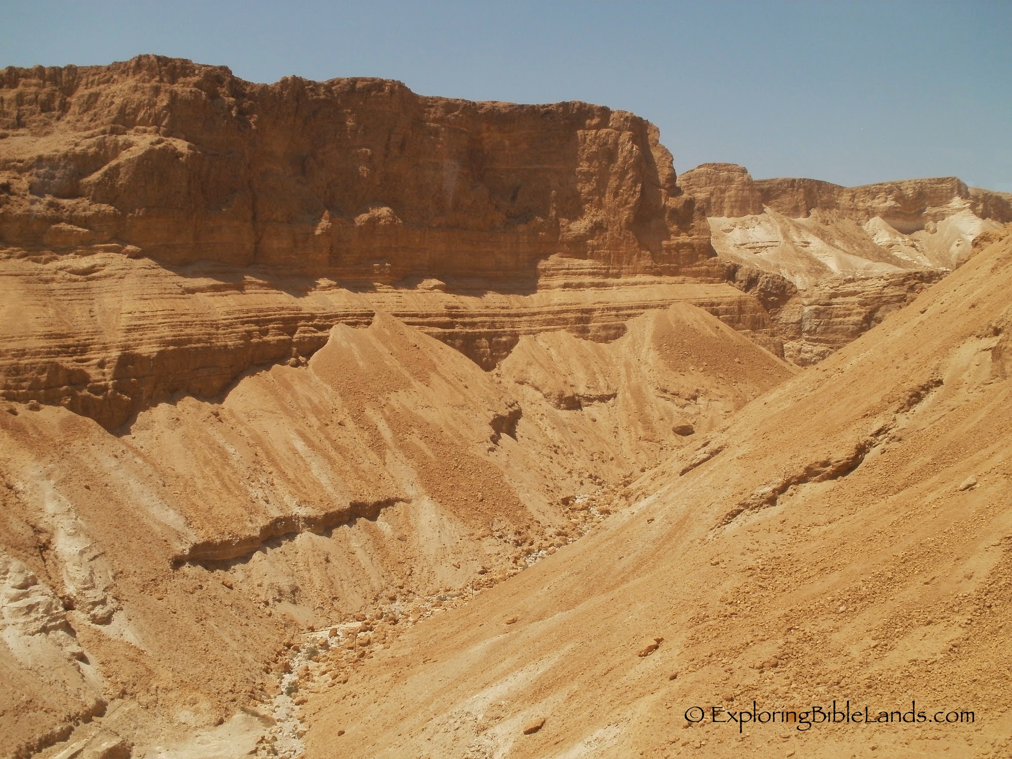
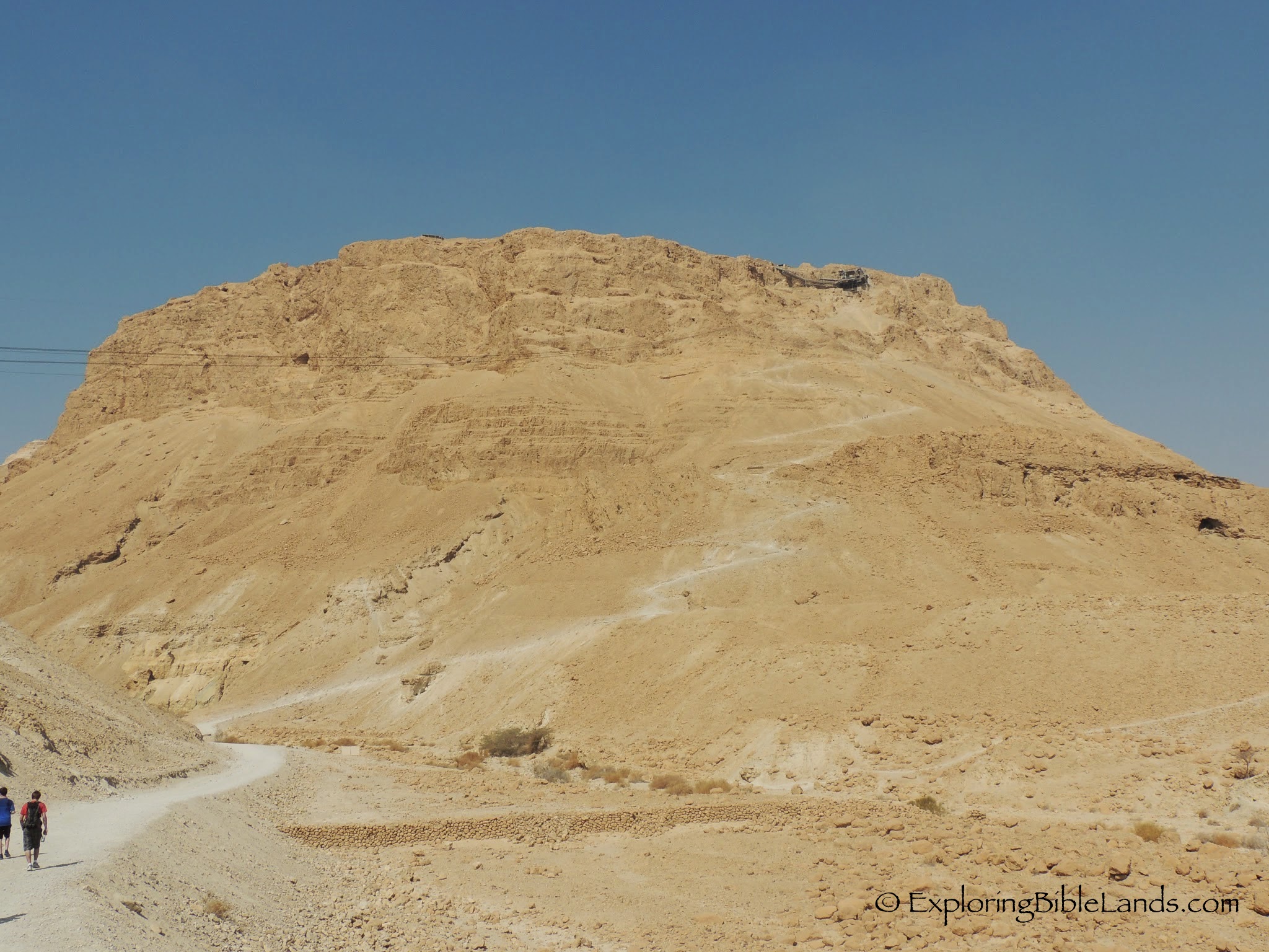
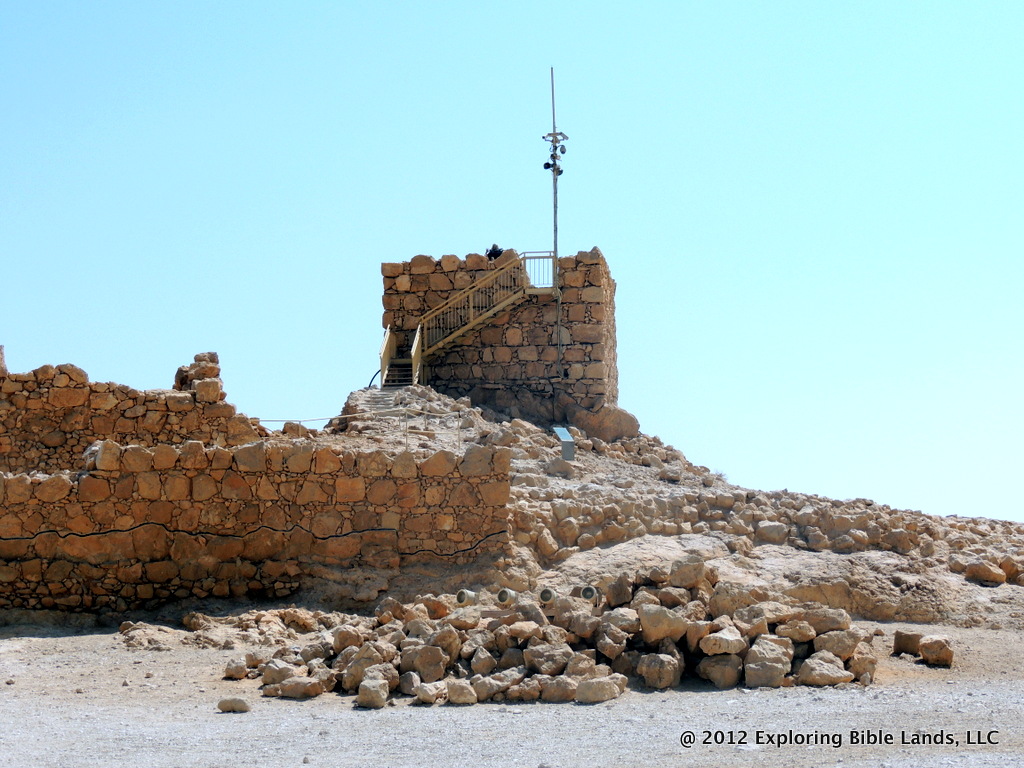
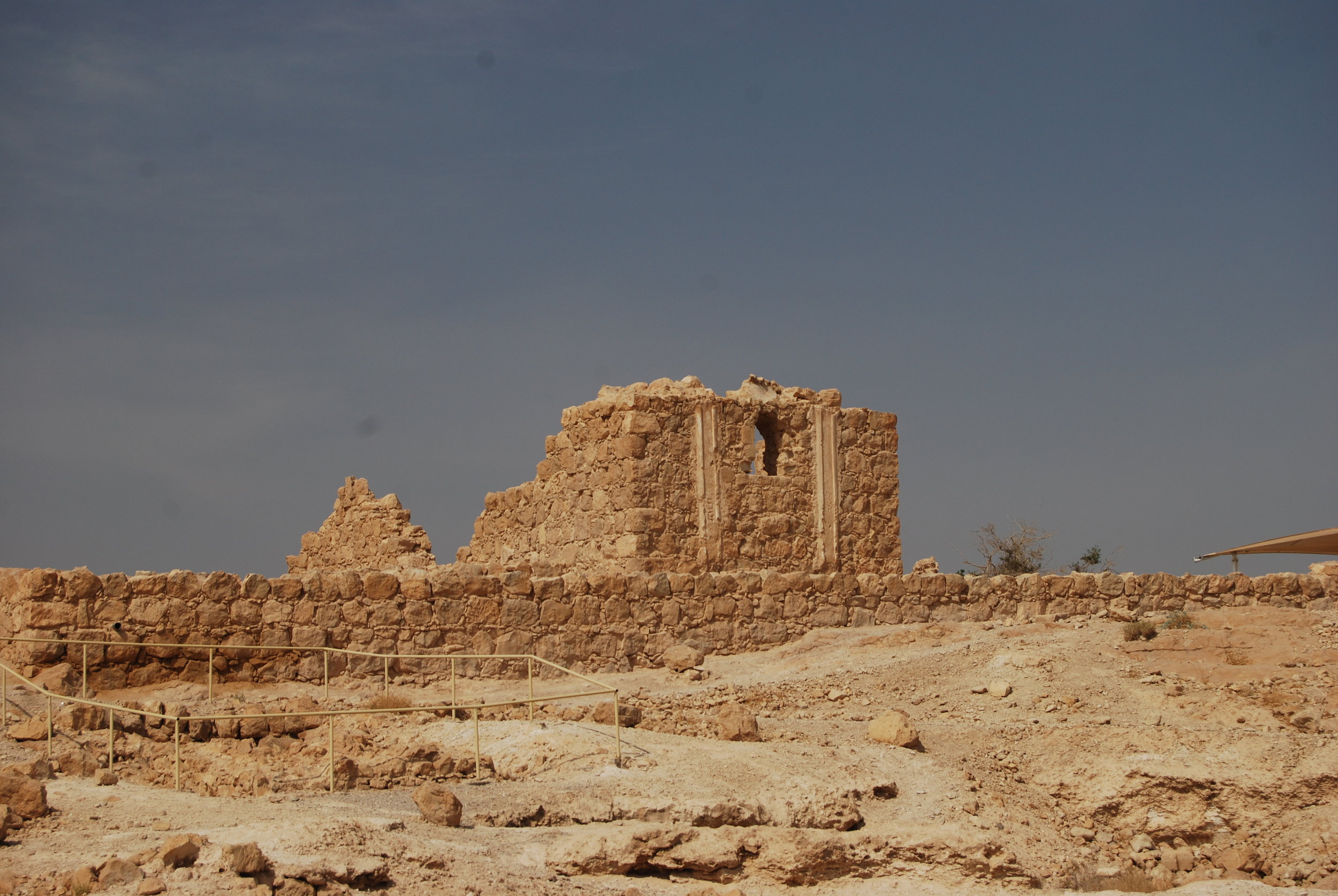
Sunday is always a special day. But I always especially enjoy gathering with fellow Christians while traveling in Israel. Today was no exception. Members of the tour led us in prayer, led songs and presented thoughts for our consideration. It was nice to pause our tour and take time to worship God. Afterwards, we left the hotel and headed toward the Dead Sea. Our first stop was at Masada. King Herod built a huge palace on the top of this plateau to visit when he wanted to escape Jerusalem. In 70AD, almost 1,000 Jews hid on that mountain and finally took their own lives instead of becoming Roman slaves. The view from the top was a little hazy, but still breathtaking.

Our next stop was at En Gedi. Bible students know that this was the place that David fled to when he was being pursued by King Saul. Of course, he went there because there was water there. Even today, there was water flowing over a waterfall even though it has not rained here in six months.

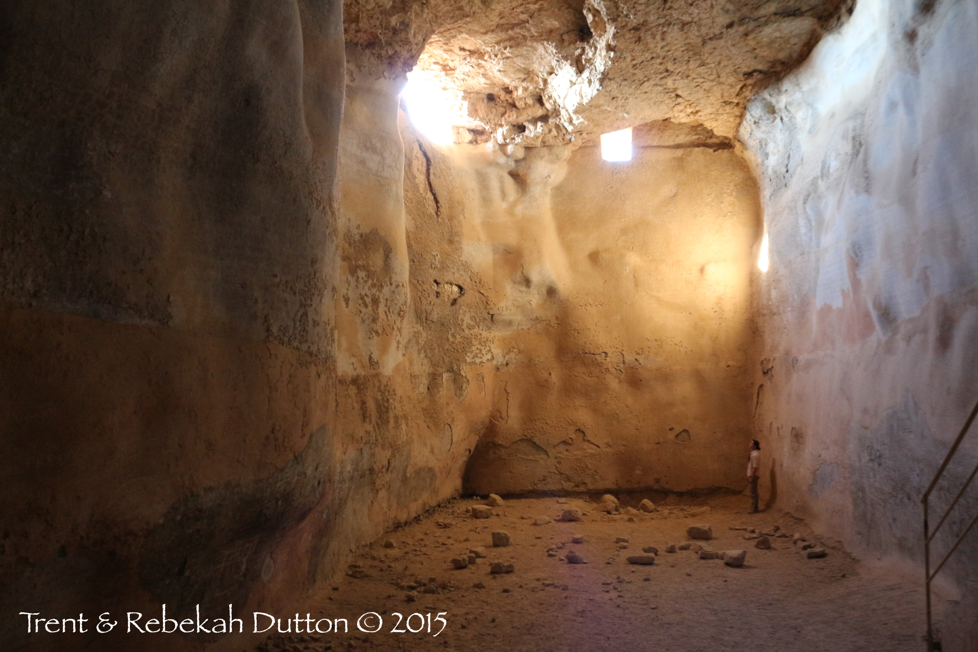
The site of Qumran is famous because it is here where the Dead Sea Scrolls were found. After eating lunch, we were able to visit this site and learn how they were found and what it means to us.

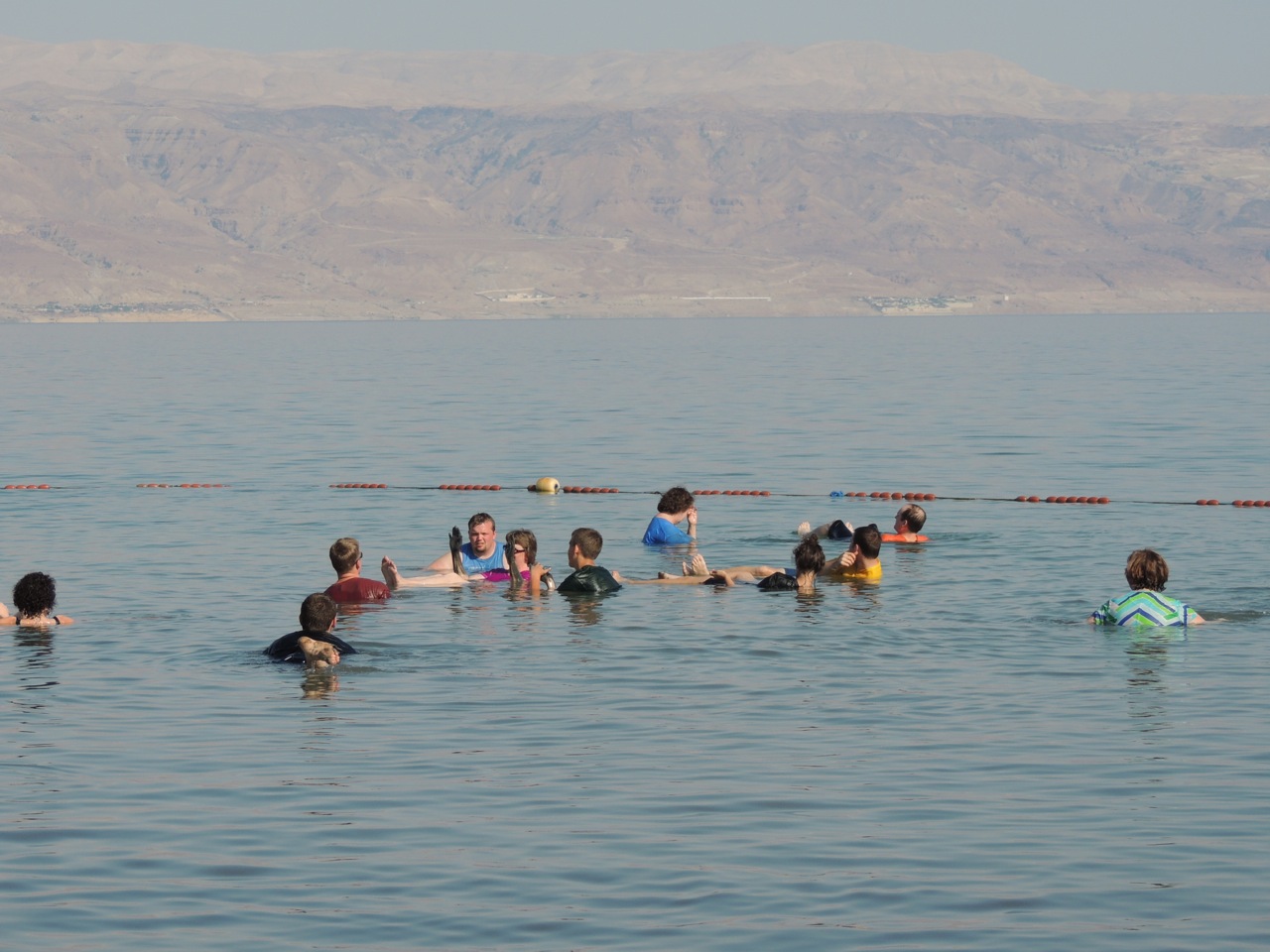
We ended the day by driving down to the shores of the Dead Sea and allowing those who wanted to, the opportunity to float in this beautiful sea. Fun was had by all.

Tomorrow will bring new adventures and more things to discover. Until then, shalom.

-------

To read other blogs about the tour, here are a couple of links:

Jeremy Dehut - www.jeremydehut.com

Jane Britnell - journeyswithjane.blogspot.com

One Year Ago - The Lowest Place on Earth

Herod's Palace at Masada NOTE: I am continuing my series of retrospective posts on the our tour one year ago. I invite you to start at the beginning and read through all of them.

A year ago today, we went to the lowest place on earth, the Dead Sea. This beautiful body of water does not live up to its name...it exceeds it. The water in the Dead Sea is a beautiful shade of blue and is actually quite clear for several feet.

We began the day by driving down to Masada, where Herod built a beautiful palace. Years later, nearly a thousand Jewish zealots held off the Roman army for a couple of years by using this "stronghold".

Our next stop was at En Gedi, for a short walk up a path to a waterfall. It is interesting to see the abundance of water in this place given the arid environment around it. It is no wonder why David fled to this location while being pursued by Saul.

After a stop at Qumran (where the Dead Sea Scrolls were found), we visited one of the oldest cities in the world, Jericho. You can visualize so many Biblical stories from this location.

We finished our day by trying to take a dip in the Dead Sea. Of course, everyone just floated to the top. But, it was a great day to end the day.

Tomorrow: We visit the Old City.


2015 Israel Poster B

Have you been enjoying these posts on last year's tour? Are you interested in traveling with me this year? Then, I would love to have you join me. Our 12-day tour is scheduled for October 12-23. We will stay one night on the Mediterranean Sea, three nights on the shores of the Sea of Galilee and five nights in beautiful Jerusalem. During the day, we will visit dozens of sites that will enhance your understanding of the land and of the Biblical stories that take place in them. Reservations are coming in, but we still have some availability! This is a first-class tour with many extras thrown in that many Israel tours overlook. If you are interested, I encourage you to read the itinerary and contact me personally for more details.


Masada Cistern

IMG_2196 copy While cisterns like those at Beit Guvrin could serve a household, others were built to store water for communities, like Herod the Great’s colossal cisterns atop Masada.  Living waters and wells are preferable, because the cistern catches and holds runoff from the rains.  This can grow rather unpleasant as all the filth of the land can wash in, creating the deep sludge in which Jeremiah found himself sinking in Jeremiah 38.

Judean Wilderness

OLYMPUS DIGITAL CAMERA Although a large portion of the country of Israel is green and covered with vegetation, some of it is not. This view of the southern Judean Wilderness provides a wonderful example of the terrain that the Israelites would have encountered as they made their way to the Promised Land.

Snake Trail Ascending Masada

snake_trail In the first century, King Herod built numerous palaces throughout Judea and Samaria. One of his most famous palaces was built on the top of a standalone plateau on the edge of the Dead Sea. It is commonly called Masada. Today, most visitors ascend to the top in three minutes via cable car. More adventurous visitors can ascend via the ancient Snake Trail.


Are you interested in traveling to Israel? Join me this October for a 12-day Bible Study tour of this beautiful land. See the Israel Tour Page for an itinerary and pricing details.


Tristram's Starling at Masada

Tristram's Starling The Tristram’s starling is a common feature in the Judaean Hill Country. It was first discovered by Reverend Henry Tristram during an ornithological study in Israel in 1863. This lovely male, with his distinctive rust-color stripe overlooks the Dead Sea from the walls of Masada. Here, their piping calls remind over-hot visitors that if other creatures can survive the heat, they can, too.

View From Ein Gedi, Next to the Dead Sea, South Toward Masada

1_EinGedi_4_SouthtoMasada_2 From the top of Wadi David at Ein Gedi, you can see the coast of the Dead Sea as far as Masada in the center of the faint ridge in the distance (a wadi is a deep ravine, usually with seasonal flash floods).  This view is one not often seen, as it is a 45-minute hike up from the waterfalls of Ein Gedi, at the site of the Chalcolithic era temple at Ein Gedi.  I Samuel 23:14 states that David had strong holds in the wilderness, and this wadi at Ein Gedi could have sustained many men while also providing an excellent defensive position.

The photo below was shot with a telephoto lens from the same perspective as the above photo, but zoomed in on Masada.  If you are familiar with Masada, you will recognize this as it's north face.  You can see the Roman siege ramp on the right side.  While Masada is best known from Herod the Great's period, sites like it and Ein Gedi could have also served as strongholds for fugitives like David or for his watchmen who needed to maintain a line of sight with other encampments.

Masada_Zoomed

The Lowest Place On Earth

The Lowest Place On Earth

ibex.jpg

masadaToday was spent the entire day around the lowest place on the earth, the Dead Sea. After breakfast, we headed toward Masada. Our goal was to beat the crowds and the heat of the day. We arrived around 9:15 and went to the top. This is a great stop. This site is one of the top tourist attractions in Israel. From a Biblical perspective, it is interesting to see the lifestyle of King Herod and knowing that it was this man's family that was the ruling party in the First Century. Our next stop was En Gedi, which included a brief hike up to a waterfall. During David's life, he went to En Gedi and after visiting the site, you know why. In the middle of the Wilderness of Judea, it was this location that had water. Even today, water continually flows from the mountains as it makes its way to the Dead Sea.

Traveling north up the coast, we found ourselves at Qumran, the site where the Dead Sea Scrolls were found. We enjoyed learning about the Essenes and their lifestyle in this arid climate.

Our next stop was at the traditional baptismal site of Jesus. The Bible tells us that John the Baptist was baptizing at "Bethany beyond the Jordan", which means that John was baptizing at some location on the other side of the Jordan from where we were located. Due to various reasons, the River Jordan is very small through here. It is only about 20 feet wide and about 2 feet deep. In many ways, it is very depressing. However, the Israelis, Palestinians and Jordanians are all working on this problem.

(Side note: While we were visiting this site, we learned that the mother of our driver had passed away. The travel company made arrangements for a new driver to meet us within a few minutes. I feel bad for Fawzi, our driver. I have known him for about five years and know that he and his family are going through a rough time right now.)

dead_seaJericho was next on our list. This site is very special for me because so many Biblical sites took place here. We discussed many of these events as well as the architectural finds that have been made here.

Having a smaller group (about 30) has its advantages. We were able to squeeze some extra time in our schedule to take everyone to the Qumran kibbutz and allow them the opportunity to float in the Dead Sea. And, they did!

Overall, another great day today. Tomorrow will be a walk around the Old City of Jerusalem which is always very interesting. Until then...

Raising the Water Level in the Dead Sea

Raising the Water Level in the Dead Sea

IMG_2615.jpg

For the past 50 years, the water level has been dropping in the Dead Sea.  Some of this has been caused by the natural climate oscillation over time.  However, some of the drop has been caused by the population growth that has taken place in Israel and Jordan. The citizens of those two countries have been diverting water for drinking and irrigation.  Water is not reaching the tributaries leading to the Jordan River and consequently, not reaching the Dead Sea.  During the past few years, the level of the Dead Sea has been declining at a rate of nearly one meter per year. For many years, there have been efforts made to reverse this situation.  The most common proposal is to pump water about 100 miles from the Red Sea to the Dead Sea (commonly nicknamed "Red-to-Dead" plan).  This plan has been hashed and rehashed a number of times.  As you can imagine, this would be a major undertaking.

A couple of weeks ago, the Washington Post reported that a tentative deal has been put in place to achieve this goal.  The plan would pump water out of the Red Sea, where it would go through a desalination process.  The clean water would be used by Israel, Jordan and the West Bank for human consumption.  The left over water would be pumped into the Dead Sea.

(On a side note, remember that you look at a map of the Bible Lands, you really must think in three dimensions.  If you do this, you will notice that the Red Sea is HIGHER than the Dead Sea.  So, overall, the process of pumping the water to the Dead Sea is an activity of gravity itself as the water will be flowing downhill a majority of the way.)

As you can imagine, this would be a very expensive operation and would take many years to complete.  But, it is an interesting concept.

The Dead Sea is mentioned a number of times in the Bible.  As a young man, David fled and hid from King Saul at En Gedi, along the banks of the Dead Sea.  While in the area, David fled to a "stronghold", that could possibly be Masada.

(NOTE: The picture at the top of this post is from Jordan, looking northwest across the northern part of the Dead Sea. Across the sea, you can see Jericho and at the top of the hill, you can see the outskirts of the Jerusalem area.)

HT: Todd Bolen

The Jerusalem Movie Trailer

The Jerusalem Movie Trailer

jerusalem_the_movie.jpg

Since I posted about the official Jerusalem movie trailer last night, I've had a couple of people ask me about some of the locations. If you are interested, here is a run-down of all of the locations in the trailer: 0:05-0:09 - The Dead Sea 0:10-0:14 - Caesarea Maritima - This is the home city of Cornelius. The apostle Paul traveled through this city on his missionary journeys and then was imprisoned here for two years before traveling to Rome. 0:15-0:20 - Mar Saba Monastery in the Kidron Valley 0:21-0:25 - Masada 0:26-0:31 - Jerusalem from Mount Scopus 0:32-0:34 - Dome of the Rock 0:35-0:37 - Western Wall Plaza 0:38-0:43 - Western Wall 0:44-0:49 - Port of Joppa - Jonah tried to flee from God by boarding a boat at Joppa. The cedars from Lebanon were delivered for Solomon's temple via the port at Joppa. Peter saw a vision while he was at Simon the tanner's house which told him to go to Caesarea and find Cornelius. 0:50-0:52 - Franciscan Chapel on the Mount of Beatitudes overlooking the Sea of Galilee - This is the traditional location of the Sermon on the Mount. 0:53-0:57 - Jerusalem from the Mount of Olives - Jesus would have traveled in this direction a number of times during His final week as he spent the night in Bethany, but spent the day in Jerusalem. 0:58-1:01 - Descending the Mount of Olives toward the Kidron Valley 1:02-1:03 - One of the many streets in the Old City 1:04-1:06 - Dinner time in the Old City 1:07-1:10 - Worshippers walk the Via Dolorosa 1:11-1:12 - Prayers at the Western Wall 1:13-1:17 - Prayers at the Al Aqsa Mosque 1:18-1:24 - Church of the Holy Sepulture - This is the traditional location of Calvary and the tomb. 1:25-1:30 - Hezekiah's Tunnel 1:31-1:33 - Coffins from Gaza at the Israel Museum 1:34-1:38 - Sunrise over the Old City 1:39-1:45 - Jerusalem from the southeast

Would you like to visit these places? Next June, I'm going and I'd love for you to join me. If you are a student of the Bible, it is a trip that you will never forget.

More Maps of the Bible Lands

Google-logo
I love good maps. I think that I might have mentioned that before. When I'm not reading my Zondervan Pictorial Bible Dictionary or Satellite Bible Atlas, I usually looking at Google Maps.

Well, Google Maps has decided to enhance their product just a little bit. About a week ago, I read a tweet from Google concerning their new version of the popular mapping program. Since it is still in beta, you had to sign up and wait for an invitation before getting in. Last night, I received my invitation. It walked me through a tutorial of some of the features. It was interesting, but I wasn't really interested in finding the best sushi restaurant in San Francisco.

I set my sight on the Bible Lands. And, I was not disappointed. While Google does not have the same quality of imagery of Israel and the West Bank as they do of the United States, I was still impressed. They also have a feature that will allow you to see the terrain the three dimensions. Which, in my opinion, makes this a valuable tool for your Bible classes or in your personal study.

Let me give you a few examples. (You can click on the images to see a larger version of the pictures.)

First, here is a view looking east across the Sea of Galilee. In the foreground you can see the Plain of Gennesaret, Mount Arbel and the city of Tiberias. On the eastern side of the sea, the terrain rises sharply as you go into the Golan Heights.

Google Maps image looking east over the Sea of Galilee.

In the second picture, we are again looking across the Sea of Galilee, but toward the north. You can see the city of Tiberias to your left, the Plain of Gennesaret and the northern shore where the city of Capernaum is located. You can follow the Jordan Rift Valley north from the Sea until you reach Mount Hermon far in the distance.

Google Earth image looking north across the Sea of Galilee.

Next, we have an picture of the western side of the Dead Sea. In the foreground, you can see Herod's fortress of Masada. For everyone that has been to Masada, you have probably stood on the northern end of the plateau and taken almost this exact same picture. (And, for those of you who have a mental image of the Dead Sea that appears to be "dead", think again. The water in the Dead Sea is really that color of blue.)

Google Earth image looking north along the western shore of the Dead Sea.

Finally, we have a picture looking east down the Valley of Elah. This valley is mostly known as the location where David slew the Philistine giant, Goliath. In the story, the Israelites were on the ridge on the left side of the picture, and the Philistines occupied the ridge to the right. Running through the middle of the valley is a stream, which is where the young David picked up his ammunition for his battle. The two warriors met in that valley.

Google Earth image looking east down the Valley of Elah.

I'm looking forward to finding other sites and seeing how they are depicted. While this is no replacement for seeing actual photographs or especially visiting these sites for yourself, it is a wonderful resource that should be used by every Bible student.

The Safety and Protection of Masada

Some of the ruins on the plateau at Masada.Any visit to the country of Israel must include a stop at Masada. Herod the Great built Masada to be one of his palaces to be used in the winter months. The plateau on which Masada was built is about 1300 feet higher than the surface of the Dead Sea. This made it almost impossible for foreign forces to penetrate its outer walls. After Herod the Great died and the Romans destroyed the city of Jerusalem in 70AD, hundreds of Jewish rebels (along with their families) retreated to Masada. Given the easily defendable nature of Masada, it took the Roman forces over three years before they were able to conquer it. Once they came in, they soon realized that all 960 of the inhabitants (with the exception of two women and five children) had burned the storage houses and committed suicide. They would rather suffer death than to live as Roman slaves. Before the time of Herod the Great, a fortress on the plateau of Masada would have been easy for anyone to defend. Although the word "masada" is never found in our English Bibles, the word literally means "fortress" or "stronghold". When David was in the area fleeing from Saul, it mentions that he went to a fortress.

So David swore to Saul. And Saul went home, but David and his men went up to the stronghold. - 1 Samuel 24:22

Later in David's life, as he reflected on his conflict with Saul, David uses the words "fortress" and "stronghold" in his description of God.

I will love You, O Lord, my strength. The Lord is my rock and my fortress and my deliverer; My God, my strength, in whom I will trust; My shield and the horn of my salvation, my stronghold. I will call upon the Lord, who is worthy to be praised; So shall I be saved from my enemies. - Psalms 18:1-3

Given the safety and protection that Masada provided to its inhabitants, it is no wonder that David used that imagery to describe the feelings that he had for God.

I've recently updated the website to include more information and pictures of Masada.

2012 Israel Trip - Day Eight

2012 Israel Trip - Day Eight

DSCN0977.jpg

Today was spent in an around the Dead Sea in the Wilderness of Judea.  We had a surprise visit this morning at Qasr al-Yahud, which is near the traditional location of the baptism of Jesus.  In the Gospels, we read that John was baptizing at "Bethany beyond the Jordan".  So, John was actually baptizing at a location on the other side of the Jordan River.  However, this is as close as we can get without going into the country of Jordan.  Due to irrigation and water control, the river at this point is very narrow compared to what it was in Biblical times. We then traveled down to the vacation home of Herod the Great, Masada.  The history of Masada is something that every person should study.  Consequently, I won't go into that now and leave that to your personal study.  Masada is never mentioned by name in the Bible, however it might have been referenced.  The word "masada" means fortress.  While in the area, the scriptures mention that David visited a fortress on three different occasions.  In addition, David mentions a fortress in four of his psalms.  So, it is highly possible that David visited here.  I had one other interesting experience at Masada, which I'll discuss later.

From there, we traveled north for a brief stop at En Gedi (where David hid while he was being pursued by Saul), Qumran (the location of the discovery of the Dead Sea Scrolls) and Jericho.  I've been to Jericho twice and it is one of the highlights of my trip.  The tel that we visit is from Old Testament Jericho (New Testament Jericho was in a slightly different location).  From that tel, you can see the size of the city, so you know exactly how far the Israelites marched as they circled the city for seven days.  You can also envision Rahab, who built her house on the wall of the city.  She could look out her window and see the Israelites as the encamped in the plains of Moab across the Jordan River.  It is a fascinating place.

Tomorrow is an early day.  We have to leave the hotel at 7:00am in order to be in the Old City in time to enter the Temple Mount by 7:30.  So, I'll need to get to bed soon.

However, back to Masada.  I'm an amateur hiker.  I really enjoy hiking in the Smokies and have hiked many miles there.  At Masada, you have two choices to get to the top.  The first choice is a tram lift that will take you to the top in about 3 minutes.  The second is the traditional route (the same route that the people of the time would have used) via the "Snake Path".  The trail is only 2 kilometers long, but it climbs over 350 meters in that distance.  (I'll leave it as a math exercise for you to figure out how steep that is.)  There were about 10 others in the group that wanted to hike the Snake Path, so I thought that I would give it a shot.  Well, I made it.  However, it wasn't a complete success.  When we left, the temperature was about 30 degrees Celcius (another math exercise for you) with no clouds (rain rarely falls here) and very little wind (we are at the lowest place on earth).  I made the trip up okay, but soon after arriving at the top, I started to get tingling feelings in my fingers.  Since that is one of the first signs of heat exhaustion, I knew that I needed to take care of myself quickly.  I took the first tram back to the visitor's center and immediately bought a coke.  I sat down in the cool air and began to recover.  Our outstanding tour guide, Elie, and could see that I was doing better, but thought that I needed something else.  He disappeared and came back with a Gatorade.  I drank it and immediately started feeling better.  So, here is what I learned from today:  if you decide to hike the Snake Trail, you'll need at least two bottles of water, not just one.  (And, let's keep this between us.  There is no need to let Tabatha it.)

Until tomorrow….