Viewing entries tagged
Caesarea Philippi

Up The Hula Valley

Up The Hula Valley

image3.jpeg

As I write this post, I am sitting on the balcony of my hotel with a view of the Sea of Galilee. As a Christian, it is difficult to put into words what it means to see this beautiful location. Peter, Andrew, James and John used to fish these waters. Jesus calmed a storm that raged on these waters. Jesus walked on these waters. All of those events happened within sight of where I now sit. I am truly humbled to be here and to be sharing this experience with this group of people. We started our final day in this region by visiting the ruins of Chorazim. Jesus cursed this city for their unbelief. While there, we were entertained by a number of rock badgers that cross-crossed the paths in front of us.

We followed that visit by driving north up the Hula Valley and visited Hazor. By standing on the top of this tel, it is easy to understand the strategic importance of this location. It is no wonder why Joshua conquered this city as part of his northern conquest.

We drove by the tel of Abel Beth Maacah. While going by, we read the account from 2 Samuel of the wise woman of this city who singlehandedly saved her city.

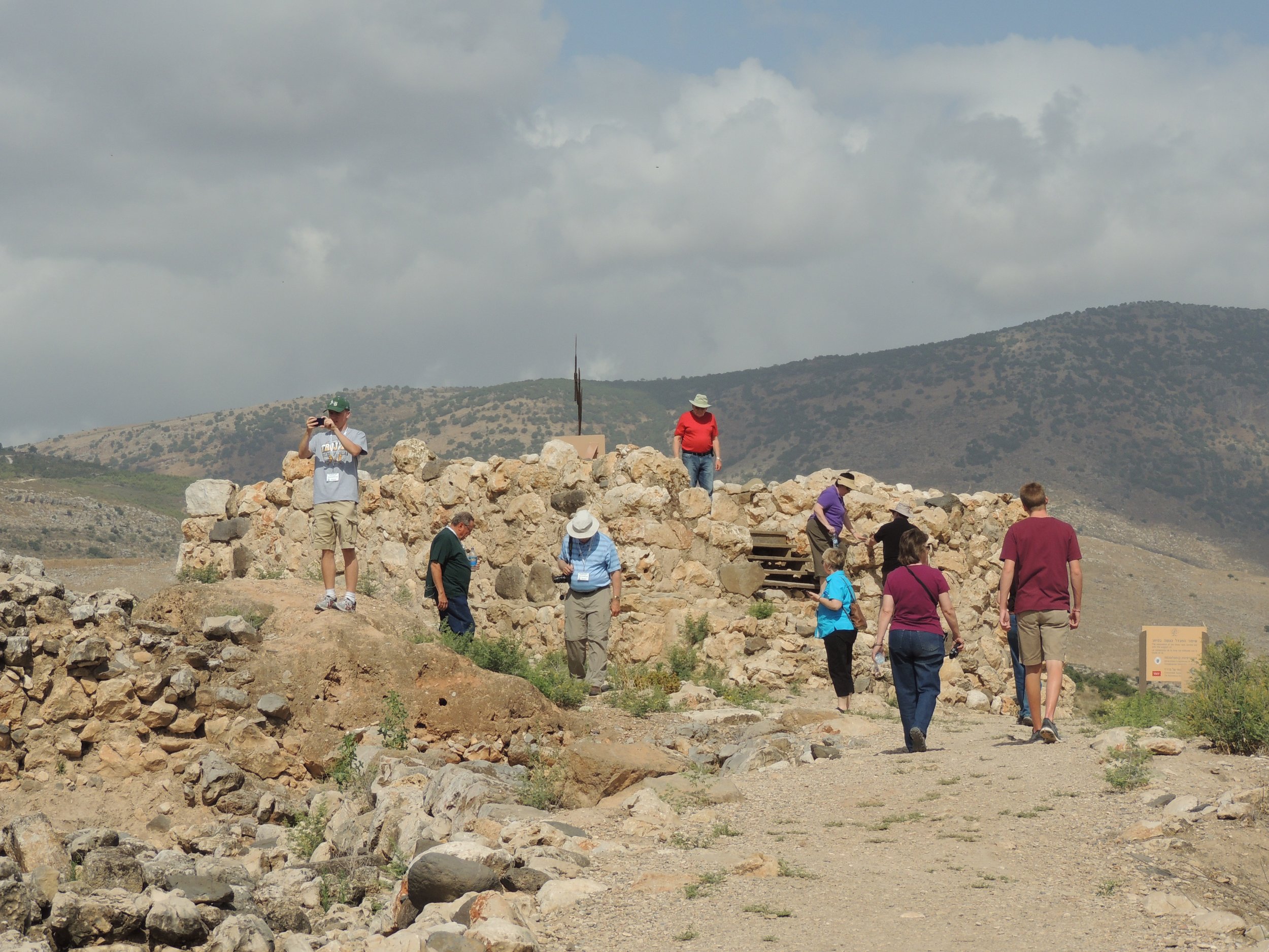
A visit to the northern part of Israel is not complete without a visit to Tel Dan. As you walk around the high place built by King Jeroboam, you are reminded how this single decision probably condemned his nation in the years to come. We also visited the Israelite Gate and the even more ancient Canaanite Gate.

Our next stop was at Banias, known in the Bible as Caesarea Philippi. By seeing he remains of the pagan temples that was the main part of this city, it is easy to understand why Peter stated that "Jesus was the Christ, the son of the living God."

As we drove back to the Sea of Galilee, our path took us through the Golan Heights. We made one stop at an overlook where we could see the Syrian plain in the direction of Damascus. Saul walked near here when he saw his vision of the risen Jesus.

Tomorrow morning we will leave Galilee and go "up to Jerusalem". As we do so, I will think of my wife, who loves the sea, but graciously stayed home and watch the kids and allowed me to come here. I will also think of all of the memories that have been made in the past days and the more that will be made in the days to come.

Until then, Shabbat Shalom.

One Year Ago - Northern Galilee and the Hula Valley

The ruins of the ancient city of Caesarea Philippi.NOTE: I am continuing my series of retrospective posts on the our tour one year ago. I invite you to start at the beginning and read through all of them. Waking up on the shores of the Sea of Galilee is an experience like none other. Before the sun rises, you hear the water lapping up on the shore. Then, the eastern sky gradually changes from a deep, dark blue to a golden yellow. All of the sudden, the first rays of the sun poke through the trees in the Golan Heights. Every time that I see it, I imagine Peter, Andrew, James and John seeing very similar sunrises after a night of fishing. It is a beautiful thing to see.

One year ago, we spent the entire day traversing north up the Hula Valley. Our first stop was at Hazor. The size of this city is amazing and something that doesn't come through in the Biblical narrative. It is no wonder why Joshua thought it was so important to seize this city.

We drop past Abel Beth Maacah and remembered the story of Sheba. We walked through the tel at Dan. There we visited the High Place built by King Jeroboam to keep the people in the nation of Israel from traveling to Jerusalem to worship God. We also visited Caesarea Philippi and remembered Peter's confession of Jesus as the son of God.

As we drove back to the Sea of Galilee through the Golan Heights, we were able to look over into the modern country of Syria toward the city of Damascus. Paul received his vision somewhere in this area.

Our day ended at et-Tell, the possible location of the New Testament city of Bethsaida. Another wonderful day in the books.

Tomorrow: A full day around the Sea of Galilee.


2015 Israel Poster B

Have you been enjoying these posts on last year's tour? Are you interested in traveling with me this year? Then, I would love to have you join me. Our 12-day tour is scheduled for October 12-23. We will stay one night on the Mediterranean Sea, three nights on the shores of the Sea of Galilee and five nights in beautiful Jerusalem. During the day, we will visit dozens of sites that will enhance your understanding of the land and of the Biblical stories that take place in them. Reservations are coming in, but we still have some availability! This is a first-class tour with many extras thrown in that many Israel tours overlook. If you are interested, I encourage you to read the itinerary and contact me personally for more details.


Region Near Banias

DSCN0346 We know that King Herod built three temples to Caesar Augustus. One was at Caesarea Maritima, the second was at Sabaste and the third was in the region near Banias (Caesarea Philippi). Recent digs in this area have focused on this site at Omrit. Some archaeologists are considering the possibility that these ruins near Banias could be the foundation of the temple which King Herod built.

Podcast #4 - Peter's Confession at Caesarea Philippi

[soundcloud url="https://api.soundcloud.com/tracks/193785730" params="auto_play=false&hide_related=false&show_comments=true&show_user=true&show_reposts=false&visual=true" width="100%" height="450" iframe="true" /] In Matthew 18, the apostle records the conversation that Jesus had with his disciples. In this conversation, Peter makes his great confession. But Matthew includes an extra piece of information concerning where this event took place. And that is what we will be discussing in this program.

The Senir River

DSCN0332 Some of the snow that falls on Mount Hermon eventually melts and emerges through a spring in Banias (ancient Caesarea Philippi). The water from that spring forms the stream Nahal Senir (pictured) and travels several miles before joining the Jordan River. The water from the Jordan River will then flow about 50 miles before entering the Sea of Galilee.

Northern Galilee

Northern Galilee

sea_of_galilee_sunrise.jpg

This morning's sunrise was partly cloudy. Therefore, the initial sunrise over the Sea of Galilee wasn't impressive, but a few minutes later, the suns rays shined through the clouds to remind us that "The heavens declare the glory of God". hazorAfter a great breakfast, we headed north of the Sea to the Hula Valley. Our first stop was at the ancient city of Hazor. The location of this city is vitally important as it controls all traffic on the Via Maris in ancient times.

From there, we drove to the northern edge of the country of Israel and viewed the site of Abel-Beth Maacah. Although it is impossible to take an entire tour group to the site, this is a favorite of mine because of how the city is situated on a hill with a commanding view of the surrounding area. Although we didn't stay long, our visit to the city went much better than Sheba's (2 Samuel 20).

We then drove a little farther north to the Israeli city of Metula to have a view over into the country of Lebanon.

dan_solomonic_gateTel Dan was our next stop. After walking through the nature preserve, we arrived at the High Place built by King Jeroboam, first king of the northern kingdom of Israel. This single bad decision by King Jeroboam basically sealed the fate for his country. The people followed him and they never recovered. We walked through the Solomonic gate and finally viewed the ancient Canaanite gate.

Leaving Dan, we traveled to Banias (ancient Caesarea Philippi). The cultic worship that was evident during the time of Christ makes Peter's answer to Jesus' question so much more meaningful ("Jesus is the Christ, the son of the living God").

jordan_riverAfter driving through the Golan Heights (with a stop of a view toward Syria), we arrived at the Jordan River, just north of the Sea of Galilee. Due to the shortage of rain during the most recent rainy season, the flow was probably lower than I have ever seen it. But, it is always a thrill to be able to see such a famous river.

We arrived back at the hotel tired, hungry and pleased with the day. Heading to bed to get a good night's rest before tomorrow.

From Israel, Shabbat Shalom.

Omrit

I've added a new page on the website concerning the location of Omrit. Haven't heard of it? Don't feel bad. I don't believe that it is specifically mentioned in the Bible, but it is turning out to be an important archaeological find. It is located approximate 4 kilometers southwest of Caesarea Philippi and just south of a major highway during the First Century. Visit the page to learn more.

2012 Israel Trip - Day Four

2012 Israel Trip - Day Four

DSCN0429.jpg

Well, today got off to a strange start…but, as always, everything works out in the end. We were originally scheduled to take a boat ride on the Sea of Galilee. However, there was no boat at the dock at 8:30. So, our tour guide called the rental company and there was a miscommunication on the date. They had us scheduled for tomorrow morning. No matter. With only about a million things to see and do in Israel, we just shuffled our schedule a bit, loaded the bus and headed out. We spent the entire day north of the Galilee region. Our first start was at the city of Hazor (it is pronounced "hot-sore"). Hazor is only mentioned a few times in the Bible, but it was a very important city. When the Israelites came into the land, Joshua conquered the city as it was one of the most important cities at that time. Later, Solomon built huge walls at Hazor to protect it. Many of these walls (including parts of the gate) are visible today. By standing on the tel, you can easily see the geographical importance of the city.

From Hazor, we made a brief stop at Abel Beth-Maacah. If you consider yourself a Bible student and don't recognize the name, don't feel bad. It's only mentioned a couple of times, most notably in 2 Samuel 20. Go back and read the story again. (Warning: The story doesn't end well for Sheba.) The location of this city has been known for years, but they have just started initial excavations of the tel this year. I mentioned this in an earlier blog post.

Our next stop was an unexpected bonus. In the First Century BC, Herod the Great erected three temples to Augustus. The first one was at Caesarea Maritima. The second was at Samaria. The third was near Paneion. For years, it was thought that this temple was located at the traditional location of Caesarea Philippi. However, recent excavations at Omrit has cast doubt on that. At Omrit (which is located about three miles from Caeserea Philippi), they have found the ruins of a Roman temple that is similar to the ruins at Caesarea Maritima and Samaria. The site is located along a VERY SKINNY single lane road that a regular car could barely navigate. However, our expert bus driver, Fawzi, was determined. After a few minutes and several near misses of trees, etc, the site was within view. It was fantastic to see it and help us to better understand the time of the first century.

From Omrit, we went to Dan. The city of Dan was originally called Laish until the Danites conquered the city after the conquest. The Danites were originally given land along the Mediterranean coast, but due to their neighbors (Philistines), they decided to relocate to Laish, which they renamed Dan. Dan became a very powerful city in Solomon's time. By the time of the Divided Kingdom, Jeroboam constructed a "high place" so that the nation of Israel could come here to worship the false god Baal. Archaeologists have found the "high place" and I have included a picture of the steps leading up to it.

Our next stop was at Caesarea Philippi, where Jesus asked his disciples "…but who do you say that I am?" Peter famously answered, "Thou are the Christ, the Son of the Living God". Ferrell Jenkins spoke to us about the importance of Jesus asking his disciples this question at this location. Seeing the area helps you to understand the true meaning of the conversation.

On our way back to the Galilee area, we drove back through the Golan Heights which is now under Israeli control since the Six-Day War in 1967. For much of the ride, you were right on the border of Syria. How close were we? Well, check out the picture. At one of our stops, I was able to take a picture of a Syrian flag flying in one of their cities.

Finally, we made a brief stop by the Jordan River just north of where it flows into the Sea of Galilee.

Overall, it was a great day. Our boat ride has been rescheduled for tomorrow morning, so we'll try to enjoy that tomorrow. Until then…Shalom.

BONUS: As I understand it, the Third Grade at Athens Bible School is following my blog and mentioning the places I mention in their Bible Class. I thought that I would throw in a bonus picture for all of them. Being in another country is really interesting. You have to deal with different languages, different customs and a different way of life. However, occasionally, you come across something that reminds you at home. That happened at lunch today. We stopped by a familiar restaurant. From the picture, can you guess where we stopped?

Mount Hermon and Caesarea Philippi

Mount Hermon and Caesarea Philippi

Mount_Hermon.jpg

Seth M. Rodriguez from BiblePlaces.com featured a picture today from Todd Bolen's Pictoral History of Bible Lands Collection. It is a fantastic aerial photograph showing the relationship between Mount Hermon and the town of Caesarea Philippi. A quote from Seth's blog reads:

In this photo, the immense size of Mount Hermon can be clearly seen while it dwarfs the remains of the ancient city of Caesarea Philippi (located at the bottom center of the photo). The ruins of the Crusader period castle of Nimrud can also be seen sitting on the ridge above Caesarea Philippi in the upper right quadrant of the photo.

This shot is helpful for a number of reasons. First, it gives the viewer an appreciation for the massive size of Mount Hermon. With its peak reaching an altitude of 9,230 feet (2,814 meters), it is almost three times the height of any other peak in the territory of ancient Israel. Secondly, it shows the geographical relation between the castle of Nimrud and Caesarea Philippi. Although I have visited both sites a number of times, the fact that they were both built on the same ridge escaped my notice until I saw this picture. However, those two reasons are not why I decided to feature this picture in today's post.

The third and most valuable reason is that it can be used effectively as an illustration when teaching or preaching on the Transfiguration of Jesus. The Transfiguration occurs in Matthew 16:28-17:9, Mark 9:1-9, and Luke 9:27-36. In each of those books, the event is immediately preceded by the discussion that Jesus had with his disciples where Peter declared, “You are the Christ, the Son of the Living God.” Matthew and Mark tell us that this conversation occurred in the region (or district) of Caesarea Philippi (Matt. 16:13; Mark 8:27).

A few days later, Jesus took Peter, James, and John up on a mountain where He was transformed in front of them. Matthew and Mark describe the location as “a high mountain” (Matt. 17:1; Mark 9:2), and Luke refers to it as “the mountain” with a definite article (Luke 9:28). Looking at this photograph it is not hard to see which mountain the gospel writers had in mind. If they were in the region of Caesarea Philippi and they went up a high mountain … indeed the most noteworthy mountain in the area … then it is not difficult to figure out which mountain was intended. Over the years, some have interpreted the “mountain” in these passages as referring to Mount Tabor on the eastern edge of the Jezreel Valley, but given the geographical indicators provided in the text, Mount Hermon is a more likely candidate.

To visualize the point Seth is making, examine the map below. The red marker is located on the city of Caesarea Philippi, the blue marker is on Mount Hermon and the purple marker is on Mount Tabor. Given the distance from Caesarea Philippi, I agree with Seth that Mount Hermon is a more likely candidate for the site of the Transfiguration than Mount Tabor.

[google-map-v3 width="640" height="480" zoom="12" maptype="terrain" mapalign="center" directionhint="false" language="default" poweredby="false" maptypecontrol="true" pancontrol="true" zoomcontrol="true" scalecontrol="true" streetviewcontrol="true" scrollwheelcontrol="false" draggable="true" tiltfourtyfive="false" addmarkermashupbubble="false" addmarkermashupbubble="false" addmarkerlist="33.247984,35.694387{}4-default.png{}Caesarea Philippi|33.412242,35.854912{}5-default.png{}Mount Hermon|32.68692,35.389194{}6-default.png{}Mount Tabor" bubbleautopan="true" showbike="false" showtraffic="false" showpanoramio="false"]